Rudno polje - Planina Zajamniki
Starting point: Rudno polje (1347 m)
| Latitude/Longitude: | 46,3458°N 13,9236°E |
| |
Walking time: 1 h 20 min
Difficulty: easy marked way
Elevation gain: -67 m
Elevation difference along the route: 50 m
Map: TNP 1:50.000
Recommended equipment (summer):
Recommended equipment (winter):
Views: 161.502
 | 2 people like this post |
Access to starting point:
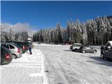
From the highway Ljubljana - Jesenice we go to the exit Lesce and follow the road ahead towards Bled. In Bled at the traffic lights, the signs for Pokljuka point us to the right. Ahead we drive through Gorje and past the abandoned ski slope Zatrnik to Rudno polje on Pokljuka (large parking lot, barracks and shooting range).
Route description:
From the parking lot, we continue on the road (in winter a cross-country ski trail) in the direction of the mountain hut Koča na Uskovnici. The road first leads past the shooting range, then passes into a spruce forest, through which it continues to a smaller but marked crossroad. From the crossroad, we continue on the left lower road (slightly right the road that leads towards the starting point for mountain pasture Konjščica and Uskovnica access by car), which is closed to public traffic by a traffic sign. On the road we descend in a few minutes into the grassy valley Španove jame, where after a few minutes the road splits into two parts.
We continue on the left road (straight slightly downhill to Uskovnica), which quickly passes into a spruce forest and begins to ascend moderately. After a few minutes of further walking, the road flattens and brings us to the upper part of the mountain pasture Praprotnica.
After the last huts the road ends or changes into a cart track, which quickly leads us into a dense forest. We continue on the marked cart track, which continues through the forest with some shorter ascents and descents. The well-marked path continues for some time through the dense forest, then descends to a forest road, which we follow to the left (right Uskovnica and Rudno polje by road).
We continue on the road for a few minutes, then we arrive at the signs for mountain pasture Zajamniki, where the signs for "sirarna" direct us slightly right onto a cart track, along which we quickly descend to the central part of the mountain pasture Zajamniki.
For a nice view it is worth ascending to the southeastern part of the mountain pasture, from where we see the entire row of shepherd huts.

Along the route: Planina Praprotnica (1212m)
Photos:
 1
1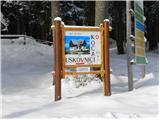 2
2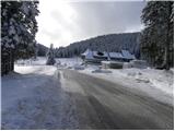 3
3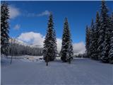 4
4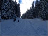 5
5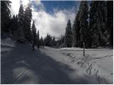 6
6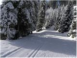 7
7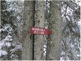 8
8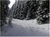 9
9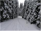 10
10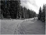 11
11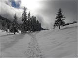 12
12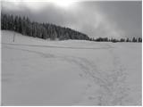 13
13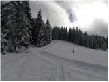 14
14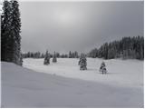 15
15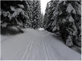 16
16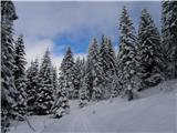 17
17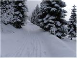 18
18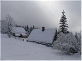 19
19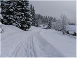 20
20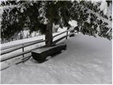 21
21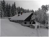 22
22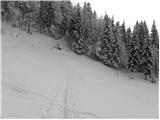 23
23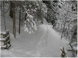 24
24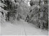 25
25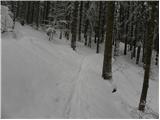 26
26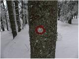 27
27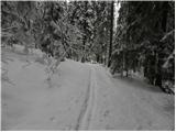 28
28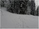 29
29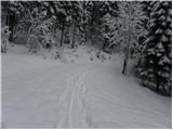 30
30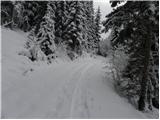 31
31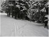 32
32 33
33 34
34 35
35 36
36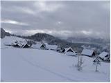 37
37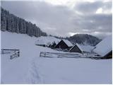 38
38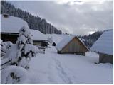 39
39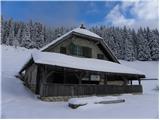 40
40
Discussion about the trip Rudno polje - Planina Zajamniki
|
| bals8. 03. 2015 |
Very nice trip in winter time, rewarded with a beautiful view of the Bohinj mountains
|
|
|
|
| Majdag9. 03. 2015 |
...but can one get there without crampons or skis, thanks...
|
|
|
|
| bals9. 03. 2015 |
yes, I came along a quite trodden path, narrow though, from the sports center direction no need for skis or crampons.
|
|
|
|
| kranjčanka12. 03. 2015 |
how long does it take to walk from the sports center direction??
|
|
|
|
| bals15. 03. 2015 |
In these winter conditions, it takes about 1 h 45 min. The path goes down for a while, then a bit up with some nice views. The path is easy.
|
|
|
|
| grego15. 02. 2017 |
Today on Planina Zajamniki found a lost cap for Canon lens. Forgotten at that topmost-most scenic hut. Whoever misses it should call: 041 664 169
|
|
|
|
| spet_jaz8. 11. 2017 |
Well, during the holidays we also set off to Planina Zajamniki. The path is marked somewhat so-so, or we missed it right at the start, but still a nice outing on a wonderful day. Some words and more photos at the link
|
|
|
|
| Majdag8. 11. 2017 |
Now it's probably already in snow, which further beautifies Triglav Street.
|
|
|
|
| Jana198423. 12. 2017 |
Hello! I'm interested in what it's like to the planina. How much snow there is or what the conditions are like. Thanks
|
|
|
|
| golica7. 01. 2020 |
how best to "connect" the two, we're going to Mrežce, since we'll be in Gorenjska (the path isn't long either), we'd also like to go to Planina Zajamniki. Is it necessary, from say Medvedova konta to Rudno polje, then according to the description to Planina Zajamniki? Or is there any idea how to visit both? Thanks
|
|
|
|
| salvinia28. 03. 2021 |
The description is slightly incorrect, total descent is about 200 meters and ascent approx. 130 meters.
The correct current description would be...
Continue on the left road (straight slightly downhill Uskovnica), which quickly turns into a spruce forest and begins to descend moderately. After a few minutes of further walking, the road levels out and takes us to the upper part of Planina Praprotnica.
Behind the last barns the road turns right (towards Planina Šeh), but we continue straight on the track (visible sign), which quickly takes us into dense forest. Continue on the track, which continues through the forest always slightly uphill. After good 15-20 minutes of walking we reach the signs for Planina Zajamniki, where the signs for "sirarno" direct us slightly right onto the track, along which we quickly descend to the central part of Planina Zajamniki.
|
|
|
|
| EvaMO4. 08. 2022 14:29:23 |
Planina Zajamniki, first aid - shepherd's hut. The owner is rude, charged 32eur for a platter for 2 people (10 slices of sausage, cheese and a bit of cottage cheese) and one beer.
|
|
|
|
| CarpeDiem2478. 08. 2022 16:24:42 |
Wow, what a crazy price this is.
|
|
|
|
| UlaT4. 02. 2023 08:39:00 |
Yesterday I walked the path for the first time, in winter conditions. Wonderful! But I would note that the elevation difference along the path was 460 m. Some descent along the path, some ascent.
|
|
|
To post a comment you must log in:
If you do not yet have a username, you must first
register.