Rifugio Sorgenti del Piave - Monte Avanza
Starting point: Rifugio Sorgenti del Piave (1815 m)
| Latitude/Longitude: | 46,6203°N 12,7157°E |
| |
Walking time: 3 h
Difficulty: partly demanding marked way
Elevation gain: 674 m
Elevation difference along the route: 800 m
Map:
Recommended equipment (summer): helmet
Recommended equipment (winter): helmet, ice axe, crampons
Views: 6.935
 | 1 person like this post |
Access to starting point:
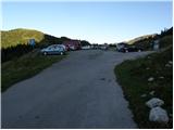
From the highway Trbiž/Tarvisio - Videm/Udine, we take the exit Tolmezzo and follow the road ahead towards the mentioned town. Near Tolmezzo, we leave the main road which leads towards the mountain pass Passo di Croce Carnico / Plöckenpass and go towards the villages Villa Santina and Ampezzo. In the settlement Villa Santina at the roundabout, we go straight following the signs Raveo, Rigolato. We follow this road all the way to Cima Sapadda, where we continue right in the direction of the summit Monte Peralba. We then follow the considerably narrow and steep road to a large parking lot below the mighty Peralba. We park on the lower parking lot, where we notice signs for mountain hut Calvi (mountain hut at the source of the Piave is a little further approx. 500 meters).
Route description:
From the parking lot, we descend a little back on an asphalt road, then signs for the peak Monte Avanza point us left onto a footpath which crosses mostly grassy slopes towards the east. After a few minutes of walking, the path starts descending and quickly brings us to a forest road, which we follow to the left. The road soon starts descending noticeably, and we follow it straight in smaller crossroads (if we keep right, we will get to a bigger cottage). The road, which meanwhile has already become a somewhat wider cart track, then brings us to the next signs for Monte Avanza (to here we need less than 30 minutes).
We continue in the direction of the mentioned summit on a marked path which starts ascending steeper through the forest. Higher up, the steepness eases and the path brings us out of the forest onto almost unvegetated slopes, where we come to an unmarked junction.
We continue sharply left on a steeper path again, to which another transverse path joins a little higher (to here we can also come via the transverse path which crosses slopes below the summit Monte Chiadenis). The path, which continues towards the northeast, gradually transitions into a smaller but very distinct valley, up which we ascend the next few minutes. At a somewhat larger rock, the marked path turns sharply left (straight unmarked path which leads through the couloir towards Monte Avanza - ascent on this path I advise against due to the great danger of falling rocks) and ascends over partly overgrown scree to the foot of the wall. Over the mentioned wall a wide path (old mule track) leads us, which in zigzags ascends towards the saddle Passo dei Cacciatori. Somewhat below the mentioned saddle we come to a marked junction, where signs for Monte Avanza direct us right onto extensive scree fields, over which we ascend to a pleasant grassy saddle, from which a nice view of Monte Avanza opens up.
The path ahead at the foot of the south walls of Crete Cacciatori crosses a smaller scree, which ends at a larger gully. Ahead we cross the gully and follow the path which is further marked with red dots. The path ahead steeply ascends a wide and exposed artificial ledge (partly destroyed mule track), which ends with crossing a precipitous slope (here a steel cable helps us). Ahead we ascend transversely at the foot of the walls on a path which is dangerous for slipping due to scree. After a few minutes of traversing, the slope flattens and the path brings us to caverns from the times of the 1st World War.
The path ahead transitions into more level terrain, over which we walk in a few minutes to the summit part of the mountain. Here the path, which is further marked with numerous cairns (in fog the orientation is relatively difficult), ascends somewhat steeper again and brings us to the summit after good 10 minutes of further walking.

Photos:
 1
1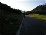 2
2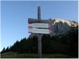 3
3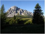 4
4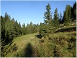 5
5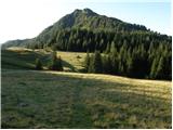 6
6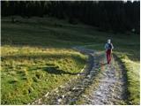 7
7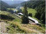 8
8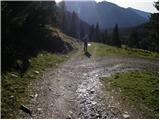 9
9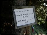 10
10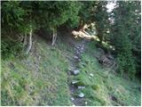 11
11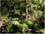 12
12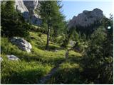 13
13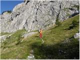 14
14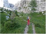 15
15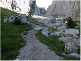 16
16 17
17 18
18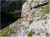 19
19 20
20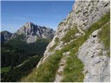 21
21 22
22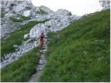 23
23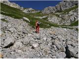 24
24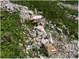 25
25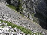 26
26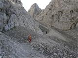 27
27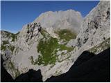 28
28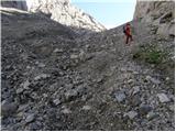 29
29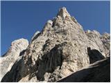 30
30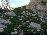 31
31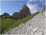 32
32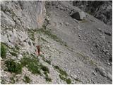 33
33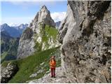 34
34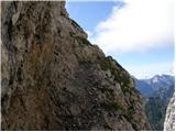 35
35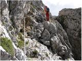 36
36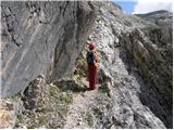 37
37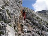 38
38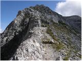 39
39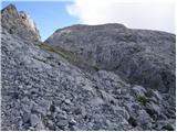 40
40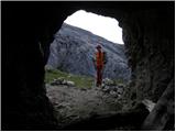 41
41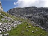 42
42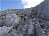 43
43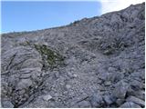 44
44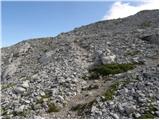 45
45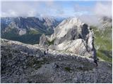 46
46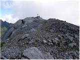 47
47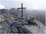 48
48 49
49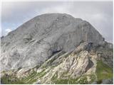 50
50
Discussion about the trip Rifugio Sorgenti del Piave - Monte Avanza
|
| mirank24. 07. 2017 |
Instead of the left turn (sl 17), continue straight into the valley - clearly visible on sl 16 and at the end climb over the step-boulder 2m high (II+) with the help of a thin wire, exit onto the track 30m below the path (sl 42). Just a little spice for those who want it
|
|
|
|
| Matjaz_654. 08. 2017 |
I combined the ascent to Monte Avanza with the ascent to Monte Chiadenis ... and made a circular tour
BLOG and PHOTOS
|
|
|
|
| sandy15. 12. 2018 |
When was this picture taken?
|
|
|
|
| Tadej15. 12. 2018 |
The description is from 2011, the pictures are from then as well.
|
|
|
|
| Pi_is_exactly_321. 07. 2019 |
The wind has practically knocked down huge spruces along the entire path through the forest (a couple hundred meters above the forest line it looks like several hectares are downed). From picture 10 to 13 the path is therefore very difficult to pass (about 200m of altitude). I recommend the alternative path: a little before picture 6 turn left (marked junction), the path leads under the walls a bit above the spot from picture 14. This path is easy, nicely marked and maintained.
Also: the signpost from picture 25 is gone; the path where you need to turn right to the extensive scree also has no other markers (this junction is about 150m below the Passo dei Cacciatori saddle).
|
|
|
To post a comment you must log in:
If you do not yet have a username, you must first
register.