Planina Ravne - Planina Polšak
Starting point: Planina Ravne (1500 m)
| Latitude/Longitude: | 46,3493°N 14,6997°E |
| |
Walking time: 1 h
Difficulty: easy unmarked way
Elevation gain: 195 m
Elevation difference along the route: 240 m
Map: Kamniške in Savinjske Alpe 1:50.000
Recommended equipment (summer):
Recommended equipment (winter): ice axe, crampons
Views: 8.069
 | 1 person like this post |
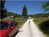
Access to starting point:
A) First, we drive to Kamnik, then continue driving towards Stahovica and the mountain pass Črnivec. A few hundred meters before the mountain pass Črnivec, we leave the main road which leads towards Gornji Grad and continue sharply to the left in the direction of the mountain pass Volovljek (Kranjski Rak). From the mentioned mountain pass, we continue straight (left road which leads to Velika planina, right Štajerski Rak) and start descending towards Luče. Lower down, the road flattens somewhat and brings us into the Podvolovljek valley. Further on, we first drive past the turn-off of the road which leads into the Lučka Bela valley, then also past the bar Pri Gamsu. After the bar, we pay attention, because just a few hundred meters further, the road which leads towards the mountain pasture Podvežak and mountain pasture Ravne and farm Planinšek branches off to the left (at the spot where we leave the main road, the road sign is approximately 11 km). Further, we drive on an initially still asphalt road which then ascends towards the Dleskovška planota plateau. Higher up, the road towards Planinšek branches off to the right, and we continue on the left upper road, which a few hundred meters further from the turn-off to the farm Planinšek becomes macadam; this then brings us a little further to the next crossroad, where we continue straight in the direction of the mountain pasture Ravne (left mountain pasture Podvežak). Further on a somewhat worse road, which we then follow to the beginning of the mountain pasture Ravne, where we park in a suitable spot by the road.
From the main road to the mountain pasture Ravne is approximately 10 km, of which approximately 4 km macadam.
B) First, we drive to Luče, then continue driving towards Kamnik. When we notice the road sign by the road showing 10.5 km, we pay attention to the right turn-off, because just a little further to the right, the road towards the mountain pasture Podvežak and Ravne and farm Planinšek branches off. Further, we drive on an initially still asphalt road which then ascends towards the Dleskovška planota plateau. Higher up, the road towards Planinšek branches off to the right, and we continue on the left upper road, which a few hundred meters further from the turn-off to the farm Planinšek becomes macadam; this then brings us a little further to the next crossroad, where we continue straight in the direction of the mountain pasture Ravne (left mountain pasture Podvežak). Further on a somewhat worse road, which we then follow to the beginning of the mountain pasture Ravne, where we park in a suitable spot by the road.
From the main road to the mountain pasture Ravne is approximately 10 km, of which approximately 4 km macadam.
Route description:
From the starting point across the mountain pasture we walk to the shepherd's hut, which we bypass on the right side, so that we continue in the direction of the mountain pasture Molička planina and mountain pasture Polšak (on the left side of the hut leads the path over Dolga trata). Behind the hut, the path is at first somewhat harder to follow, but the blazes help us, and a little further we join the cart track which branches off from the road on the mountain pasture Ravne at the right bend.
When we step onto the cart track, we continue left, on it we at first walk without major changes in elevation, then start gently to moderately ascending. After a few minutes, we reach an indistinct saddle between Dleskovec on the left and Smrekovec on the right. Here from the right joins the path from the end of the road, and we continue straight across the grazing fence. Behind the grazing fence follows a short traverse, then we arrive at the next marked junction, where we continue straight in the direction of the mountain pasture Polšak (left Korošica, Molička planina, and at the junction there are signs for Lučka koča). Although the turn-off is marked, the path further on is no longer marked, exceptions are occasional unofficial signs with a red line.
After a short initial ascent, the path flattens, then for some time descends lightly, further on it traverses the slopes to the right. When the traverse ends, we reach an indistinct little valley, where the path to the nearby hunting hut branches off to the right, and we continue left and ascend through the little valley, where the path leads past the water catchment. Through a pleasant little valley, surrounded by sparse larch forest, we ascend slightly to moderately, and then after a few minutes we reach the mountain pasture Polšak, in the middle of which is a newer shepherd's hut (the old one burned down).
Description and pictures refer to the condition in the year 2016 (August).

Photos:
 1
1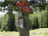 2
2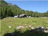 3
3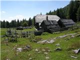 4
4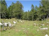 5
5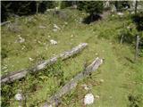 6
6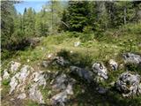 7
7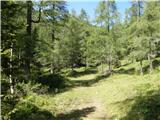 8
8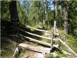 9
9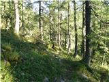 10
10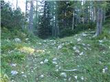 11
11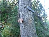 12
12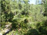 13
13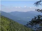 14
14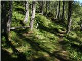 15
15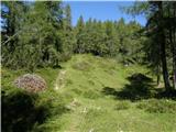 16
16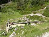 17
17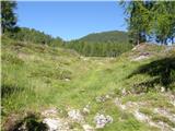 18
18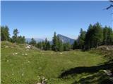 19
19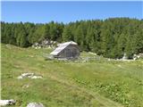 20
20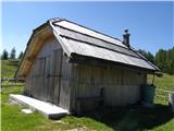 21
21
Discussion about the trip Planina Ravne - Planina Polšak
|
| micamaca20. 08. 2010 |
I'm interested if anyone knows whether the old path from Luč (via Dol) to Planina Polšak is reasonably passable or traceable?
|
|
|
|
| jprim23. 07. 2017 |
Please Tadej, correct this nonsense regarding the elevation.
Best regards.
|
|
|
|
| Tadej23. 07. 2017 |
Thanks for the notice. I have corrected it.
|
|
|
To post a comment you must log in:
If you do not yet have a username, you must first
register.