Kopišča - Planina Dol (Martinj steza)
Starting point: Kopišča (540 m)
| Latitude/Longitude: | 46,3089°N 14,6082°E |
| |
Route name: Martinj steza
Walking time: 2 h 45 min
Difficulty: difficult unmarked way
Elevation gain: 768 m
Elevation difference along the route: 825 m
Map: Kamniške in Savinjske Alpe 1:50.000
Recommended equipment (summer): helmet
Recommended equipment (winter): helmet, ice axe, crampons
Views: 8.660
 | 1 person like this post |
Access to starting point:
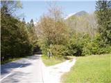
First, we drive to Kamnik, then we continue driving in the direction of Kamniška Bistrica and the cableway to Velika planina. In Stahovica we continue left (direction Kamniška Bistrica and cableway Velika planina) on the moderately ascending road, then we follow past the bottom station of the cableway to Velika planina. Only a few hundred meters ahead from the cableway to Velika planina, we come to a smaller hamlet named Kopišča. Here we turn right and then we park at an appropriate place by the road.
Route description:
From the starting point, we continue on a cart track which gently ascends through the forest. Higher up, the cart track becomes quite rough and gradually starts to ascend steeper and steeper. A bit higher, we will notice an old hunting path which branches off from the cart track and then starts to ascend relatively steeply. The path, which ascends moderately to steeply through the forest, then brings us higher to old mining adits. The path ahead transitions to steep but still forest-covered grassy slopes. Further, the trail flattens for a short time, then starts steeply ascending in zigzags through the forest. Higher, we reach the foot of very steep slopes, where with the help of a small wooden bridge we enter rocky terrain. Over a short very steep step, a steel cable assists us, and the path then transitions to steep and mainly in wet slippery-dangerous grassy slopes. A little further, the path completely flattens, then for quite some time crosses the slopes to the right.
The path ahead brings us to a nice viewpoint, after which the path soon transitions to a cart track and then past the hunting cottage brings us to a macadam road, on which we walk to Planina Dol in a few minutes.

Photos:
 1
1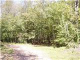 2
2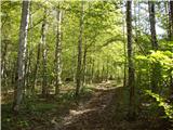 3
3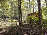 4
4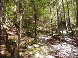 5
5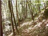 6
6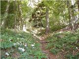 7
7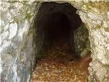 8
8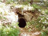 9
9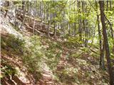 10
10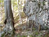 11
11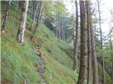 12
12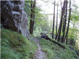 13
13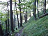 14
14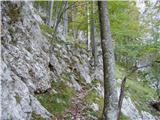 15
15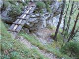 16
16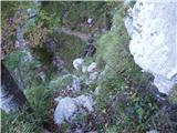 17
17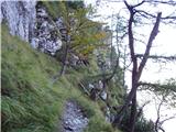 18
18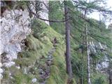 19
19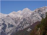 20
20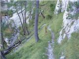 21
21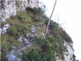 22
22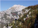 23
23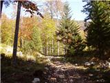 24
24 25
25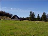 26
26
Discussion about the trip Kopišča - Planina Dol (Martinj steza)
|
| 11120. 11. 2015 |
The landscape and conditions change over time, and the description needs updates. After the glaze ice and bark beetle, the forested slope is no longer the same.
From the asphalt road at the end of Kopišča, a macadam forest road (logging track) branches off towards the slope, ascending ever steeper to the turning bay around the large rock. Here, find the path that starts on the right side of the incised "roundabout", among fallen trees and undergrowth. Later there are no issues, except for "detours" around fallen trees.
If approaching Martinj steza from above, follow the forest road continuing from Planina Dol past the last cabin westwards, past the hunting hut (on the left). After about a kilometer, when the road starts climbing steeper in the forest, notice the cart track branching left, which soon becomes a path harder to follow in autumn or winter due to leaf cover. Orientation issues end at the plateau edge, where the path descends amid ample views.
Otherwise, I advise against visiting Kopa, especially when wet, as the exposed path narrows, and the overgrown trail on very steep meadows is prone to slipping, where you can only grab grass blades. Even in dry conditions, crampons with ice axe would be advisable.
Bojan, 19.11.2015
|
|
|
|
| iUnknown28. 07. 2018 |
Does anyone know how this trail compares in difficulty to the hunting trail over Rigelj or the one that branches off the Rigelj trail towards Kisovec? I'm more interested in whether there's any climbing on walls or over fallen trees, not how much fitness it requires.
|
|
|
|
| garmont29. 07. 2018 |
Regarding steepness, it's fully comparable. Fallen trees don't pose problems, but at the spot where the cable is located, it's quite exposed.....more than the trail over Rigelj.
Regards
|
|
|
|
| matic411. 03. 2019 |
I would recommend using a helmet. When crossing the slope (sika 10) it has happened to me several times that chamois dislodge stones (or even substantial rocks). This dangerous section is about 50m long. Higher up I haven't experienced anything falling down, but you walk under the wall for quite some time.
|
|
|
To post a comment you must log in:
If you do not yet have a username, you must first
register.