Belopeška jezera - Mangart (Via Italiana)
Starting point: Belopeška jezera (929 m)
| Latitude/Longitude: | 46,4733°N 13,6713°E |
| |
Route name: Via Italiana
Walking time: 5 h 30 min
Difficulty: extremely difficult marked way
Via ferrata: C
Elevation gain: 1750 m
Elevation difference along the route: 1800 m
Map: Julijske Alpe - zahodni del 1: 50.000
Recommended equipment (summer): helmet, self belay set
Recommended equipment (winter): helmet, self belay set, ice axe, crampons
Views: 203.942
 | 12 people like this post |
Access to starting point:
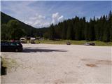
From Kranjska Gora via the border crossing at Rateče we drive towards Trbiž / Tarvisio. Soon after the border crossing, the road in the direction of the Belopeška lakes / Laghi di Fusine branches off to the left, which in a moderate ascent we then follow to a large parking lot at the Upper Mangart (Belopeško) lake.
Route description:
From the parking lot, we continue on the left side of the inn following the signs for Bivacco Nogara. The path runs on the road and in a few minutes brings us to a crossroad, where the path towards the mountain hut Zacchi branches off to the left. We continue right on the road along which we walk for some time, then we turn slightly right onto a cart track. When the cart track ends, we continue on the path through a meadow, which brings us to a junction. Left leads path 513 towards the mountain hut Zacchi, while we continue right on path 517/A towards bivouac Nogara. The path then brings us into the forest through which we ascend quite steeply for quite some time. Out of the forest we come onto grassy slopes and soon we are at a junction again. We head right towards bivouac Nogara, while left the path goes slightly downhill towards the mountain hut Zacchi. We continue on grassy slopes slightly to the right and soon come to a somewhat more demanding part of the path. Here the path ascends steeply and several fixed protections assist us. This is followed by crossing steep grassy slopes, after which the path becomes flatter again and soon brings us to bivouac Nogara.
At the bivouac, where there is also a junction, we continue to the left following the inscription on the rock »Via Italiana«. The blazes on this section of the path are quite faded, but numerous cairns assist us. The path then crosses the slope to the left and brings us to the start of the climbing section. At the beginning, the path ascends steeply next to the steel cable to the left upwards and brings us to a small cavity. From the cavity, we then climb through a window onto a precipitous ledge and continue upwards along the wall. The path turns to the left and crosses a precipitous slope, then ascends almost vertically upwards and brings us to a somewhat less steep grassy slope. We cross the slope next to the steel cable to the left and soon we are before probably the most difficult part of the path. First we ascend vertically next to the steel cable, then along an extremely exposed wall with the aid of brackets we climb above the rocky overhang. Here we stand on a wide bracket, below us a deep precipice. We continue on brackets vertically upwards. The path then goes slightly to the right and ascends steeply several more times with the aid of brackets. This is followed by an exposed crossing along a narrow ledge to the left, then we ascend again with the aid of brackets and pegs along the vertical wall. Again we walk above a deep precipice on wide brackets from which we then ascend almost vertically upwards. This is followed by crossing to the left along a narrow exposed ledge and then a steep ascent with the aid of brackets. The path then becomes somewhat less steep and soon we reach the ridge from which a view opens towards Slovenia. A short descent follows next to the steel cable and we join the path from Mangartsko sedlo.
We continue to the left along the well-marked path and initially walk on smooth rocky slabs. After that, the path turns slightly left onto scree slopes below Mangart, which in early summer are still snow-covered. The path further ahead slowly turns to the right and soon we are at a junction, where we go right (left along the ridge to Kotovo sedlo, Loška Koritnica). The path continues turning right so that we almost encircle Mangart. An ascent awaits us along a panoramic grassy slope. Then we cross the gully and to the summit only the final steep section remains, which we overcome in zigzags.
The Via Italiana path is extremely demanding and suitable only for the most experienced mountaineers with mandatory self-belaying. The path is otherwise excellently secured but from a technical viewpoint it is among the more difficult in the Julian Alps and perhaps even the most exposed in the entire Julian Alps.
On Slovenian territory, we will not find such demanding high mountain paths.
We can descend to Mangartsko sedlo and then along the easier path (path 517) back to the Belopeška lakes.

Photos:
 1
1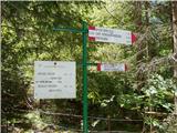 2
2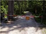 3
3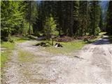 4
4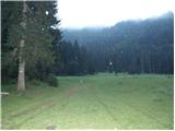 5
5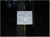 6
6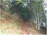 7
7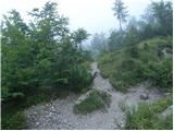 8
8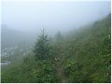 9
9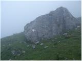 10
10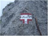 11
11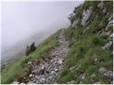 12
12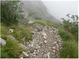 13
13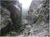 14
14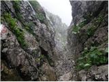 15
15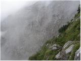 16
16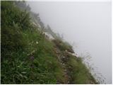 17
17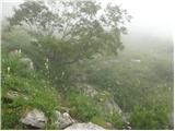 18
18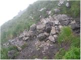 19
19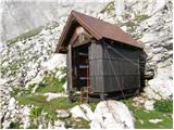 20
20 21
21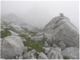 22
22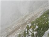 23
23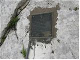 24
24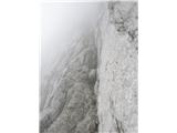 25
25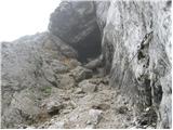 26
26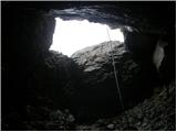 27
27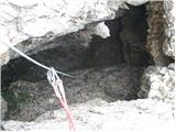 28
28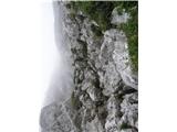 29
29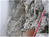 30
30 31
31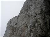 32
32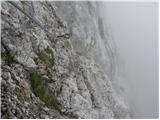 33
33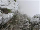 34
34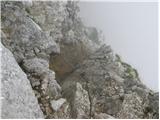 35
35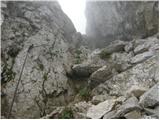 36
36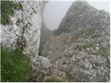 37
37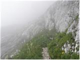 38
38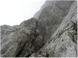 39
39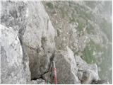 40
40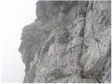 41
41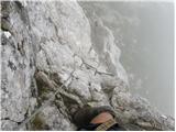 42
42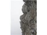 43
43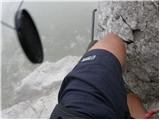 44
44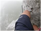 45
45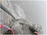 46
46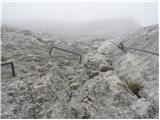 47
47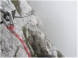 48
48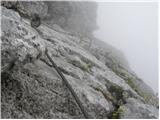 49
49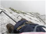 50
50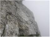 51
51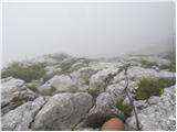 52
52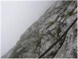 53
53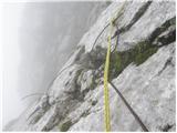 54
54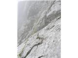 55
55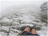 56
56 57
57 58
58 59
59 60
60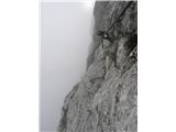 61
61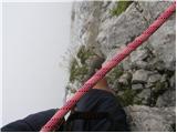 62
62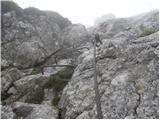 63
63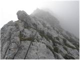 64
64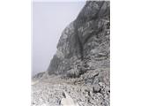 65
65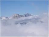 66
66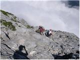 67
67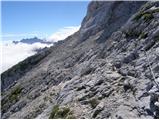 68
68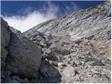 69
69 70
70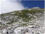 71
71 72
72 73
73 74
74
Discussion about the trip Belopeška jezera - Mangart (Via Italiana)
Show older messages
|
| Rok9. 08. 2008 |
The trail is officially closed due to damaged safety equipment.
|
|
|
|
| ania12. 08. 2008 |
I went to Mangart via VIA ITALIANA on Sunday, 10.8., specifically I descended from the saddle to Bivacco Nogara and then up via ferrata. I really liked the path, but it's true it's very exposed and you have a lot of air under your feet for most of the path. Personally, it seemed very short and not too difficult. It's closed probably due to a pulled-out peg in the lower part and torn cable, which is replaced with a rope.   I recommend it. I recommend it.
|
|
|
|
| triglavski12. 08. 2008 |
I wouldn't boast about walking a closed path, let alone recommend it to anyone, extremely tasteless. Last year we closed the Slovenian route in Mangart due to a landslide, falling rocks and missing protections, some didn't respect it, it was fatal for a 10-year-old boy from Austria and he lay hit dead 300 meters lower on the scree. And if by chance some accident happened on this closed path, you'd be surprised if they charged you for the rescue in that case, probably not, but they'd probably wonder who those fools are who go to rescue such irresponsible people.
|
|
|
|
| ania13. 08. 2008 |
I wasn't boasting, that's how it read. I just wanted to say that you can go via italiana. The hut keeper at the saddle said that the signs warning that the ferrata is closed have been there for more than a year and that they were repairing the path. On Sunday there were many hikers on the ferrata. That's all.
LP
|
|
|
|
| triglavski13. 08. 2008 |
On this website there is a notice about currently closed paths:
Belopeška jezera - Mangart (Via Italiana), damaged protections
Belopeška jezera - Vevnica (Via dela Vitta), damaged protections
Belopeška jezera - Visoka Ponca (Via ferrata Alla), damaged protections
Zadnja Ponca - Vevnica, damaged protections
Permanently closed is the path to Jalovec from Tamarja through Jalovški ozebnik, falling rocks.
Closed paths in Kamniško-Savinjskih Alps:
Hunting path from Logarska dolina to Okrešelj, rockfall
Makekova Kočna - slap Čedca, rockfall
Everyone goes at their own risk, some are aware of it, others not. Recommending walking on a closed path is completely inappropriate or approximately like saying: "it doesn't matter if the traffic light is red, just drive on"
|
|
|
|
| ania13. 08. 2008 |
I myself knew that the path was closed. I read on this site and read that despite the closed path, the path is passable. I knew about the tangled rope instead of the cable and the pulled-out peg. Otherwise I wouldn't have gone to the ferrata.
Lp
|
|
|
|
| ledo8413. 08. 2008 |
ania, I need your contact email for some info regarding the Belopeska jezera-Mangart path. If you could reply to my email address ledo@net.hr
Kudos for the trip ! Greetings from sase.
|
|
|
|
| triglavski13. 08. 2008 |
"I myself knew that the path was closed." I really have no comment on this anymore.
|
|
|
|
| ania13. 08. 2008 |
This path description or photos were also made recently when the path was closed. Otherwise, everyone knows their own abilities.
LP
|
|
|
|
| triglavski13. 08. 2008 |
I surrender. Some people's abilities exceed the knowledge and experience of those who professionally deal with paths and mountain accidents. If Ania had seen a mangled body under a wall at least once, she would probably think differently.
|
|
|
|
| marija13. 08. 2008 |
Down in the valley we feel so safe, especially in the city. But that's a big illusion. If we were more dependent on nature, as we are dependent on it high in the mountains, we would realize that we cannot control our physical survival, let alone the survival of our soul. In nature we are cautious. In urban comfort we are neither prepared nor cautious. In the mountains I realized that I am dependent on Him. When walking in the mountains I see things more clearly than in the city. Without proper footwear and equipment, a person risks. marija
|
|
|
|
| žl14. 08. 2008 |
Ania, your abilities are really unlimited. I hope not many hikers will imitate them. The last sentence that triglavski wrote to you is very true. It might really change your thinking or rather your actions.
|
|
|
|
| panda22. 08. 2008 |
I've been to Mangart via both routes: Slovenian up, Italian down. My wish this year was up via ferrata, but I skipped it due to the official notice that it's closed. Even though the path is somewhat passable, I won't tempt fate or put myself and others in unnecessary trouble. But, who waits, will get it.
|
|
|
|
| tadeya14. 08. 2009 |
How is it this year with this path, is it still officially closed? Has anyone been up there recently? Thanks for the answer...
|
|
|
|
| bridnk14. 08. 2009 |
Quite a few people on this forum are also alpinists even if not; a real mountaineer will already know how to pass a few damaged protections, let everyone think what they want
|
|
|
|
| tadeya15. 08. 2009 |
I completely agree, but I was still wondering if it's officially closed. I'm heading there today, so I'll see what it's like, right?
|
|
|
|
| Bojan_A16. 08. 2009 |
I was there today (15.8). The condition of the safety gear is as described.
No problems with the first pulled-out peg, because there's a crossbar. The chain has been replaced with a rope, on one of the easier sections anyway. The second pulled-out peg is the most problematic as the fall is twice as long because of it. I recommend clipping into the brackets in that section.
I'LL WRITE THE BLOG LATER
|
|
|
|
| kofetarca16. 08. 2009 |
I went today from the saddle down to Bivacco Nogara and then up the via ferrata. It was my first time and honestly... I enjoyed it.
|
|
|
|
| salvinia26. 06. 2010 |
The trail is closed this year too.
|
|
|
|
| salvinia26. 06. 2010 |
Same trail to Vevnica and Via ferrata Alla to Visoka Ponca.
|
|
|
|
| skrajnik26. 06. 2010 |
how is it closed?
didn't they repair it last year?
|
|
|
|
| IgorZlodej27. 06. 2010 |
At Belopeška jezera among other signs there is also a sign for the closed Slovenian trail to Mangart, if there is any change Alessio will write it.
|
|
|
|
| kdamjan10. 08. 2010 |
Via Italiana is obviously renovated and secured very correctly. Yesterday I walked it and there are no visible or felt damages on the protections. It's full of new bolts and even some steel cables. The execution is in classic Italian style - loose steel cables.
|
|
|
|
| francip23. 08. 2010 |
I'm wondering if there's a possible path from Mangart saddle to descend down and then just climb the wall?
Has anyone done this variant already?
|
|
|
|
| Zasavčan17. 06. 2011 |
IS THERE ANY MORE DANGEROUS PATH IN SLOVENIA THAN THIS ONE?
|
|
|
|
| klm17. 06. 2011 |
This dangerous path is routed on the ITALIAN side. In Slovenia, for example, Kopiščarjeva or Hanzova path to Prisank is one level or a slightly easier shade than the path described above.
|
|
|
|
| turbo17. 06. 2011 |
Mistake!!! There are no dangerous paths in Slovenia, nor elsewhere!!! Only difficult, very difficult, extremely difficult ones 
|
|
|
|
| zvitorepec27. 06. 2011 |
Crazy, what to say... probably people going on such paths have no family or kids, otherwise I simply can't understand it. Probably true that much is psychological and it's different walking ledges with 300 m drop below or 1 m, so in this case much is mental but I would never go on this... thanks for such pleasure.
|
|
|
|
| ljubitelj gora27. 06. 2011 |
, if you have a via ferrata kit, it's much easier.
|
|
|
|
| ponosen28. 07. 2011 |
Yesterday I went up via ferrata Italiana to Mangart, at the start of the wall a sign says closed, but no defects visible on it... Further via Slovenian still lots of snow and falling rocks (even boulders).
|
|
|
|
| Lisa4. 09. 2011 |
3.9. did the same approach to Mangart as the predecessor "ponosen".
Before entering the wall (ferrata) there are no more signs anywhere about any closure of this path or similar. So, ferrata is OK. Protections are sufficient and in perfect condition.
On the Slovene continuation however, without a helmet you really have no business (!!!), because stones fly nonstop.
Lp, S.
|
|
|
|
| slavi09024. 09. 2011 |
Lisa.... my husband and I also did the same tour yesterday, the route is really fantastically secured, except for one pulled-out peg....... on the Slovenian one, you really shouldn't go without a helmet, rocks fly by nonstop.
|
|
|
|
| slavi09024. 09. 2011 |
Can't attach pictures here. Where can I?
|
|
|
|
| Lisa4. 09. 2011 |
slavi0902 - one peg is indeed pulled out. Slipped my mind , sorry if I misled anyone . But that pulled-out thing doesn't cause problems..
|
|
|
|
| slavi09025. 09. 2011 |
Jože. ...........thanks
Lisa........ of course that pulled-out peg doesn't cause any problems, you didn't mislead anyone
|
|
|
|
| urbancek8. 09. 2011 |
Which trail do you think (those who've done both) is harder? Via Italiana or to Vevnica Via della Vita? How do these two compare to Cjajnik in Košuta? Thanks for the answer!
|
|
|
|
| meta508. 09. 2011 |
I've climbed all three and each is tough in its own way. Vevnica is technically more demanding than Mangart, which I think is more exposed. Cjajnik requires more arm strength... if you've done one of them, you won't have trouble with the others.... just boldly go and GOOD LUCK.
|
|
|
|
| bagi8. 09. 2011 |
@Urbanček, don't forget something. When you climb Via de la Vito, ask yourself where you'll go next. Neither left, nor right, nor down is easy unlike Cjajnik and Via Italiane, which have relatively easy descents. Time-wise it will drag on too. You can check the photos of this route a few posts back. Good luck.
Emil
|
|
|
|
| VanSims8. 09. 2011 |
Isn't the descent to Tamar via Kotovo sedlo somewhat easier from there? Of course you need two vehicles then.
|
|
|
|
| turbo8. 09. 2011 |
If you do Via Italiana, you have your car at Mangart saddle, descend to Nogara, do the ferrata, continue on the Slovenian side to the top of Mangart and descend to the saddle on the Italian side.
If you do Vevnica, Via della Vita, the easiest descent is to Loška Koritnica. From the bivouac above Zagače only downhill. You need an additional transport, that's a second car in Koritnica. It's nicer to go to Mangart, either the hard way over Mali Koritniški or over steep grass around to the junction with the Italian one that leads up from the saddle. And then from Mangart back past Nogara to the lakes. Or, if you know, take the path (pathless, easier scramble) that descends between Vevnica and V Koncu Špico towards Tamar, in the direction of the bivouac below Kotovo sedlo. Kotovo sedlo is first quite down, then quite up, but it's marked.
|
|
|
|
| ljubitelj gora8. 09. 2011 |
The safety gear from the pictures looks like that, also spread out that way, but have they installed any?
|
|
|
|
| VanSims8. 09. 2011 |
First, the pictures were probably taken a long time ago, meanwhile the path has been renovated as far as I know.
Second, I don't go on such paths (not yet appealing to me) but as far as I know the cables on such paths must be loose because of...something to do with self-belaying...let the experts explain.
|
|
|
|
| turbo9. 09. 2011 |
Many places have safety cables intentionally strung loosely. So they serve their purpose, which is to clip onto them with a via ferrata set, and for climbing you use pegs, bolts and natural holds. And not to hang on the safety cable and use it to progress. Extreme vias ferratas, from E upwards, have cables tightly tensioned, so you use them precisely for progression, that is with hands on the cable and feet - friction on the rocks.
Many places in Italy some caretakers cheekily hinted to me that the safety cables are loose also so you can see how much someone has in their pants. Of course, this was meant more as a joke.
|
|
|
|
| urbancek9. 09. 2011 |
I agree, if you have other holds available, it can be loose as far as I'm concerned... I'm not convinced that looseness really makes a big difference in case of a fall, since in any case the carabiners slide to the first bolt, where everything tightens up..
|
|
|
|
| geppo9. 09. 2011 |
In Austria the cables are loose (with a hanging loop of the braid) in the most demanding sections which are now rated E/F.
http://www.youtube.com/watch?v=CXfiNSu7Gzg
This way the force of the carabiner impact on the anchor is slightly relieved (in case of a fall). Solutions are now also sought with shock absorbers, or in Gonžarica there are rubber cones.
Personally, I saw a fall in Gonžarica in the first most demanding section (E) and it ended luckily without serious injuries.
regards
|
|
|
|
| urbancek10. 09. 2011 |
With a group I plan to Mangart from Belopeška jezera, so I'm interested if some of us go Via Italiana, some on that "easier" path you mentioned leading to Man. sedla, is this easier path marked or can someone give some info or description thereof? Thanks!
P.S: Also interested in the difficulty of this "easier" path...
|
|
|
|
| urbancek10. 09. 2011 |
Probably both go to bivak Nogara, then one branches off (so paths 517A and B)... Am I wrong? Interested if from the lakes one needs to watch out for anything, because I heard people here in this area often stray from the right paths?
|
|
|
|
| jackman11. 09. 2011 |
Yesterday my wife and I went along this route, both securely harnessed with full gear. We came from the saddle, descended to Bivacco Nogara and then into the wall. The climbing route is well protected everywhere, especially without people.
It's really something special. 300 m of pure vertical. Everyone gets their fill of climbing. I recommend it, but wisely.
|
|
|
|
| urbancek11. 09. 2011 |
Walked it today. Nice climbing path, but by no means as difficult as one might read on some sites, including this one (not sure if it even deserves the ferrata label). It's not long, slightly more exposed in two places, otherwise pure pleasure, nice climbing, that's all. Expected more...
|
|
|
|
| ghandy21. 09. 2011 |
How many hours from Mangart saddle past bivouac Nogara to Mangart summit?
Thanks.
|
|
|
|
| ljubitelj gora25. 09. 2011 |
I did this path today alone, went without a via ferrata set, exposure incredible, vertical ascents, but it worked, from now on via ferratas will be my lifelong sport.
|
|
|
|
| urbancek25. 09. 2011 |
Well you are...
- going without a set is stupidity without parallel...
- that you keep yelling ALONE ALONE AND ALONE that you went, that's stupidity...
- if you think that with this writing you come across as some mountaineering expert, you're mistaken, with it you prove just the opposite, because the best up here are reticent or rather keep quiet...
...you're incredible...
|
|
|
|
| ljubitelj gora25. 09. 2011 |
Yes I really am incredible, full of desires and a true lover of mountains or now of real via ferratas.
Yes they watched me from the saddle how I climb
|
|
|
|
| Kozorog25. 09. 2011 |
Mountain lover.... you're really unbelievable as urbanček wrote to you... too bad you'll never know what those who saw you climbing like that without gear thought about you...
in my humble opinion you weren't the king....
|
|
|
|
| ben25. 09. 2011 |
@mountain lover: "exposure incredible, vertical ascents, but it went"
Obviously it went...but if it hadn't, we wouldn't be reading any of this, except in some black chronicle!!!!
Best B
|
|
|
|
| ljubitelj gora25. 09. 2011 |
I wouldn't dig a pit for anyone else, if this path poses no problems for me, then it doesn't...next time I'll definitely use the via ferrata set since on this path, excluding me, it's 99.9% mandatory, and probably 99% of people use it.
|
|
|
|
| urbancek25. 09. 2011 |
No, now I'm really falling off the chair laughing
|
|
|
|
| ljubitelj gora25. 09. 2011 |
Yes urbanček, that's me, like summer weather in the mountains.
|
|
|
|
| Kozorog25. 09. 2011 |
.. unpredictable?
|
|
|
|
| ljubitelj gora25. 09. 2011 |
Yes, but the path is renovated, new safety equipment.
|
|
|
|
| Ljubiteljica. gora25. 09. 2011 |
Hello. There are no more suitable hikes for me in our mountains. I've been hiking actively for two years and know every corner and pitfalls in the Alps. Now I'm heading to the Himalayas since I haven't been there yet, I'm curious about the weather there. Is a via ferrata set needed, do I need ice axe and crampons? Anyway, easy paths don't interest me, only the hardest ones. Would anyone go with me?
Thanks and best regards
Let those who can understand...
|
|
|
|
| Bojan_A25. 09. 2011 |
This is to die laughing. Just politely asking the moderator for safety to delete all posts (including mine) so no one really thinks something now and follows the mountain lover's instructions to walk this ferrata WITHOUT via ferrata set.
|
|
|
|
| Kozorog25. 09. 2011 |
Mountain lover... tomorrow in the Himalayas from 03:00 am to 10:00 am sunny, then a northwest wind will blow and it will start clouding over. At 7800 to 8100 m, wind with average speed of 110 km/h.
Equipment up to 6800 m can be summer gear (swimsuit and flippers..) above that you need an ice axe and crampons... in the afternoon stable weather with low cloud cover. Enjoy the ascent!
|
|
|
|
| Ljubiteljica. gora25. 09. 2011 |
Urbi et orbi!
Capricorn, I can't tell you how grateful I am for this information. I think I'll manage to complete the tour by 10:00, as I'm full of stamina and always hike the path faster than marked. I usually go quite fast, could go faster, but can't go slower. Tomorrow evening I'll check in with photos and fresh news.
Peace to all people.
|
|
|
|
| neph25. 09. 2011 |
I'm not that familiar with the site to know the most active people or nicknames, but I understand the joking above. But I don't understand the profile description of "mountain lover":
If someone has the same wishes for via ferratas, we can go on a tour together, persons 20-30 years old are welcome, preferably 25-30. Write anytime. Climbed Via Italiana (without self-belaying), Via della Vita, and slightly easier Plemenice on Triglav, Mrzla gora and to Križ via "via ferrata".... I'll also do winter tours, practically active all year.
Someone tell me this is also a joke. Please.
|
|
|
|
| ktbffh25. 09. 2011 |
Neph, this is no joke. The guy is incredible, has balls and brains in the right place. Next Saturday he'll be on 24 hours in the name of the week section. Worth checking out.
|
|
|
|
| ljubitelj gora25. 09. 2011 |
Ever since some of you read 24 hours you're total pessimists, journalists brainwash you, I've already forgotten if the website 24ur is even called that correctly, because I NEVER go up there....but if journalists brainwash me I'll send them on a tough via ferrata for brainwashing.
|
|
|
|
| ktbffh25. 09. 2011 |
Exactly, mountain lover.
send them on a tough via ferrata for brainwashing... and without protection.
It's useless to read this forum and advice. Who even uses protection on via ferratas anymore?!
|
|
|
|
| neph25. 09. 2011 |
Mountain lover, I'm not the type to mock anyone, so I apologize for copying the description. I seriously thought you were having some internal jokes... I respect your achievements too, but I suggest you first ensure your maximum safety and gain experience, only then invite some green colleague on a demanding path. Personally, I wouldn't dare take a complete stranger on any more difficult path, let alone a "via ferrata", since I don't know their abilities... Accidents happen quickly. Safe steps to you!
|
|
|
|
| ljubitelj gora25. 09. 2011 |
No one would respond anyway, not because of my writing, but in general it's extremely hard to find a climbing partner.
Of course I'll take care of my safety, not just the self-belaying kit, but some ice axe will be in the backpack too...since I started early and by 30 I'll already have 3 closets full of every gear.
|
|
|
|
| urhh26. 09. 2011 |
mountain lover, people went crazy because they can't stop you
don't give up!
|
|
|
|
| nevi26. 09. 2011 |
Mountain lover, I myself was on this trail yesterday too. Maybe we met. Can you describe to me a bit how you were dressed?
|
|
|
|
| geppo26. 09. 2011 |
Look "mountain lover ".
Since you've now become such a "ferrata climber" come to Vinska gora and climb that short ferrata, I'll take some photos...deal?
best regards
|
|
|
|
| janez.novak26. 09. 2011 |
I have climbed and hiked most of the difficult trails in Slovenia and surroundings (Via Italiana, Montaž,...). Twice I tried Gonžarjeva peč but turned back at the start of the smooth slabs. Maybe the reason was that I was alone, but the difficulty is exceptional and it cannot be compared, say, to Via Italiana
|
|
|
|
| ljubitelj gora26. 09. 2011 |
@nevi
You can't miss me, because I was dressed kind of like this (gray shirt, brown shorts and blue helmet).
|
|
|
|
| nevi26. 09. 2011 |
Thanks, you weren't the one I thought you were.
|
|
|
|
| nevi26. 09. 2011 |
We saw a man whom we assumed had come to the saddle via V.I. He had only a daypack and was also without helmet. That's why he somewhat caught our eye. He continued the ascent on the Italian route. But it's possible we missed him earlier and he was just wandering a bit before deciding which way to the top.
|
|
|
|
| urbancek26. 09. 2011 |
Kucelj, I agree with you regarding the difficulty of this trail...
|
|
|
|
| ljubitelj gora26. 09. 2011 |
If you understood the word ferrata a bit, the correct translation would be secured climbing path.
|
|
|
|
| JusAvgustin26. 09. 2011 |
25.9.2011 I know it has nothing to do with it, but anyway: you opened a new thread titled: http://www.hribi.net/trenutnerazmere.asp?slo=1&gorovjeid=10001&id=3964
Not long ago you couldn't distinguish via ferratas from alpinism, for you it was the same, then you constantly whined about equipment, how you don't have it, how this and that... expensive, etc... now you would already carry a rope with you... you've made a huge leap from "pre-alpine hiker" to beginner alpine mountaineer (not to be misunderstood by chance, respect, really good, incredible progress, all my respect you have balls but in the wrong place), now you want to "jump" into the world of alpinism in two years... I'm speechless, you're the first one who managed to leave me speechless, however not because you showed me/us how fast you're progressing but because of your immense desire to prove yourself (who cares if you went alone?!), otherwise I don't know who you want to prove yourself to so strongly?! The other thing is your inexperience, fury and "I want everything! right now...", others are lame, slow... hey man calm down, there are people here who have been hiking mountains since you were just someone's wish... In short, it's not worth wasting more words: to me personally you seem irresponsible, immature, chasing your own tail, misleading others, unstable... Maybe you're a really nice guy but from the posts you've piled up together I can only conclude what's written above. I know some defend you, that you're a young calf who just rams head through the wall, but you arouse distrust in me and it has been so since your first nickname mate07... In short, if you think you can "fool" someone up here, first ask yourself if you're not "fooling" yourself...
|
|
|
|
| ljubitelj gora26. 09. 2011 |
Mah Jus, I do this for my own satisfaction and desire, and obviously you will never represent me as wanting to prove myself NO, because I make videos for myself (I watch them in winter) I also add them myself and write as it was.
|
|
|
|
| ljubitelj gora26. 09. 2011 |
I wanted to make you jump out of your chair a bit, both on Saturday and yesterday I had a self-belay kit with me.
|
|
|
|
| Ljubiteljica. gora26. 09. 2011 |
I think we have institutions in the country that could help you.
|
|
|
|
| JusAvgustin26. 09. 2011 |
and those are not psychiatric...
|
|
|
|
| ljubitelj gora26. 09. 2011 |
Yesterday I was a bit confused, so only now I realize what I'm writing.
|
|
|
|
| janna26. 09. 2011 |
That's already quite worrying
|
|
|
|
| pikica126. 09. 2011 |
Ljubitelj, you've started a battlefield on almost all titles, calm your frantic hormones.
|
|
|
|
| ljubitelj gora28. 09. 2011 |
I really went to Mangart from Belopeška jezera via Via Italiana without a self-belaying set, already at Nogara bivouac I precisely looked where the path to Mangart goes, you could clearly see hikers ascending, and the difficulty was incomparable to our paths to any mountain from the Slovenian side, already at the entry to the climbing part I wondered if I should continue at all and I went, the most scary was a bit higher when the path goes onto brackets and vertical ascent, I was really a bit scared, but far from panic, great fear would have made me on the middle of the path, if I had been that scared, I would have immediately returned to the valley from the top "sedla" via the normal path and wouldn't have continued via Slovenian to the top of Mangart, which is again very demanding. Don't get me wrong, but since I already wrote above/started commenting, let me add a few more words. Everyone perceives path difficulty differently, for some ascent to Mrzla gora is a problem, for some not, for others Plemenice are medium difficult, for others very demanding, many things influence the mountaineer's ability, from age to XX ascents. I've been actively mountaineering only since 2008, that year I reached only a few peaks up to 1500m, in 2009 I first climbed above 2000m (Stol), but only easy paths, 2010 I first crossed a path partially secured with pegs and protections, this year I moved to very-extremely demanding paths.
Since many people will still read this commenting, let me say that BY NO MEANS go on this Via Italiana path without a self-belaying set, there is NO such path here and the next path is EXTREMELY demanding.
|
|
|
|
| JusAvgustin28. 09. 2011 |
I believe there aren't many up there who enjoy reading your nonsense. Unfortunately we're forced to... I wish you lots of luck on the ascent to Široka peč, choose your partner wisely...
|
|
|
|
| VanSims28. 09. 2011 |
Whether he'll even have a climbing partner...
Or he'll first say he didn't have one, then that he wanted to lift us off the chair and he did have one, that climbing partner will then show up from some profile with very few views (or will it be "klemen85#" still unknown) with a comment "Dear! Unbelievers, malicious, arrogant..." then he'll say again that he didn't have one and that you should by no means venture on this route without a climbing partner.
I don't know what emoticon to add at the end... any except 'cool' would be appropriate.
|
|
|
|
| geppo28. 09. 2011 |
We always get caught up in ruminating, criticizing, advising, being horrified and I could list more, but we don't ignore...
the purpose of this writing is anyway such as Mate07 already created it
my suggestion is that Tadej opens a topic under general discussions (mountain lover), so that it doesn't get written all over and new, new, new ones are not opened.....
Regards
|
|
|
|
| turbo28. 09. 2011 |
Tadej,
could you perhaps open a section - forum
titled Myths Fairy Tales and Stories  so that mountain lovers have more space for their adventurous descriptions so that mountain lovers have more space for their adventurous descriptions
LP
B o j a n
|
|
|
|
| ljubitelj gora28. 09. 2011 |
My opinion would be to actually disconnect from this portal, I added my opinion, my comment, I never insult anyone, nor curse them or write any "ugly" words....real hikers laugh at us and don't post here.
DISCONNECT, if anyone wants to write to me, let them write to my e-mail, which is in the profile.
BYE Unbelievers, malicious, arrogant, I don't need such fellow hikers as some of you up here.
|
|
|
|
| Ljubiteljica. gora28. 09. 2011 |
Mountain lover
I welcome your move and wish you all the best in your new endeavors. Above all, I hope that at altitude you will be able to think soberly and sensibly about how and in what way you will act in the given situation.
I'm curious if you will also change your username on this portal now, since you're starting a new period. Remember the following sentence: A wolf changes its fur, never its nature.
regards
|
|
|
|
| CarpeDiem24728. 09. 2011 |
Good luck mountaineer, and wits in your head (helmet on it) and good boots on your feet!
|
|
|
|
| heinz28. 09. 2011 |
It's just not the nicest to discredit someone who is obviously getting more serious about hiking and just has a slightly too long tongue, so that he ends up backing down himself.. reminds me of parliament.. Possible that for Matej, or the fan, the keyboard actually causes bigger troubles than the mountains themselves..
|
|
|
|
| VanSims28. 09. 2011 |
Just to be clear, I'm not doubting his feats. After all, whether I believe him or not doesn't harm me. Even if I find out someday that it's all a lie, it won't harm me. So why wouldn't I believe him.
But with things like 'I carried the full kit', 'I didn't carry the full kit',... and the like, he discredits himself. How are readers here supposed to know when he's telling the truth and when not?
If he has a too long tongue, at least let him have it consistently.
|
|
|
|
| ghandy29. 09. 2011 |
Hi!
Well, back to the debate about the path, not about the personality profile
so, I'm still interested in how many hours from Mangartsko sedlo to Bivacco Nogara and to the top of Mangart.
And I know that you don't go to the mountains by such "shortcuts". Just, if you don't have much time and have a strong desire to go via Italiana, otherwise it just doesn't work...
LP
|
|
|
|
| ghandy29. 09. 2011 |
I already know. (If anyone else is interested: 1 hour to the bivouac and 1.5 hours back to the saddle. Then another 2 hours to the top)
|
|
|
|
| BT8829. 09. 2011 |
But I'm on the side of mountain lovers. We won't talk about psychiatric issues here because someone who solos the Long German DOESN'T NEED A PSYCHIATRIST. Us little Slovenians are full of malice and envy. A mountain lover is just a bold young guy and most survive it, not all of course
|
|
|
|
| BT8829. 09. 2011 |
Mountain lover stay with us
|
|
|
|
| ljubitelj gora29. 09. 2011 |
I'm staying anyway, because I can't without you
|
|
|
|
| CarpeDiem24729. 09. 2011 |
Super! I think the kid isn't wrong, we have to think positively, that's how we mountaineers are!
|
|
|
|
| GregorC29. 09. 2011 |
The guy isn't wrong, hats off to his tours too. But what he shows half around the forum is another matter.
|
|
|
|
| urbancek29. 09. 2011 |
How do you even know that everything he wrote and hiked is true?
I strongly doubt it, because someone who does such things usually already has quite a bit of mountain knowledge (if not, he surely gets it on these tours) and doesn't write or ask nonsense... This is obviously a hoax from too much free time...
|
|
|
|
| ljubitelj gora29. 09. 2011 |
I add all photos from my tours to Facebook.
|
|
|
|
| CarpeDiem24729. 09. 2011 |
@Urbanček, if he walked them he did, if he didn't he didn't, he didn't harm or enrich me (or anyone else) with that, so in the worst case he brought himself around.
|
|
|
|
| VanSims29. 09. 2011 |
In the end, velkavrh confirmed that they were at Jalovec. That's something already.
|
|
|
|
| zmaJ29. 09. 2011 |
Is anyone going up here on Saturday, 1.10., so I can join?
|
|
|
|
| zmaJ1. 10. 2011 |
Here, today my buddy and I were up there.. Too bad the climbing part in the wall is so short, otherwise nothing special. I certainly wouldn't classify it as extremely difficult. The nature takes your breath away, especially if the weather is ideal like today.
|
|
|
|
| zmaJ1. 10. 2011 |
Well, that's how you tease mountain lovers (that going up without self-belaying is really a bit iffy..), here is a list of mountains I've hiked this year from mid-August onwards, before that I had never been in the mountains (high mountains), except solo, but that wasn't anything anyway.
1 - Grintovec (2558m)
2 - Planjava (2392m)
3 - Dolgi hrbet (2473m)
4 - Skuta (2532m)
5 - Štruca (2457m)
6 - Montaž (2753m) via Amalia
7 - Triglav (2864m) via Plemenice
8 - Mangart (2679m) via Italiana
And so no one takes this as self-praise, because it's not, but don't tell me that every beginner has to first hike easy paths for a couple of years, because in SLO there apparently aren't any difficult paths except alpinistic ones.
|
|
|
|
| ljubitelj gora1. 10. 2011 |
@zmaJ
I had already done the above listed routes before Via Italiana except Montaž, also adding Mrzlo goro, Rinke, Kočna-Grintovec (from Jezersko, both routes), and to Vevnica as well as Visoka Ponca ferrata...
|
|
|
|
| urbancek2. 10. 2011 |
You two make me laugh with such stupidities...
|
|
|
|
| JusAvgustin2. 10. 2011 |
hahahahahahahahahahaha, city boy I agree!
|
|
|
|
| JusAvgustin2. 10. 2011 |
I didn't know that via Plemenice exists
|
|
|
|
| Ljubiteljica. gora2. 10. 2011 |
Yes, of course it exists. But you have to be interested in mountains for just one year.
|
|
|
|
| sportnick2. 10. 2011 |
Today with 4 colleagues I climbed Mangart via a combination of Via Italiana & Slovenska pot. From saddle to bivouac in 30 min, from bivouac back to saddle via Via Italiana in 1 h 20 min (with stops for photos), then to the top via Slovenska pot in 1 h.
Via Italiana did not seem particularly demanding to me. Of course no doubt it's a very difficult route, but based on descriptions and some comments I expected it much harder. True, I'm not afraid of heights, no vertigo and in good shape.
Of course I had via ferrata kit and used it all the way.
I agree with much of what ljubitelj_gora wrote. Similar experience. Been hiking since 2009 almost every weekend (weather permitting) for at least one ascent. Interested in more demanding secured climbing routes. If Via Italiana is described as most exposed in Julian Alps, then need to look further across border.
But no misunderstanding, just my subjective opinion.
|
|
|
|
| ljubitelj gora2. 10. 2011 |
@sportnick
Try Cjajnik or ferrata on Vevnica, ferrata on Peč.
|
|
|
|
| B.Smart3. 10. 2011 |
I agree with sportnick.
The path is excellently secured and if you are in good condition, focused while climbing and have no fear of heights, you should climb it without problems.
Before tackling this path, I read all comments on this and similar forums and I must say, I was a bit scared of it. However, the fear was unnecessary and I was a bit disappointed when I saw the edge of the saddle and realized that the climbing was already over. Once you start climbing like this, you just want more
In short, excellent path and I recommend it to everyone who doesn't fear sheer walls below them, has ALL the necessary equipment and is appropriately fit.
And one more thing. Expressions like madman, idiot etc. have no place in comments, because everything can be said in a more cultured way...
|
|
|
|
| ghandy5. 10. 2011 |
I agree. The path is beautiful, but it's not that difficult, I don't know.
|
|
|
|
| CarpeDiem2475. 10. 2011 |
Športnik, I recommend to you as the next step Vevnica from Belopeška lakes. For my taste it's a shade harder. Otherwise later maybe some Dachstein (haven't been yet but watched climbing videos and it looks crazy).
|
|
|
|
| CarpeDiem2475. 10. 2011 |
Here is an interesting video of the mentioned path for example around 4:00 it's interesting!
|
|
|
|
| urbancek5. 10. 2011 |
Vevnica is somewhat harder than Italiana... in my opinion...
|
|
|
|
| sportnick6. 10. 2011 |
CarpeDiem247, thanks for the link. Looks great.
|
|
|
|
| JusAvgustin6. 10. 2011 |
What a shame to drill such a beautiful wall...
|
|
|
|
| VanSims6. 10. 2011 |
Why? They could also make some via ferratas in the Martuljška divjina and on some section of PP to make access a bit easier for people.
Uuups, did I say that out loud?
|
|
|
|
| JusAvgustin6. 10. 2011 |
believe me they wouldn't stand there long... you've really hit me in the heart now
|
|
|
|
| dolinka6. 10. 2011 |
given this "racing" in our mountains I'm really glad the season is slowly ending and we didn't have more accidents (and that f.Italiana and Via de la Morte are on the Italian side). You besieged our end so much that we locals had to retreat abroad to real wilderness. Leave at least PP as it is!!!
|
|
|
|
| jero31. 12. 2011 |
I'll go to Mangart via Via Italiana over the summer. I'll go from the saddle to Bivak Nogara and then via ferrata to the summit. I'll do this in July or August 2012.
|
|
|
|
| ljubitelj gora20. 06. 2012 |
Does anyone have info on what level this ferrata is rated: A, B, C, D, E? Thanks lp
|
|
|
|
| bagi9. 07. 2012 |
Via Italiana is passable without issues, of course for people with appropriate experience. Protections are good, the rest is classic. It's quite busy, as yesterday at 6 a.m. there were already 11 people in the wall. Continuation further along the Slovenian and Italian routes is completely snow-free.
|
|
|
|
| kary30. 07. 2012 |
According to the via ferrata rating scale from 1-6, the Italian route is rated 4/5. lp
|
|
|
|
| urbancek30. 07. 2012 |
So it's overrated then
|
|
|
|
| Kita30. 07. 2012 |
4/5 well then Železna kaplja is somewhere between 7/8... Mašera can't rate ferratas he hasn't done like Železna kaplja, Gonžarjeve peči etc...Those ratings in that book are just nonsense....
|
|
|
|
| Matjaz_656. 08. 2012 |
some photos from ascent via Via Italiana ... long variant from Belopeška lakes ;-)
my advice regarding ascent from saddle to summit ... better ascent via Slovenian and descent to saddle via Italian path ... although here as well as in Mašer ascent via Italian path is suggested
|
|
|
|
| andrej7822. 08. 2012 |
Today we started our ascent (descent) from Mangartsko sedlo over Jezik to bivak Nogara, which we later truly regretted as we saw that the direct path to the Via Italiana entry goes right along the wall, so we had to go back at least 100 vertical meters to the wall entry (advice for others). Before the entry, 3 Austrians fully equipped ahead of us. We let them go 15 minutes ahead, but they belayed continuously, so our patience ran out and we went! We almost paid for this decision with our lives, as a 50 cm diameter stone immediately flew, passing just half a meter from our heads with a warning from the triggerer who was already past us. We pushed and overtook them for our safety. The path at the beginning fairly demanding, but not too exposed. The path gradually becomes very demanding, directly vertical, exceptional exposure, difficulties increase towards the top. We complete the ferrata in under 50 minutes and since we didn't feel like descending back to the saddle, up to the top via the Italian side. Lots of people at the top, mainly Italians and Austrians. We descend via the Slovenian to the saddle, on the way we meet our policemen and get a warning about the demanding descent path and inappropriate footwear (5.10 shoes?!). Quite some traffic on the path, but all properly equipped and capable.
lp
|
|
|
|
| andrej7822. 08. 2012 |
For all racers and free solo enthusiasts, the entire trail completed in under 4 hours, without free soloing.
|
|
|
|
| andrej7822. 08. 2012 |
Time for the trail as described in the above description. lp
|
|
|
|
| ziga9325. 08. 2012 |
I'm wondering, if I climb from Belopeška jezera to Mangart, what's the easiest way down back or is there another path?
|
|
|
|
| andrej7825. 08. 2012 |
Descent via Jezik past the bivouac into the valley, completely undemanding.
|
|
|
|
| proman29. 08. 2012 |
Hello!
I'm wondering if it's possible to descend from Mangart saddle to Bivacco Nogara, and then via Via Italiana to the summit?
|
|
|
|
| mirank29. 08. 2012 |
By cable or on foot? Otherwise look a few lines above your post.
|
|
|
|
| MANGRT29. 08. 2012 |
proman
here is something: http://www.hribi.net/trenutnerazmere.asp?slo=1&gorovjeid=1&id=1146&stran=3
|
|
|
|
| Močerad29. 08. 2012 |
Proman:
Of course. From the saddle you descend to the entrance of Via Italiana, then continue on the Slovenian or Italian path to the summit..
|
|
|
|
| Močerad29. 08. 2012 |
Proman:
Of course. From the saddle you descend to the entrance of Via Italiana, then continue on the Slovenian or Italian path to the summit..
|
|
|
|
| subaru31. 08. 2012 |
On Tuesday climbed Via Italiana with colleagues.
Fixed protections in excellent condition. Hats off to the path maintainers who take care of and maintain these things.
|
|
|
|
| katja8710. 09. 2012 |
On Sunday, 9.9.2012, we set off for Mangart. From Mangart Saddle we descended to the start of ferrata Via Italiana, climbed it and continued the path upwards along the Slovenian route, descended on the Italian side.
The ferrata is quite adrenaline-filled and I recommend it only to the experienced, as it mainly requires arm strength, and to those who are not afraid of heights, as the drop is quite substantial. The path is extremely well protected, with the cable all the time. The safety gear is in excellent condition.
You can view pictures from the hike on the website of the Mountaineering Association Matica Murska Sobota: http://www.mojalbum.com/pdmaticams/20120909-mangart-cez-ferato/foto/20041540
|
|
|
|
| Tj10. 09. 2012 |
Also on Sunday 9.9.2012 via Via Italiana from Belopeška jezera. Nice, varied path, from the initial walk through the forest and across meadows to exposed climbing with deep and wide views.
Warning to those with poor orientation: before the somewhat more demanding part of the path below bivouac Nogara, when the waterfall is visible, follow the markers to the right - it's well marked, but I was misled by the well-trodden paths left towards the waterfall (probably sheep trails) - well, I made a little detour and saw the waterfall up close.
|
|
|
|
| pinny24. 10. 2012 |
Can anyone tell me how many hours the descent takes if we descend to Mangart saddle and then back to Belopeška lakes via the easier path (path 517)?
|
|
|
|
| pinny27. 10. 2012 |
Here it is, I also climbed the ferrata up and down, the only thing I didn't reach is the top of Mangart, because the upper part was nicely iced and I didn't risk it, even though it was only about 20 minutes away. But here it's written as an extremely demanding marked path, I have to say it wasn't difficult for me at all, pretty easy it seemed to me, and I'm just a beginner in ferratas. Maybe demanding from this side that you have to walk about 3 hours to reach the ferrata
|
|
|
|
| pikica127. 10. 2012 |
Why didn't you go to the top if it's so easy Even if it's nicely icy it shouldn't be a problem if the path is easy.
|
|
|
|
| pinny30. 10. 2012 |
It was really easy for me, but I didn't go to the top because I didn't risk it, I didn't have crampons with me
|
|
|
|
| IgorZlodej31. 10. 2012 |
Others, prepare better for the tour and don't underestimate, and don't mislead others with your "izi", especially since we don't know who you are.
|
|
|
|
| Tj31. 10. 2012 |
The decision not to go to the top if you don't have appropriate equipment for the conditions is certainly wise. As already written - the summit will wait.
Comments on difficulty are of course subjective and must be taken as such; a more realistic path description is with the difficulty rating. I myself wouldn't label this path as "izi", but it seemed less demanding than I expected given the "extremely difficult" label - some "very difficult" path seemed harder to me, the Slovenian route to Mangart is no easier than Via Italiana - of course it's all subjective. The lower perceived difficulty certainly also contributes to the path being very well secured.
|
|
|
|
| CarpeDiem24731. 10. 2012 |
Because of comments like the one by Pinny, there can be many accidents, after all someone who previously didn't dare to tackle Via Italiana can be encouraged this way. I believe those (official) ratings have some weight, but if some local Messner comes along, for him it's just "pasulj", but since I believe not only Messners read this forum, let that rating stay. If nothing else, as a warning to all who are still gaining experience.
|
|
|
|
| jax31. 10. 2012 |
Well, I will very hardly buy the thesis that an accident can happen just because someone once wrote some comment on the net. If someone gets into trouble because they blindly followed opinions (I repeat, OPINIONS) of anonymous writers on web forums, then, sorry, the problem is not with those anonymous writers. If someone is still in doubt about how demanding some path is, there is authoritative literature from people with name, surname and experience. But if someone believes anonymous web users more, they are to blame themselves.
|
|
|
|
| urbancek1. 11. 2012 |
Of course jax, we already talked about this once...
|
|
|
|
| ljubitelj gora1. 11. 2012 |
Some climb this route easily, others with fearful respect.
|
|
|
|
| ljubitelj gora2. 11. 2012 |
Explain, because not everyone should be put in the same basket, different ages, experiences, abilities.
|
|
|
|
| milesdavis2. 11. 2012 |
I exaggerated a bit with genius,
but what you said - you are absolutely right!
Nice regards and many more of your beautiful photos that say more than words ...
|
|
|
|
| pinny2. 11. 2012 |
That my post would consequently provoke such a stirred-up response, I didn't think so .
Well, to shed some light on things ......
I am 34 years old, 191cm tall weighing 85kg, medium build, otherwise more of a cyclist than anything else, and as for having some stamina, not even close, but whatever I do and go, I have my own pace, now it can be slow for someone, fast for someone else, just like the difficulty of climbing or something else, people are different .
Otherwise, regarding my climbing and mountaineering experiences, I never really pursued it much, Uršlja gora, Smrekovec and Peca is that, and even that I could count on the fingers of one hand, and there would still be some left. Otherwise this year I was for the first time on: Triglav, Skuta, Ojstrica, on Begunjščica, and climbed Gonžarjeva peč 13 times. That's all from me about my climbing and hiking exploits . Now let everyone form their own opinion
|
|
|
|
| Kita4. 11. 2012 |
Pinny... Gonžarjeva peč and Via Italiana are something completely different, Gonžarjeva peč is a real modern sports via ferrata, its technical difficulty far surpasses the Mangart ferrata, which perhaps reaches C/D difficulty at one point and where we still occasionally see some friction climbing peg, but almost none on Via Italiana, so technically these two ferratas can't even be compared... Via Italiana is a high alpine ferrata that besides technical knowledge requires good stamina and strong psyche...
|
|
|
|
| jax4. 11. 2012 |
A few things are getting mixed up here ... first of all regarding the last comment: that Italiana requires good stamina, that's not entirely true. Maybe on the described way yes, but if you tackle it like most from Mangart saddle, then for the whole loop you need about 4-5 hours. Not exactly overly long and strenuous, right?
As for the psyche, here's the thing, and on that I would partly refer also to Primož's comment about there having been fatalities on Italiana. Of course there have. But here I really want to see the statistics. Off the top of my head I would conclude that there have been quite a few more deaths on the upper Italian path than on the ferrata. Simply, demanding and dangerous path are not the same thing. So I can just offhand list a few paths in Slovenian mountains that are not particularly demanding, yet are still considered dangerous. For example, on Korenova on Krn the middle section through the grass is certainly more dangerous than the secured part. And Kovinarska on Deblo peč - nothing difficult, but if you slip there, oh boy. The terrain is crumbly and muddy. Kačji graben has also seen many rescues. Something could be said about Grdem graben on Kočna. All these are paths that are really not particularly demanding, but due to various reasons (unsecured, bad terrain, exposed) can nevertheless be very dangerous. Now - I really should see the statistics, but roughly I would say there have been more fatalities on such paths than on ferratas.
About Italiana itself - what more can I say until I finally climb it too. Hopefully soon ...
|
|
|
|
| milesdavis4. 11. 2012 |
Andrej Mašera says, quote: "... and it has unfortunately already claimed several victims. The most tragic incident occurred in 1972, when for unknown reasons three mountaineers from Proseka fell down the entire wall to the foot screes." (A. Mašera, 1996)
|
|
|
|
| Kita4. 11. 2012 |
So, if you don't need any fitness then literally anyone without fear of depths can crawl up there, since it's 4 to 5 hours—nothing easier... Even for such a short via ferrata fitness is needed even if it sounds ever so funny...
|
|
|
|
| dprapr5. 11. 2012 |
Fitness is a broad concept!
@jax was probably thinking about the aerobic abilities of the individual, not so much about strength, which is primarily needed on harder via ferratas. For a few hours of walking and climbing we really don't need much endurance. But if we talk about strength, mobility, balance, the picture is different.
However, visiting such a path can be very deceptive even straight from the car. Weather and conditions in the high mountains are unpredictable and can change quickly. Something can go wrong for us, the tour time extends accordingly, and if we are not properly equipped and prepared, such a short via ferrata can become something quite different from what we expected or wanted.
|
|
|
|
| IgorZlodej7. 11. 2012 |
Certainly Via Italiana requires a well psychophysically prepared mountaineer (m/f). All other philosophizing is completely superfluous. When you see someone in the wall on the edge of strength and fighting mortal fear, everything is clear to you.
|
|
|
|
| MaxSi6. 08. 2013 |
Mangart was until a few days ago still among my "unconquered" summits, but only because you can almost drive up to it by car. However, the view of the entire group from the Belopeška end is so beautiful that I couldn't resist it anyway. Of course, the via ferrata tempted me the most, which sparks heated debates .
The day brought heat records in Slovenia, which was already noticeable during the approach to the wall where the via ferrata starts. Initially a pleasant but steep path through the forest soon turned into hellish panting on the sun-exposed slope. Water ran out quickly and pure luck that there is a spring of cool water under the bivouac (despite the drought), which successfully restored energy for the further ascent.
The wall was luckily mostly in the shade, which only affected the external temperature, internally it still rose, as climbing the via ferrata is always an adrenaline rush, especially on an ascent like Via Italiana. I won't go into describing the via ferrata, but just comment on those who label it as nothing special... Via Italiana via ferrata is very demanding and definitely intended only for very experienced climbers. It is secured quite solidly, only occasionally is there a weak link, like the aforementioned rope above and a pulled-out peg somewhere in the middle. Extreme conditions in the mountains certainly strongly affect the protections, so they are not always 100% reliable, rely also on your own grip. I believe that some climb such a via ferrata "easily" and without protection, but for most it is an exceptional achievement. I myself have done most of them, even much more challenging ones, but I think the right attitude is needed, as many interested can get the wrong impression of the approach, which can lead to inevitable disaster. In short, respect for the exceptional via ferrata.
I was surprised that after finishing the climbing the summit looked so far away. I thought I was almost at the top, but still had quite a way to walk. Here a similarly secured climbing shortcut to the top would definitely be welcome, instead we almost completely circle Mangart. Well, at least we are rewarded with wonderful views.
Only on the descent do we realize that we have covered almost 1800m of elevation. The path is relatively easy, but it just doesn't end. A repeat will definitely follow, but never in such heat.
For conclusion, one more thing. Of course, there is still quite a bit of snow in the high mountains and if I return to my first paragraph, when I wrote that Mangart didn't tempt me mainly because of the "car" approach from the saddle, I have to criticize the "Sunday" approachers ... When you see Czech tourists in sandals on snowfields, aaaaaahhhhh... no comment.
Happy trails!
|
|
|
|
| Pero#2415. 08. 2013 |
Hello,
I'm wondering if anyone has information on whether the road to Mangart saddle is now open to cars? Where do you need to descend from the saddle to reach the Via Italiana ferrata and not directly to the Belopeška lakes. What is the condition of the protections on Via Italiana? Thanks for the answers. lpp
|
|
|
|
| andrej7815. 08. 2013 |
Italiana is o.k., with car you can also go to the top of the saddle, although officially the road is closed, but most drive.. You descend after about 15 minutes on the path towards Mangart, to the left down to Bivak Nogara, about half an hour walk to the bivouac, then left into the wall, then keep more to the right so you don't go too low...
|
|
|
|
| Pero#2415. 08. 2013 |
Andrej thanks. Could you please tell me more precisely where to branch off to Bivak Nogara - is it marked? If I read correctly, from the saddle you start towards Mangart and after about half an hour the path splits into Slovenian and Italian. If I understood you correctly, I branch off to Bivak Nogara before this split? How is it marked then - to the bivouac and onwards? Thanks... lpp
|
|
|
|
| andrej7815. 08. 2013 |
You start from the saddle and after 15 minutes you have a left downward branch (marked) to Bivak Nogara, which is about half an hour walk down. To the wall you go a bit higher than the bivouac (you don't go to the bivouac itself), so stick to the path that goes more to the right along the wall (you also have a direct option along the wall, steeper... but very steep). If it's not clear, I'll send you the GSM number to zs and call me.
lp
|
|
|
|
| Pero#2415. 08. 2013 |
No need, I think it will be fine. Thank you for your time and effort. lpp
|
|
|
|
| barbara.hribi16. 08. 2013 |
Yesterday (15.8.) my partner and I went from Belopeška jezera to bivak Nogara, then via ferrata Via Italiana and finally along the "Italian route" to the top of Mangart. Really nice tour!! Via Italiana is really well secured, but it is indeed for the brave and well-prepared. We descended back via the Slovenian route to the saddle (the Slovenian route is in my opinion much worse secured compared to the ferrata and the Italian one), but it is quite interesting and nothing bad if there's some adrenaline. From the saddle we descended past the sheep to bivak Nogara, enjoyed a perfect lunch in the sun and headed back to Belopeška jezera, which were basking in the sun. Too bad there was fog just when we were at the top, but that's how it is in the mountains. Let me mention that my partner and I have done quite a few mountain paths, rarely used a via ferrata set, but yesterday on Via Italiana we used it diligently. However, only on the ferrata (to get from the car to the saddle), for me the path to Mangart alone wouldn't have such charm as it did otherwise, but for some, the path from the saddle to the top of Mangart is also a nice experience.
|
|
|
|
| Pero#2416. 08. 2013 |
Andrej, thanks again for the info, today my partner and I did this tour and enjoyed it very much. lpp
|
|
|
|
| nightclimb17. 09. 2013 |
Video Mangart via ferrata Italian & Slovenian route
|
|
|
|
| LunaMars19. 09. 2013 |
Hi. Does anyone go this week or plan to go this weekend via Via Italiana? Mainly, what are the conditions... is the path normally passable or is snow an obstacle?
Thanks everyone for replies.
|
|
|
|
| Evk26. 09. 2013 |
Went yesterday, path in good condition and normally passable, snow only in small patches and doesn't obstruct the path.
|
|
|
|
| Dkrepfl22. 07. 2014 |
Hi, does anyone know if via italiana is normally passable and if there's still any snow? Thanks for the answers!
|
|
|
|
| redbull22. 07. 2014 |
check under forum conditions Mangart via italiana,, everything is explained, winter gear needed
|
|
|
|
| Jonny_12. 07. 2015 |
Notice / warning: The path from Belopeška jezera towards bivouac Nogara is in very poor condition and therefore more demanding. Especially on the grassy crossing above the waterfall and below the bivouac, the already overgrown path is completely lost due to a recent scree slide, making it quite difficult to follow. This section of the path is not trodden and is therefore quite unpleasant to walk.
|
|
|
|
| BMarolt12. 08. 2015 |
Jonny, because of your comment I expected some new landslide, but it turned out that your earth slide is already very old. It is true that the path above the waterfall is a bit harder to follow, but whichever variant you choose leads you back to the marked path, so no problem. But I must praise the maintainers of the via ferrata, which is in very good condition (lots of new pegs, steps, cables).
Good luck!
|
|
|
|
| Vincenc5226. 08. 2015 |
I intend to climb ferrata via Italiana. Is there any comparison via Italiana - Cjajnik. What is technically more demanding. And if they are comparable at all. Thanks for the answer!
|
|
|
|
| palček plezalček26. 08. 2015 |
Cjajnik - shorter, direct exit requires more strength in arms; Mangart - longer approach and of course the whole tour is longer, but it's nicer, at least to me.
|
|
|
|
| Lucky1827. 08. 2015 |
Hi, I'm interested in how long the descent from Mangartsko sedlo via path 517 to Belopeška jezera takes? And are there any signs at the saddle for this descent, as it's my first time on this path. Thanks
|
|
|
|
| magroman10. 12. 2015 |
Hi,
Has anyone been recently in this direction?
How is the snow situation?
best regards Roman
|
|
|
|
| redbull10. 12. 2015 |
if now there's not much snow on this path, then it's already ridiculous.
It can definitely be done, however with equipment
Good luck
|
|
|
|
| magroman10. 12. 2015 |
Hey,
I just thought you would reply. I hoped you've pulled some trip here recently. Equipment is always ready, good luck to you too.
|
|
|
|
| Igor.K1. 08. 2016 |
Hi. Yesterday descended from saddle to bivouac Nogara. The sign marking the junction is poor, broken and spins in all directions, so I'm providing coordinates of the crossroads where the path branches left over the saddle to the bivouac. 46.445326 N 13.649693 E. The bivouac is not visible when descending, so don't panic that you've missed the path; soon the H mark (helicopter landing site) becomes visible on the small flat area above it. I must praise the ferrata, as it is excellently secured throughout. So go boldly. Already seeking new luck. Vevnica or Cjajnik, maybe something else. GOOD LUCK
|
|
|
|
| borlepadrino11. 09. 2016 |
The via ferrata is very nice and safe everywhere, plenty of holds for hands and feet. Difficulty is B. At the top there were too many people for my taste, I don't understand parents who take 11-year-olds through this ferrata and even less reasonable parents who take five, six-year-old girls along the Slovenian path on Mangart.
|
|
|
|
| cotro416. 09. 2016 |
so they renovated it, is there any comparison with Kopiščarjeva on Prisank which I already did so much that I have some pics before I tackle it...
|
|
|
|
| redbull16. 09. 2016 |
To renovate Via Italiana even more? It was already too well done before
|
|
|
|
| cotro416. 09. 2016 |
I don't know when it was written that some pegs are missing and no one knows who will fix it, but I got a reply from Bojan Ambrožič saying it's not harder than Kopiščarjeva just more exposed, so it'll have to be attacked soon...
|
|
|
|
| _sandra_16. 09. 2016 |
Kopiščarjeva on Prisank is a demanding secured path, this one here is a ferrata, there is surely a difference, in principle ferratas are harder than secured paths.
|
|
|
|
| jax16. 09. 2016 |
Well, Kopiščarjeva is a secured climbing path. ZPP and ferrata are synonyms.
|
|
|
|
| cotro416. 09. 2016 |
difficult secured climbing paths (ZPP) - ferratas
Well, I was just interested in the comparison a bit to know... because some crazy I climbed on crags some years ago but quit due to lack of cash. Like Tofana di Rozes, Gradiška tura, Plemenice, Hanzovo on Mojstrovka and Slovensko on Mangart without SVK because no need, so confident then and in Beli peči etc... I don't go blindly now and better ask around a bit...
|
|
|
|
| luy16. 09. 2016 |
Climbed in August difficulty B cables in good condition
|
|
|
|
| cotro416. 09. 2016 |
Cool, just watching some Croats, two old ladies with DG glasses, the guy pulls them up at times with a rope on their SVK or carabiner on SVK... crazy stuff
|
|
|
|
| ljubitelj gora16. 09. 2016 |
A few years ago I climbed the ferrata without a via ferrata set/harness, but there was plenty of adrenaline. After overhanging chimneys outward and when I finally spotted the saddle, I breathed a sigh of relief. The "mistake" was made and there was no way back, except to go all the way to the end. Before that, I watched others from the bivouac and knew I could manage. That day I wondered if others hadn't scared me with their words like "oh my god" and such. To Cjajnik with the self-set. Now for the last three years I've been hiking off-trail up to grade II, and sometimes grade III. So this ferrata is much harder than Kopiščarjeva, which I've already done and didn't miss the self-set on, and continued on Jubilejna.
|
|
|
|
| Branee16. 09. 2016 |
If you've climbed Via Lipella in Tofane, then this is a joke.
|
|
|
|
| bite18. 09. 2016 |
I'm wondering if you met a lot of hikers on the Via Italiana path due to the popularity of the mountain?
|
|
|
|
| ljubitelj gora18. 09. 2016 |
At that time on a Sunday I overtook about 10 of them.
|
|
|
|
| dprapr18. 09. 2016 |
If the child is properly secured and enjoys the path, I see no obstacle.
I know someone who started with two-thousanders at three years old, at eight was twice on Triglav in one week, at ten already in one day to Triglav, at eleven already on Via Amalia,...
With the right approach, proper securing, gradual progression, engaging in various sports, a lot is possible.
|
|
|
|
| ms_primoz20. 09. 2016 |
dprapr - where is your acquaintance now?
|
|
|
|
| redbull21. 09. 2016 |
I'm also interested in what sense
|
|
|
|
| pinkapolonka21. 09. 2016 |
My 11-year-old, who climbed this ferrata last Saturday and then the Slovenian one to the top, was on top of Triglav at 6 years old. We've already been to almost all Slovenian two-thousanders. Last year we were at Rjavina, Jalovec, Škrlatica.. this year we also climbed Vrbanove špice, via Plemenice to Triglav, from the gate to Stenar and Razor in one day... and I could list more. We've been going to the mountains together practically since her birth, first in a backpack, later slowly on her own. It's true we always check the weather and don't go to high mountains in winter. She has so much stamina that she can walk most paths in half the "official" time. She also climbs artificial walls. In mountains we all three like best climbing secured paths and some nice scree descent
I'm proud of her because she will always choose mountains over computer, games, TV, because it's not hard for her to get up at 5am on Saturday for a tour, because even though we live in the city she knows nature, knows Slovenian mountains better than many adults, knows trees, plants,... she learned that sometimes she has to try to achieve something, that she is proud of herself when she reaches the top and enjoys the view... this perseverance learned in the mountains she has successfully transferred to everyday life, knows how to accept challenges and doesn't give up easily. The greatest sense of all this is that we three are together and enjoy the mountains.
|
|
|
|
| adry21. 09. 2016 |
To this there's really nothing to add except congratulations to the parents.
|
|
|
|
| redbull21. 09. 2016 |
This is an example - all congratulations if only there were more like this
Good luck
|
|
|
|
| Branee21. 09. 2016 |
Well nice, but that you have been to "almost all Slovenian two-thousanders" certainly doesn't hold, because for something like that a 6-year-old would have to hike/climb enormously. There are nearly 350 of them and many are not marked. Otherwise it's of course positive and refreshing that parents invest so much energy in their children, there is too little of that in times of turbo capitalism
|
|
|
|
| pinkapolonka21. 09. 2016 |
Thanks, you're right. Almost all is indeed a possible exaggeration
|
|
|
|
| mukica21. 09. 2016 |
Pinkapolonka, congratulations everyone... it's nice to read that your young hiker loves the mountains, nature and enjoys everything the alpine world offers
Good luck on all paths
|
|
|
|
| pinkapolonka22. 09. 2016 |
Thanks, as it usually turns out, we parents are really a role model for children - but we can choose whether to be good or bad
Daughter has a harness and self-belay set (don't know exactly which, brand is black diamond), and that rope for belaying, on more exposed spots she's also tied to dad. And of course helmet, and gloves are very useful too.
|
|
|
|
| Over The Hills And Far Away23. 08. 2017 |
This year walked with a colleague Plemenice to Triglav, Hanzova to Mojstrovka, via ferrata to Češka koča and Kopiščarjeva to Prisank. I think Via Italiana shouldn't be a problem for me, or am I wrong?
Thanks for the answers, LP.
|
|
|
|
| Optimist00710. 09. 2017 |
Go boldly but carefully into this demanding "wall".
I climbed it on Friday, 8.9.2017, all ok, just a pity it was foggy and slippery.
Otherwise fantastic!
|
|
|
|
| ŠpRo298. 06. 2018 |
Hi, has anyone been there these days? Conditions, is it dry? Thanks.
|
|
|
|
| pohodnica1114. 07. 2018 |
Hi, has anyone been on this path yet?
|
|
|
|
| redbull15. 07. 2018 |
This one's good.
How many of you were there?
Good luck
|
|
|
|
| trdi7725. 07. 2018 |
On Wednesday, 24.7., we ascended Mangart. At 7:00 we set off to Mangart saddle, to the parking under the hut. The path ahead is prohibited due to landslide, but most ignore the sign and go to the top. The road is normally drivable.
The path led us to the top of Mangart saddle, where we descended to bivouac Nogara (where the path from Belopeška lakes joins) and ascended the Via Italiana ferrata. The ferrata ascent is extremely adrenaline-fueled, so I advise against it for those afraid of heights. Helmet, harness and via ferrata kit are mandatory. However, the path is very well protected and the steps carved nicely. There are no issues with clipping anywhere, you can step normally and clip to the next cable everywhere. There are perhaps two points where the wall forces a view into the abyss, but the pegs are well routed. The entire path after the ferrata offers a superb view of the Belopeška lakes. After about an hour of climbing, we reach the top below Mangart Stena, where the path goes right over a small snowfield to the Slovenian route on Mangart. The path here is also well routed, so self-belay is practically not needed, perhaps for better feel. Of course, be careful and approach the wall with respect. After one and a half hours we arrived at the summit, with a magnificent view all around. We descended via the Italian route, which is much easier than the Slovenian one. Of course, finish at the hut and we're already looking forward to the next ascent, this time directly from the Belopeška lakes.
Best regards and good luck
|
|
|
|
| čebejla26. 07. 2018 |
Bravo for the ascent. Exactly the info I needed. How long does the descent to bivouac Nogara take?
|
|
|
|
| trdi7727. 07. 2018 |
Descent to the bivouac is relatively quick, say half an hour, if you want to check out and photograph the wall where the ferrata awaits.
Descent to the bivouac goes something like this. From the last serpentine before the top of Mangart Saddle, turn right off the road (quite steep ascent - the path is clearly visible). The path leads you to a rocky slope and there you head left. At the saddle, you need to go over the fence. From this saddle, you can see the roof of the bivouac a bit higher and the route marked H.
Have a nice day.
|
|
|
|
| lojz5. 08. 2018 |
Is the path from the bivouac along the Via Italiana ferrata more demanding than Plemenice?
|
|
|
|
| redbull5. 08. 2018 |
There it's a ferrata, via Plemenice however the ferrata is only the first 30m height, the rest is not ferrata.
|
|
|
|
| trdi777. 08. 2018 |
Lojz would probably say yes. I didn't carry safety gear through Plemenice and I didn't feel as much adrenaline as on Via Italiana, so my opinion is that Via Italiana is one grade harder than the path through Plemenice.
|
|
|
|
| mukl17. 09. 2018 |
I'm not exactly a novice when it comes to mountains, but I had considerable respect for this path, if not a touch of awe.
Well, yesterday I completed it and can say it's exceptionally beautiful and very well secured, but not for those prone to vertigo or who might panic on the wall, because there's no way back there.
|
|
|
|
| Oko29. 06. 2020 |
Ferrata well secured, mostly new bolts, no visible damage. At end of ferrata you can descend a bit lower to Mangartsko sedlo and tackle also the Slovenska ferrata (lower on rock path clearly marked). Path from saddle to Mangart snowed in places, crampons mandatory.
|
|
|
|
| redbull29. 06. 2020 |
If it were a ferrata, it would need quite a bit of iron "stuff", but as it is there's hardly any
|
|
|
|
| jax30. 06. 2020 |
In reality, the Slovenian naming is quite confusing. Which is the Italian path, which is the Italian ferrata - that creates confusion by itself. In reality, the Italian naming is much simpler and clearer - Ferrata italiana, Ferrata slovena and Via normale. And it's immediately clear which is which.
|
|
|
|
| dprapr30. 06. 2020 |
The path naming is quite good. And it's completely clear which path is which.
The problem is that some have confused secured paths with via ferratas and thus replaced nice Slovenian words with a foreign term that has nothing in common with them. Maybe just a couple of pegs and cables...
|
|
|
|
| Turbolazec6. 07. 2020 |
Hi! Does anyone know if there's still any snow on the path?
|
|
|
|
| Krrokarr19. 07. 2020 |
Were there yesterday, 18.7.2020 ... Practically no snow to the saddle (i.e., end of the ferrata), under the summit on the "Italian" path there are still some snow patches where winter gear doesn't hurt (although many passersby didn't have it).
|
|
|
|
| milepetro11. 07. 2022 15:36:21 |
The description does not quite reflect the state in the pictures. The photos are awkwardly taken in fog.
|
|
|
|
| TineX12. 06. 2025 15:23:43 |
Hi, I'm interested in the conditions for Mangart. How many snow patches are left?
|
|
|
|
| totht15. 06. 2025 14:01:08 |
I would also like current info.
|
|
|
|
| Jernej9681. 09. 2025 08:54:23 |
Walked the path yesterday, 31.8.2025. No peculiarities on the path. Protections in good condition, water at spring below bivouac flows abundantly.
|
|
|
To post a comment you must log in:
If you do not yet have a username, you must first
register.