Jochart via Waschhofer Ridge, 2022-09-09
Play video
 | 0 people like the video |
Similar videos:
 | Sonnkogel over Salzstein, 2022-08-19
The Sonnkogel is a 1190 m high elevation on the mountain ridge that extends abou... |
 | Trafelberg from the East 2022-09-14
The Trafelberg is quite a colossus of a mountain in terms of mass, although only... |
 | 1st August 2018 | Stavdal, Stordal, Norway
Film: Stavdal, Stordal, Norway - 1st August 2018.From a flight testing my old Dj... |
 | 23th June 2018 (11pm) | Midsummer Eve Bonfire
Film: Slinningen, Aalesund, Norway 23th June 2018 (11pm)Midsummer Eve Bonfire 2... |
 | 23th June 2018 (10pm) | Midsummer Eve Bonfire
Film: Slinningen, Aalesund, Norway 23th June 2018 (10pm)Midsummer Eve Bonfire 2... |
|
Description:
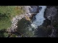
The Jochart is a 1266 m high mountain northwest of Rohr im Gebirge. Hiking trails lead up from the Traisenbeck curve or from Rohr. I ascended pathless from the northwest from the Innerhalbachtal over the ridge, which old maps call 'Waschhofer Berg'. Starting point was the point south of the 'Kumpfmühle', marked as 'Postbriefkasten' in Google Maps, and in others as 'Gasthof Raintaler' (which I couldn't find, however). The Hofstättgraben runs east of it to the south. There are no parking spaces there, I used a layby on the roadside.
Keywords:
Video length: 09:39
|
Comments
You must log in to post a comment:
If you do not yet have a username, you must first
register.