Login
Login
Username:
Password:
Remember me:
Login
Not registered yet?
Registration
.
Forgot password?
List of mountains
Trip search
News
Forum
List of mountains
Trip search
Panorama
Video
Summit register
Events
Animals
Flowers
Map
GPS tracks
Webcams
Pictures
Donate
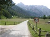
Logarska dolina
Support Hiking-trail.net with a donation. Thank you.
close
Logarska dolina
Country:
Slovenia
Mountain range:
Kamnik Savinja Alps
Latitude/Longitude:
46,3855242°N 14,62200912°E
Altitude:
866 m
Type:
Valley
Description:
Images:
Show map
Points in the vicinity:
Sušica
Zgornji Pavličev Kogel
Koča na Klemenči jami pod Ojstrico
Koran
Veliki vrh
TIC Logarska dolina
Palenk Waterfall
Bajta
Logarska Dolina
Plesnikova Planina
Savinjek
Matkov kot
Turni
Rkljeva peč
Kipernik
Matkovo okno
Rjavčki vrh (Planinšca)
Travnik
Krofička
Bar Pod slapom
Detailed descriptions
Koča na Klemenči jami (1208m)
1,2 km southeasterly
Veliki vrh above Matkov kot (1539m)
1,6 km north-northwesterly
Palenk waterfall (730m)
1,6 km north-northeasterly
Plesnikova planina (1319m)
1,8 km east-northeasterly
Matkov kot (920m)
2,1 km northwesterly
Webcams
Kamniško sedlo
3,3 km south-southwesterly
Logarska dolina
3,9 km north-northeasterly
Paulitschsattel
4,8 km northwesterly
Solčava
6,7 km northeasterly
Grintovec
7,4 km west-southwesterly
Panoramas
Koča na Klemenči jami (1208m)
1,2 km southeasterly
Krofička (2083m)
2,5 km southeasterly
Ojstrica (2350m)
3,0 km south-southeasterly
Strelovec (1763m)
3,1 km east-northeasterly
Dom na Okrešlju (1396m)
3,2 km southwesterly
GPS tracks
Logarska dolina - Klemenča Jami Mountain Hut
Kamnik Savinja Alps
Plesnikova planina - Koča na Klemenči jami
Kamnik Savinja Alps
Dom planincev v Logarski dolini - Zabrložnica
Kamnik Savinja Alps
Dom planincev v Logarski dolini - Krofička (Dom planincev - Koča Klemenčja jama - Škrbina - Krofička - Koča Klemenčja jama - Dom planincev)
Kamnik Savinja Alps
Koča na Klemenči jami - Krofička
Kamnik Savinja Alps
Video
Matkov Kot Škaf 2014
Matkov kot - Škaf - 2013
Matkov kot - Škaf
Zabrložnica Matkovo Window Okrešelj
Krofička
Starting points
Dom Planincev v Logarski dolini
0,2 km southerly
Na razpotju
0,8 km north-northeasterly
Hotel Plesnik
1,2 km north-northeasterly
Logarski kot
1,4 km south-southwesterly
Koča pod slapom Rinka
2,5 km southwesterly
Copyright © 2026 Hiking-trail.net,
Terms of use
,
Privacy and cookies