Hiking-trail.net
hiking-trail.net
Login
Login
Username:
Password:
Login
Not registered yet? Registration.
Forgot password?
Činčev breg

Činčev breg

Country: Slovenia
Latitude/Longitude: 46,837493°N 16,043038°E
Altitude: 375 m
Type: Summit
Weather forecast:
Fr
Sa
Su
Mo
Tu
Description:
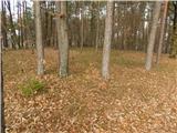
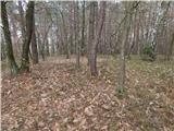
Činčev breg is 375 meter high peak. The peak is located 0.6 km south-southeast from the center of Bonisdorf and 1.4 km north-northeast from the center of Sotina. bivouac Abzweigung Merkendorf is a bit further away.
Images:
Činčev breg Činčev breg
Show map
Points in the vicinity:
Detailed descriptions
Webcams
Kuzma
2,9 km easterly
Klöchberg
10,6 km southwesterly
Mačkovci
10,8 km east-southeasterly
Straden - Saziani
13,7 km west-southwesterly
Čepinci
14,0 km east-northeasterly
Panoramas
Serdiški breg (Rdeči breg) (416m)
2,4 km west-southwesterly
Rotunda of St. Nikolaj (Selo) (251m)
21,4 km east-southeasterly
Bukovniško jezero (189m)
28,9 km southeasterly
Zavrh v Slovenskih goricah (370m)
37,1 km south-southwesterly
GPS tracks
Starting points
TV Neuhaus am Klausenbach
1,4 km north-northwesterly
border crossing Sotina
1,8 km westerly
Sotina (Dajčev mlin)
1,9 km southwesterly
Sotina
2,0 km south-southwesterly
OMP Kuzma
2,2 km northeasterly
         
Copyright © 2026 Hiking-trail.net, Terms of use, Privacy and cookies