Snow conditions 26. 4. 2026
26.04.2026
Avalanche forecast
Sunday, 26. 4. 2026
Danger level Sunday, 26. 4. 2026 at
Danger level 1 – low
Southern Julian Alps, Central Julian Alps, Eastern Julian Alps, Western Julian Alps, Kamnik Alps, Savinja Alps and Carinthia, Western Karawanks, Central Karawanks
The danger of snow avalanche release will be low
The old snowpack is mostly well transformed, bonded and stable. The danger of wet snow avalanche release will be relatively low. During warming, a snow avalanche may occur during the day.
This week, mainly in the high mountains, a smaller amount of new snow fell. Smaller snow deposits formed, which can be potentially unstable.
Snowpack
Danger patterns
dp.10: spring conditions
In clear weather and dry air mass, the snowpack will mostly refreeze overnight. During the day the snow will crust and melt again. The zero isotherm will be at an elevation of around 2800 m.
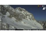
Ridges are already quite bare even in the high mountains. There is relatively little snow for this time.
Weather
On Sunday it will be clear at first, in the afternoon slightly to moderately cloudy. Some high mountain peaks will occasionally be in fog. Wind will mostly be light and variable. At midday, the temperature at 1500 m around 12, at 2500 m around 3 °C.
Outlook
On Monday temporarily more cloudiness. Slightly cooler. The snowpack due to some more cloudiness probably will not refreeze.
https://www.hribi.net/snezne_razmere_v_gorah Source: ARSO