Žlebinje - Črnokalska Varda
Starting point: Žlebinje (379 m)
| Latitude/Longitude: | 45,5769°N 13,8751°E |
| |
Walking time: 10 min
Difficulty: easy marked way
Elevation gain: 44 m
Elevation difference along the route: 44 m
Map: Primorje in Kras 1:50.000
Recommended equipment (summer):
Recommended equipment (winter):
Views: 929
 | 1 person like this post |
Access to starting point:
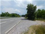
From the highway Koper - Ljubljana, we take the exit Kastelec, then continue right in the direction of Ljubljana, Kozina and Podgorje. Two crossroads follow, where we stick to the direction for Kozina; when we reach the old road Koper - Ljubljana, we drive along it to the first turn-off of the forest road to the right (the turn-off from the main road is located near the spot where the highway goes into the Kastelec tunnel). We drive onto the mentioned road, which immediately changes into a cart track, and we park in an appropriate place beside the side road.
The starting point is appropriate if we come from the direction of Kastelec or Črni Kal, because from the opposite direction it is prohibited to turn onto the side road. If we come from the direction of Kozina, then the starting point Varda is more appropriate.
Route description:
From the starting point, we continue on the cart track, and after a few steps we reach a marked path, which we follow to the left (right Črni Kal). The path ahead leads us through the underpass below the main road, and then on the other side we continue right in the direction of Varda and castle Socerb. A few junctions follow, where we follow the blazes; after that follows a steep ascent to the summit of Črnokalska Varda, where there is a summit log box and from where a nice view opens up.
Description and pictures refer to the condition in the year 2016 (June).
Photos:
 1
1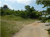 2
2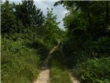 3
3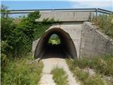 4
4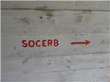 5
5 6
6 7
7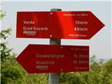 8
8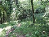 9
9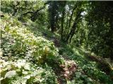 10
10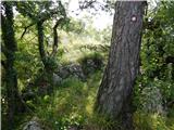 11
11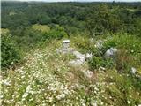 12
12 13
13
Discussion about the trip Žlebinje - Črnokalska Varda
To post a comment you must log in:
If you do not yet have a username, you must first
register.