Zgornji Goreljek - Javorov vrh (Pokljuka)
Starting point: Zgornji Goreljek (1279 m)
| Latitude/Longitude: | 46,3362°N 13,9651°E |
| |
Walking time: 1 h 30 min
Difficulty: easy marked way
Elevation gain: 203 m
Elevation difference along the route: 250 m
Map: TNP 1:50.000
Recommended equipment (summer):
Recommended equipment (winter):
Views: 25.995
 | 2 people like this post |
Access to starting point:
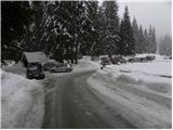
From the highway Ljubljana - Jesenice we take the exit Lesce and follow the road in the direction of Bled, there at the traffic-light crossroads signs for Pokljuka direct us to the right. This road, which in the lower part runs through some villages and later starts to ascend more steeply, we follow in the direction of Šport hotel on Pokljuka. At the crossroads in the immediate vicinity of the hotel we continue slightly left and continue driving towards the mountain pasture Goreljek and ski lift Jelka, which is situated by the eponymous inn. We park on the arranged parking lot by the information boards (parking lot on the right side of the road is intended for visitors of the ski slope).
Route description:
From the parking lot, we continue on the road which is gently descending towards the bottom part of the mountain pasture Goreljek. After approximately 15 minutes of walking, we come to the marked crossroad, where we continue right in the direction of the mountain pasture Zajamniki. We continue the ascent on the forest road which quickly passes into the forest and is then barely ascending. Eventually, the road on the right side bypasses the mountain pasture Jelje, and we follow it for some time, and then on the right side we notice signs for Javorov vrh, which point us to the right on at first a wide footpath. The path ahead at first moderately ascends, and then for some time flattens and brings us into a belt of sparse forest. After a few minutes, the path returns into a dense spruce forest and it again starts moderately ascending. The mentioned path, by which we notice some old and quite faded blazes, we then follow all the way to vegetated Javorov vrh.
From the top, we continue a little further (direction west) and after some 10 steps of additional walking, we get to a nice vantage point, from which a nice view opens up on the highest peaks of the Julian Alps.

Along the route: Planina Jelje (1300m)
Photos:
 1
1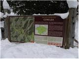 2
2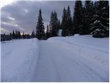 3
3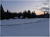 4
4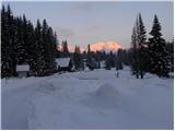 5
5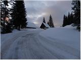 6
6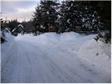 7
7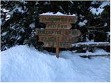 8
8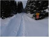 9
9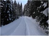 10
10 11
11 12
12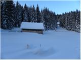 13
13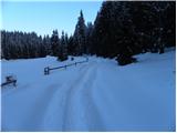 14
14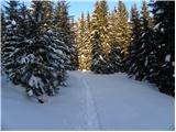 15
15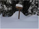 16
16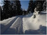 17
17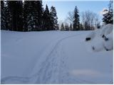 18
18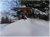 19
19 20
20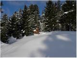 21
21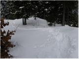 22
22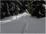 23
23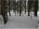 24
24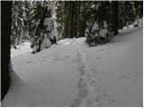 25
25 26
26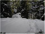 27
27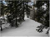 28
28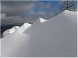 29
29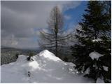 30
30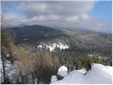 31
31
Discussion about the trip Zgornji Goreljek - Javorov vrh (Pokljuka)
|
| Breda28. 06. 2010 |
Yesterday I was at Javorov vrh. From the road from Goreljek to Zajamniki, at the sharp bend turn right into the forest. Short walk through the forest from the road to the top. Nice view from the top towards some Julian peaks. The peak is on Bohinjska planinska pot, if you need a stamp bring a pad. No logbook at the top.
|
|
|
|
| gojzer7529. 10. 2010 |
Visited Javorov vrh yesterday, very nice and not too cold day, excellent "tour" for winter so you don't get stiff...
|
|
|
|
| frenk 4510. 05. 2011 |
mushrooms, mushrooms, mushrooms or does anyone know, are they already growing on Pokljuka?
|
|
|
|
| heinz10. 05. 2011 |
especially those under the oaks..
|
|
|
|
| turbo11. 05. 2011 |
Mushrooms, yeah yeah.
Many say everything went to the mushrooms 
|
|
|
|
| Zvonček22. 08. 2017 |
Today I was at Javorov vrh. The summit sign might have been visible in 2010, now spruces have overgrown it. I turned around only at the Konjska dolina sign and on one of the bends took a path that seemed logical to me for the summit. After 10 m I accidentally looked back and saw the Javorov vrh 1.6 km sign (why it says another 1.6 km, I really don't know). The summit is worth a visit, as the view is exceptional.
|
|
|
|
| modrook1212. 07. 2020 |
Hello! I'm interested in how well the trail is marked? Best regards, Franci
|
|
|
|
| modrook1217. 07. 2020 |
Yesterday we walked this path. The path is really very poorly marked. No markings anywhere, the sign shown in picture no.20 you really can't see because it's all overgrown. If you hadn't memorized how the junction looks from the pictures, you'd surely miss it. The path maintainer should take better care of it. The summit itself has beautiful-beautiful views.
|
|
|
To post a comment you must log in:
If you do not yet have a username, you must first
register.