Zgornje Poljčane - Studenice castle
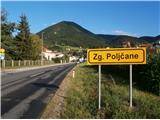
Starting point: Zgornje Poljčane (270 m)
Walking time: 55 min
Difficulty: easy marked way
Elevation gain: 45 m
Elevation difference along the route: 130 m
Map: Posavsko hribovje Boč - Bohor 1:50.000
Recommended equipment (summer):
Recommended equipment (winter):
Views: 2.399
 | 2 people like this post |
Access to starting point:
A) From the direction of Ljubljana we leave the highway in Slovenske Konjice and through Žič, Loče and Zbelovo drive to Poljčane. At the crossroad, we continue right in the direction of Zgornje Poljčane for a few hundred meters, where we park in the center of the settlement; a suitable place is the parking spot by the cemetery.
b) From the direction of Maribor we leave the highway in Slovenska Bistrica, where the signs point us to Poljčane. Through the center of the settlement Poljčane we continue in the direction of Zgornje Poljčane, where in the center of the settlement we park; an appropriate place is the parking spot by the cemetery.
Route description:
After a short tour of the center of the settlement Zgornje Poljčane we continue across the stream Bela by the rectory a little upwards along the road. We reach the entrance to the church left by the path, on the facade there is also a relief of two Romans. After the tour we continue left in the direction of the settlement Podboč on an asphalt connection, also Formilska kolesarska pot. We soon reach a pleasant, smaller settlement Podboč and left by the path the tree Černogova tisa and a well renovated by locals.
We continue right on the road upwards, now we also enter the landscape park Boč & Plešivec. The asphalt surface changes into a forest road. The view left is also a view lower to the surroundings of Poljčane and the bed of the flood river Dravinja among fields and meadows. The road passes into the forest and we soon reach a grassy plain, where the road flattens.
On the grassy plain there is on the right a smaller storage with a field and on the left vineyards. We continue again through the forest and the road winds pleasantly left, right... At the end of the flat part sharply left downwards and descent on a narrower forest stone road, while to the right upwards there is a continuation higher to Boč.
We continue downwards, the path descends pleasantly, it is well compacted and we soon reach the intermediate goal of the path, the spring of the Topli/Studeniški stream at an altitude of 295 meters.
Across a wooden bridge we continue to the other side of the stream and soon continuing after a short plain lightly downwards, where left by the path there is a nuns' cemetery and right a smaller spring/streamlet in a wooden trough. A few meters further upwards on a narrower path by a wooden fence for grip. We follow the path higher, downwards the old core of Studenice with the monastic complex is nicely visible. By the descendant of the old Maribor vine we continue to reach Studeniški Castle. Through the centuries some has been preserved, also renovated a decade ago and the goal of the path rewards us with beautiful views of the world of the Dravinja river valley, Boč...
The length of the described path is around 3500 meters, 130 positive elevation meters and 85 negative elevation meters.

Along the route: Izvir Toplega (Studeniškega) potoka (295m)
Photos:
 1
1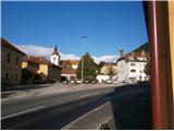 2
2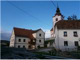 3
3 4
4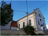 5
5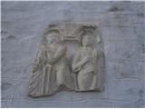 6
6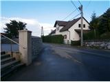 7
7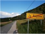 8
8 9
9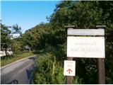 10
10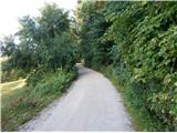 11
11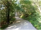 12
12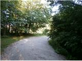 13
13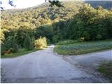 14
14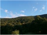 15
15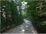 16
16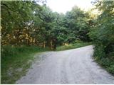 17
17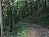 18
18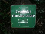 19
19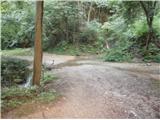 20
20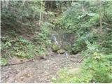 21
21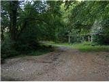 22
22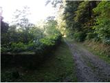 23
23 24
24 25
25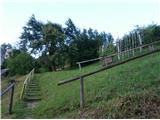 26
26 27
27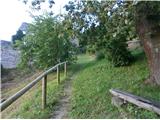 28
28 29
29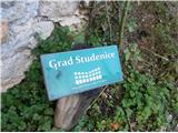 30
30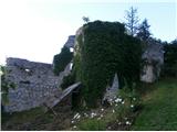 31
31
Discussion about the trip Zgornje Poljčane - Studenice castle
|
| bruny21. 10. 2014 |
Up higher on the top of Boč near the RTV tower, the mists of the distinct northern front were moving quickly before reaching it. Short cycling activity today between 1.73 - 5.15 kilometers along the described path... Studeniški grad by bike in one circular combination... there through the vineyards/plateau Pritensko and back down along the Dravinja... There through Zgornje Poljčane and back through Spodnje Poljčane. In both combinations, the settlement Podboč and a few tens of meters were missing to connect through the center of the settlement. Final approach to the castle on foot. Interesting circular section between Poljčane and Studenice and a bit of Boč. There were still some southern directions but the partial northern breath was already felt...
Track:Studeniški grad,21.10.2014
|
|
|
To post a comment you must log in:
If you do not yet have a username, you must first
register.