Zgornje Poljčane - Boč (via Baba)
Starting point: Zgornje Poljčane (360 m)
| Latitude/Longitude: | 46,2971°N 15,5834°E |
| |
Route name: via Baba
Walking time: 1 h 45 min
Difficulty: easy marked way
Elevation gain: 618 m
Elevation difference along the route: 618 m
Map: Posavsko hribovje (Boč - Bohor) 1:50.000
Recommended equipment (summer):
Recommended equipment (winter):
Views: 111.842
 | 8 people like this post |
Access to starting point:
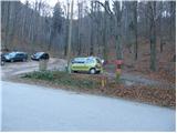
From the highway Ljubljana - Maribor, we head to the exit Slovenske Konjice and Poljčane. At the first intersection after leaving the highway, we continue left in the direction of Poljčane (right Slovenske Konjice). The road then takes us through Draža vas, Žiče and Loče. In the village Loče we come to a roundabout, where we continue "straight" in the direction of Poljčane (the exit from the roundabout is not marked). A little further on, the road brings us to a larger intersection, where we continue right in the direction of Zgornje Poljčane (left Poljčane). We follow this road to the village, where the road sign for Boč directs us left upwards. We then drive to the first hiking signposts beside which there is a parking lot where we park.
Route description:
From the parking lot, we continue right on the path in the direction of the mountain hut Dom na Boču over Babe. The path which runs through the forest already starts relatively steeply ascending and after approximately 15 minutes of ascent crosses a road. The steepness of the path after a further few minutes of ascent decreases. Next follows a shorter crossing of the slopes on a wide path, and then the path for a short time moderately ascends. A little higher, the path brings us on a wide cart track which we follow to the right and then we soon leave it. Further, blazes point us to the left upwards. After initial few steep meters from the spot when we left the cart track, the path barely ascends to the spot when it brings us to the road. Further follows a 5-minute walk on the road that runs in the middle of a large meadow to the mountain hut, which is situated on the other side of the extensive meadow.
From the hut, we continue straight on the path in the direction of Boč. The path at first crosses the meadow and then goes into the forest, where it soon brings us on a cart track, where we have two options to continue, which are approximately equally long. We continue right in the direction of the shady path Senčna pot. After a few steps of easy walking on the cart track, a marked footpath branches off to the left upwards, that in some parts starts relatively steeply ascending (straight ahead the cart track brings us to the road).
The path which all the way to the top runs through the forest after 45 minutes of walking from the mountain hut brings us to Boč. Here the ascent does not end yet. In front of us we see a 20 m high lookout tower on which we ascend via steep stairs. The ascent to the top of the tower rewards us with a nice view.

Photos:
 1
1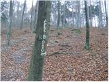 2
2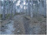 3
3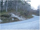 4
4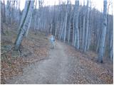 5
5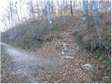 6
6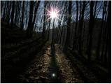 7
7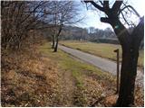 8
8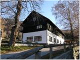 9
9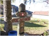 10
10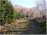 11
11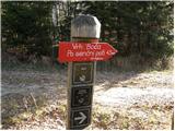 12
12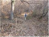 13
13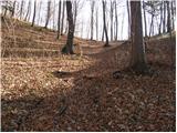 14
14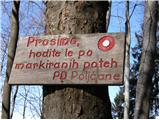 15
15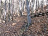 16
16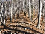 17
17 18
18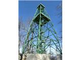 19
19
Discussion about the trip Zgornje Poljčane - Boč (via Baba)
|
| Stolar17. 09. 2009 |
Nice trip, suitable just for the days ahead of us.
|
|
|
|
| Luciano6728. 09. 2009 |
We walked the route together with my father-in-law on Saturday morning and I have to admit we were thrilled. I recommend it to everyone who wants to visit Boč, the ascent will be rewarded at the end with a wonderful view from the tower.
|
|
|
|
| Okmodko19. 04. 2010 |
I went, but it cut me so much in the back that I don't know if I'll go again. Anyway plenty of frost and that in February, but I didn't find any woman. So I'm staying in the village.
|
|
|
|
| klm11. 09. 2010 |
Today I ran to the top. The path is quite straight, already right at the start at the parking lot it starts steeply ascending. From the starting point to the top there is 640 m of ascent, which needs to be overcome in just 2.7 km - comparable to the ascent to Kamniški vrh!
Otherwise, the Poljčane PD has set up new signposts and markings. Both paths described in the forum intertwine with each other, and further on both have their own variations. If the visitor is early enough and as quiet as possible, they will have plenty of opportunities to surprise a herd of mouflons.
|
|
|
|
| Matjaz_652. 05. 2011 |
some of my photos ... with ascent over baba and balunjačo ... and descent along shady path and over baba
from the starting point we can actually ascend via the children's path ... which joins above the hut on the path over balunjačo ... or over baba to the hut ... and further over balunjačo or shady path 
|
|
|
|
| panda23. 05. 2011 |
Today after many years back on top of Boč. Start for two from the parking lot in Spodnje Poljčane at a fairly "late hour" i.e. 9 o'clock on the "over Baba" path. Short rest at the hut for sandwich and water from backpack, as the hut is unfortunately closed on Mondays. On the summit it was quite windy, views so-so. To the south Gorjanci, then Lisca, Kum, partial Kamnik range, Peca and in front of it Uršlja gora, Pohorje........ Descent the same way and then to the famous golden baked trout in the famous Indian valley just before the rain. All's well that ends well.
|
|
|
|
| Helena42. 08. 2017 |
Hike over Baba. At the beginning a bit steep, then nice path to the hut. From the hut onwards through the forest, also a bit steep but nice path. You get the stamp at the hut. Markings well indicated.
|
|
|
|
| jprim3. 08. 2017 |
Super, after a long time something new reported.
|
|
|
|
| Sandi7229. 12. 2024 12:32:07 |
Was up there today, the steepness doesn't let up to the top. From the transmitter to the tower it's icy and very slippery!
|
|
|
|
| jprim30. 12. 2024 12:52:33 |
I just say, where are those times when you were trudging more than half a meter deep on the ridge, winter, winter, real winter.
Another path that's not in the trail description.
LP!
|
|
|
To post a comment you must log in:
If you do not yet have a username, you must first
register.