Starting point: Zgornja Sorica (950 m)
| Latitude/Longitude: | 46,2273°N 14,029°E |
| |
Walking time: 1 h 30 min
Difficulty: easy marked way
Elevation gain: 597 m
Elevation difference along the route: 597 m
Map: Škofjeloško in Cerkljansko hribovje 1:50.000
Recommended equipment (summer):
Recommended equipment (winter): ice axe, crampons
Views: 10.133
 | 1 person like this post |
Access to starting point:
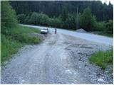
From Železniki we drive towards Soriška planina. At the crossroad at Zgornja Sorica we continue left in the direction of Petrovo Brdo and Tolmin and then after 50 meters we park at a suitable spot next to the next crossroad.
From Podbrdo we drive towards Železniki, but only to the village Petrovo Brdo, where we continue left in the direction of Soriška planina. We follow this road to Zgornja Sorica, where we park only about 50 meters before the crossroad, where the road towards Železniki branches off to the right downwards.
Access from the Bohinj direction is also possible.
Route description:
From the starting point, we head onto an ascending macadam road, which after just a few steps brings us to a crossroad. We continue on a somewhat steeper cart track, which climbs between the two roads (the right road leads to the nearby quarry). The initially relatively steep cart track soon flattens and brings us over a panoramic slope (view of Sorica) to the point where we join a marked path (it is also possible as far as here on the marked path that starts right at the crossroad, but I do not recommend the ascent on it due to overgrowth).
We continue the ascent on a well-marked footpath, which higher up approaches the road to Soriška planina completely.
We continue straight in the direction of Lajnar (right along the road to Soriška planina) on a path that becomes increasingly overgrown. The still well-marked path, which ascends the slopes of Dravh, brings us higher to the edge of the forest, where we notice a decaying shepherd's hut.
Further, the path leaves the forest onto a heavily overgrown grassy slope (the blazes also become rarer), along which we ascend on a barely visible path. The overgrown path in the upper part crosses several slopes that are slippery and dangerous when wet, then brings us to the main ridge, where the overgrowth ends.
We continue right (left to Lajnar) along the ridge path, which after 10 minutes of further walking brings us to the panoramic summit.

Photos:
 1
1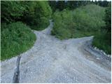 2
2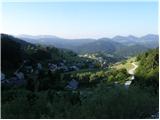 3
3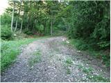 4
4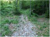 5
5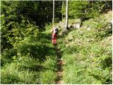 6
6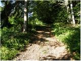 7
7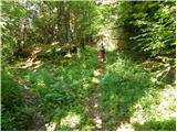 8
8 9
9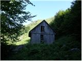 10
10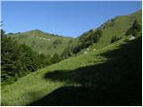 11
11 12
12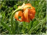 13
13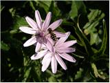 14
14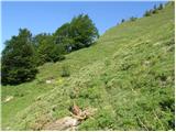 15
15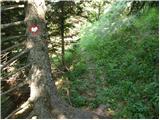 16
16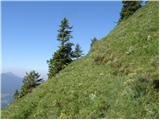 17
17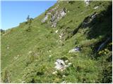 18
18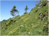 19
19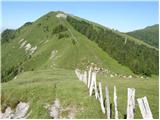 20
20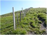 21
21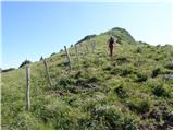 22
22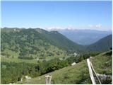 23
23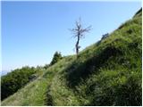 24
24 25
25
Discussion about the trip Zgornja Sorica - Dravh
|
| rober17. 06. 2009 |
Nice... especially probably because there aren't many people, a trip for the soul...
|
|
|
|
| Tadej17. 06. 2009 |
The path is really solitary and surrounded by numerous flowers, the view is also nice. Somewhat less pleasant is the ascent through tall grasses, especially if they are wet.
Descent is possible via the usual path to Litostrojska koča and then partly by road, partly on footpath back to the starting point.
|
|
|
|
| grega_p7. 11. 2009 |
With a colleague, we went up from Zg. Sorica today, but we didn't anticipate such winter conditions, so it was already sinking properly at the top, I'd say about 30cm of fairly dry snow up there. And unfortunately no view due to fog, but at least the body got a good workout. Down to Soriška planina on ski tracks past the border dogs and back to the car by road. All in all about 3h in these conditions.
Thanks to the predecessor for the track, otherwise I would have gone along the usual path, where due to steep grass I would probably have taken two steps forward and one or more back:-)
Good luck everyone!
|
|
|
|
| viharnik7. 11. 2009 |
Your predecessor was probably no one else but the African Janez, who is a fan of ski touring - Gore ljudje net.
|
|
|
|
| vespuci20. 05. 2012 |
For everyone heading to the path described above, let me say that due to the collapsed path before stepping onto the ridge – rain has carved a 2 m wide gully, I do not recommend it.
|
|
|
|
| Habič Borut21. 01. 2013 |
The path is not really dangerous, just need to be a bit careful. We walked it on January 2nd this year.
Borut
|
|
|
To post a comment you must log in:
If you do not yet have a username, you must first
register.