Zettersfeld - Goiselemandl
Starting point: Zettersfeld (1860 m)
| Latitude/Longitude: | 46,8678°N 12,78353°E |
| |
Walking time: 1 h 30 min
Difficulty: easy marked way
Elevation gain: 573 m
Elevation difference along the route: 573 m
Map:
Recommended equipment (summer):
Recommended equipment (winter): ice axe, crampons
Views: 2.224
 | 2 people like this post |
Access to starting point:
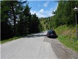
Through the Karawanks Tunnel, we drive to Austria, and then we continue driving towards Spittal and further towards Lienz (a little after Spittal the highway ends). Further, we drive on a relatively nice and wide road through the Drau Valley. In the center of Lienz, at the roundabout, we continue right towards the town of Matrei. Already after a few hundred meters after the roundabout we continue sharply right and then left over a bridge towards the town of Thurn. Further, we all the time follow the green signs »Zettersfeld Zentrum«. A little before the ski center, when the road starts descending, we will on the left side of the road notice a macadam road which leads towards the ski area and is closed for traffic. By the road are also yellow hiking signposts. We park on one of the smaller parking lots nearby. A little further on the main road there is also a larger parking lot.
Route description:
From the starting point, we go on a macadam road (path 9b) following the signs »Steinermandl«. The road which is closed for traffic ascends towards the east and brings us to the ski area where we soon come to a junction.
We continue left following the signs »Steinermandl« and we are then for some time ascending below the chairlift, which runs towards the summit Steinermandl. The road later turns left and it ascends a little steeper. From the path, we have otherwise all the time a very nice view towards the Lienz Dolomites and the town of Lienz. The road then becomes gentler and leads us past a large artificial lake, which is intended for snowmaking. Here the road turns slightly to the right and it brings us to a marked junction.
Ahead on the road leads the path towards the summit Steinermandl and the upper chairlift station. We continue left upwards on a footpath which starts ascending on a grassy slope. Higher when the slope becomes gentler we come again to a junction.
From the right joins the path from the upper station of the chairlift, straight leads the path on the north side of the peak Goiselemandl (Goiselemandlweg Nord), and we continue left on the path 913 following the signs »Goiselemandl, Schleinitz«. Further, the path runs towards the northwest and brings us below the slopes of the peak Goiselemandl. Here we leave the path towards the lakes Neualplseen and summit Schleinitz and we continue right upwards where the signpost points us. Next follows even a little steeper ascent on a grassy ridge by the fence all the way to the top from which a nice view opens up on all sides.

Photos:
 1
1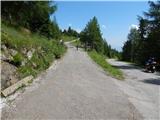 2
2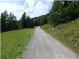 3
3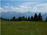 4
4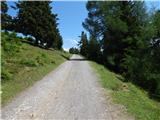 5
5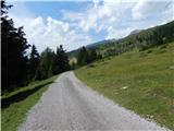 6
6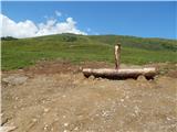 7
7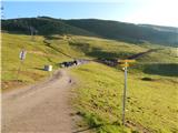 8
8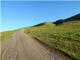 9
9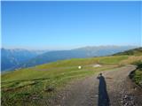 10
10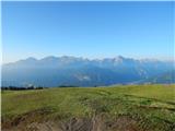 11
11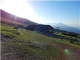 12
12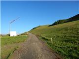 13
13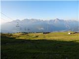 14
14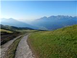 15
15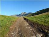 16
16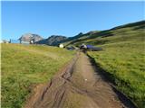 17
17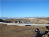 18
18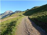 19
19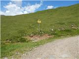 20
20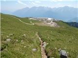 21
21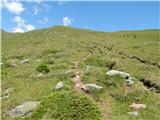 22
22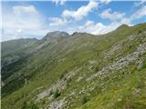 23
23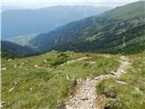 24
24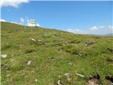 25
25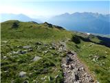 26
26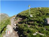 27
27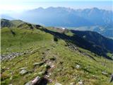 28
28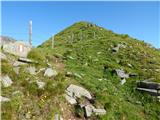 29
29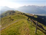 30
30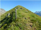 31
31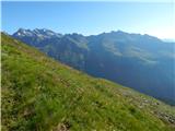 32
32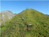 33
33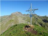 34
34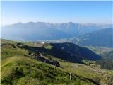 35
35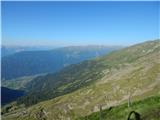 36
36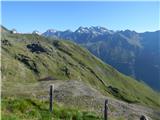 37
37
Discussion about the trip Zettersfeld - Goiselemandl
|
| Okmodko26. 08. 2013 |
Hey moderator! High tours are so extensive, why not expand them in the list of mountains to include Ankogel group, Venediger group, Veliki Klek group, Goldberg, Schober, Kreuzeck group, and maybe some others I forgot?
|
|
|
To post a comment you must log in:
If you do not yet have a username, you must first
register.