Šajda / Zell-Schaida - Obirska planina
Starting point: Šajda / Zell-Schaida (1069 m)
| Latitude/Longitude: | 46,4791°N 14,4675°E |
| |
Walking time: 1 h 30 min
Difficulty: easy marked way
Elevation gain: 203 m
Elevation difference along the route: 225 m
Map: Karavanke - osrednji del 1:50.000
Recommended equipment (summer):
Recommended equipment (winter): ice axe, crampons
Views: 4.326
 | 1 person like this post |
Access to starting point:
A) Over the border crossing Jezerski vrh or Pavličev vrh we drive to Železno Kaplo / Bad Eisenkappel, from there we continue driving left towards Šajda / Zell-Schaida. When we get to the village Šajda / Zell-Schaida we will notice near the church the parking lot and signposts for Ojstrc / Hochobir, where we park.
B) Over the border crossing Ljubelj we drive to Austria, we follow the main road towards Celovec / Klagenfurt to the village Podljubelj / Unterloibl, where we turn right towards the settlement Borovlje / Ferlach. From Borovlje we continue driving through the villages Medborovnica / Unterferlach, Ostrovca / Ostrouza, Trata / Tratten, Glinje / Glainach, Vesca / Dörfl, Ždovlje / Seidolach, Dobrova / Dobrowa, Kočuha / Gotschuchen, Šmarjeta / St. Margarethen, Dolnja vas / Niederdörfl, then past the settlement Zgornja Vesca / Oberdörfl we descend to the stream Borovnica / Freibach. We cross the mentioned stream, then we quickly ascend to an intersection, where we continue right towards Borovniško dammed lake / Freibach - Stausee, Šajda / Zell - Schaida. A little above the dammed lake we leave the main road which leads towards the hamlets Sele - Pri cerkvi / Zell - Pfarre, Sele - Borovnica / Zell - Freibach and continue driving left towards the hamlet Sele - Šajda / Zell - Schaida and Šajda pass. We then follow the road, which ascends a little more steeply, to Šajda pass, where we also park at a suitable place near the church or the pass.
Route description:
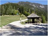
From the parking lot, we head onto the asphalt road which goes towards Železno Kaplo / Bad Eisenkappel. After a few tens of meters of walking, the footpath branches off to the left, onto which we also turn. The path, which rises only slightly, crosses a larger number of gullies, mostly through the forest. Because the path has quite a few junctions we have to carefully follow the blazes. A few minutes before the mountain pasture Obirska planina we encounter an exposed passage, which is well secured and in dry conditions does not pose a greater risk. In the snow and ice great caution is needed. After that we step onto the planina, along which we walk to the shepherd's hut.
Photos:
 1
1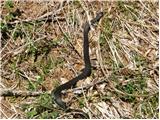 2
2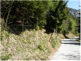 3
3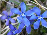 4
4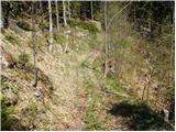 5
5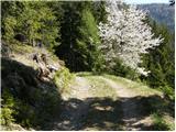 6
6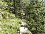 7
7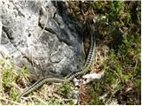 8
8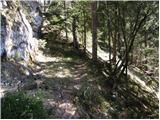 9
9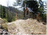 10
10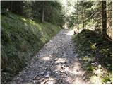 11
11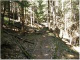 12
12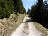 13
13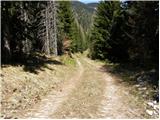 14
14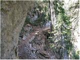 15
15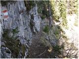 16
16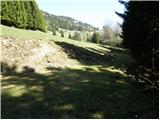 17
17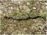 18
18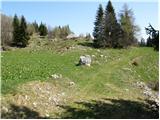 19
19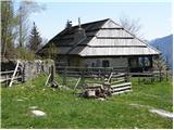 20
20
Discussion about the trip Šajda / Zell-Schaida - Obirska planina
|
| Gustl10. 08. 2012 |
Is there really so many snakes on the trail as this album shows....3 pictures out of 14, and the first is on the asphalt road.
|
|
|
|
| Gustl13. 08. 2012 |
I did the route yesterday - didn't meet any...
|
|
|
To post a comment you must log in:
If you do not yet have a username, you must first
register.