Zbelovo (podvoz pod železnico) - Ljubična gora (via Marijine stopinje)
Starting point: Zbelovo (podvoz pod železnico) (264 m)
| Latitude/Longitude: | 46,2958°N 15,5325°E |
| |
Route name: via Marijine stopinje
Walking time: 45 min
Difficulty: easy marked way
Elevation gain: 269 m
Elevation difference along the route: 269 m
Map:
Recommended equipment (summer):
Recommended equipment (winter): crampons
Views: 1.980
 | 2 people like this post |
Access to starting point:
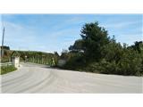
A) We leave the highway at the Slovenske Konjice exit and turn left, direction Žiče. In Žiče at the crossroads we turn left, direction Loče. In Loče at the roundabout we turn in the direction of Poljčane - Zbelovo. We drive through Zbelovo, where at the end of the settlement we see the underpass under the railway track. We drive through the underpass and immediately turn right, past the bus stop over an old wooden bridge and park on the left on a smaller parking lot.
B) We leave the highway at the Slovenska Bistrica-Jug exit and follow the signposts in the direction of Poljčane. We drive through Poljčane; at the end of the settlement signs direct us to the right, direction Loče - Zbelovo. We follow the main road until we arrive at the underpass under the railway. We do not turn right through the underpass, but turn left before the bus stop onto the old wooden bridge, and then park on the left on a smaller parking lot.
Route description:
When we park, we head along the road that continues past the parking lot and the whole time runs parallel to the railway. At the end of Zbelovska Gora we reach the first crossroads, where we turn left and follow the asphalt road until we see that on the left side of the road a staircase starts steeply ascending into the forest. Here we are also greeted by mountain signposts for the path along Marijine stopinje. We follow the quite steep and very beautiful path straight uphill. The path is well marked and trodden and without turn-offs. We follow the blazes and soon arrive at the cross at Marijine stopinje, which is the point of the Loško-Zbelovska hiking trail and some "unofficial summit" (the summit of Ljubična gora is a little further along the path by the telecommunication tower and it is not marked).
By the cross there are also benches and a logbook. The summit is not panoramic, but we can extend the path by five minutes and also go to the church of St. Mary on Ljubična gora, which offers beautiful views of Pohorje and Ptujsko polje.

Photos:
 1
1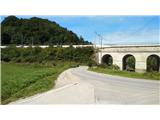 2
2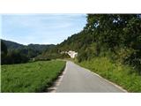 3
3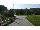 4
4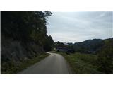 5
5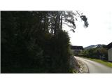 6
6 7
7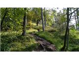 8
8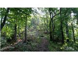 9
9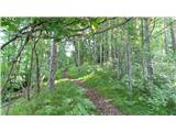 10
10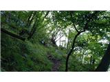 11
11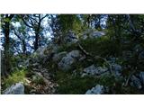 12
12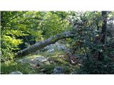 13
13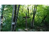 14
14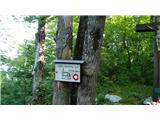 15
15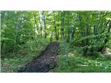 16
16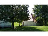 17
17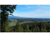 18
18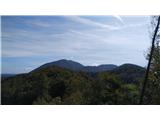 19
19 20
20
Discussion about the trip Zbelovo (podvoz pod železnico) - Ljubična gora (via Marijine stopinje)
To post a comment you must log in:
If you do not yet have a username, you must first
register.