Zatrnik - Hotunjski vrh (west path)
Starting point: Zatrnik (880 m)
| Latitude/Longitude: | 46,3682°N 14,0334°E |
| |
Route name: west path
Walking time: 40 min
Difficulty: easy unmarked way
Elevation gain: 227 m
Elevation difference along the route: 240 m
Map: TNP 1:50.000
Recommended equipment (summer):
Recommended equipment (winter):
Views: 8.950
 | 3 people like this post |
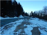
Access to starting point:
A) We drive to Bled, and then continue driving in the direction of Pokljuka. When we arrive at Zatrnik, we do not park at the parking lot by the inn Gostilna Zatrnik, but about 100 meters ahead at the parking lot on the right side of the road. Parking at the parking lot in front of the inn is allowed only for guests of the inn Gostilna Zatrnik (pr Jagru).
B) We leave the Gorenjska motorway at the Lipce exit, and then follow the signs for the settlement Kočna and later Spodnje Gorje. In Spodnje Gorje we join the road from Bled, and we continue in the direction of Pokljuka. When we arrive at Zatrnik, we do not park at the parking lot by the inn Gostilna Zatrnik, but about 100 meters ahead at the parking lot on the right side of the road. Parking at the parking lot in front of the inn is allowed only for guests of the inn Gostilna Zatrnik (pr Jagru).
Route description:
From the parking lot by the main road, we descend to the parking lot by the inn pr Jagru, but we find the beginning of the path in a smaller valley, where in winter there are two children's drag lifts. We continue beside the ski slope or ski piste Bambi (right drag lift), and then, when the drag lift ends, we continue the ascent along the route of a former ski slope. The path, which is usually trodden also in winter, continues along the ski piste, which higher turns increasingly to the left. Higher up, increasingly beautiful views open up from the path, reaching all the way to Triglav, and the path quickly brings us to the former upper station of the drag lift, from where only some 10 steps of walking along the ridge separate us from the summit of Hotunjski vrh.
Description and pictures refer to the condition in 2017 (January).
Photos:
 1
1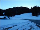 2
2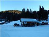 3
3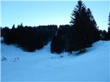 4
4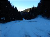 5
5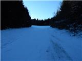 6
6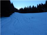 7
7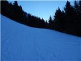 8
8 9
9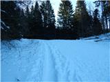 10
10 11
11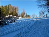 12
12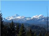 13
13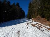 14
14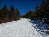 15
15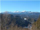 16
16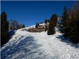 17
17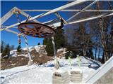 18
18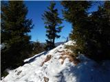 19
19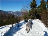 20
20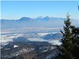 21
21 22
22
Discussion about the trip Zatrnik - Hotunjski vrh (west path)
|
| Majdag9. 04. 2024 10:46:51 |
6.4... Gače, Hotunjski vrh a bit in our own way..
Ascent, unmarked but well-trodden path starts a little from Krnica, left into the forest. Parking space for two cars. Long cart track that turns into a nice path over the green gully. Then through scrub to the forest road. A few steps left to the cabin. And then right is the path or trail that leads all the way to the meadow and Hotunjski vrh.
https://jelenkamenmajdag.blogspot.com/2024/04/gace-hotunjski-vrh-nad-zatrnikom.html
|
|
|
|
| Majdag4. 02. 2025 15:15:19 |
2.2..... Hotunc...
To the right of the ski slope is the easiest and most beautiful ascent and also descent. Snow is just right to step nicely. Towards the top, spruces are lightly decorated with white. Descent on the other side is even steeper path and towards the end a lot of mud. I enjoyed views only on the info boards. Fog everywhere. In the valley towards Pokljuka it was already brightening, lots of traffic...
|
|
|
To post a comment you must log in:
If you do not yet have a username, you must first
register.