Starting point: Zamedveje (200 m)
| Latitude/Longitude: | 46,051°N 13,5887°E |
| |
Walking time: 2 h 30 min
Difficulty: easy marked way
Elevation gain: 612 m
Elevation difference along the route: 612 m
Map: Goriška 1:50.000
Recommended equipment (summer):
Recommended equipment (winter):
Views: 15.733
 | 1 person like this post |
Access to starting point:
From Nova Gorica, we drive towards Tolmin or vice versa. In the village Plave we turn left (from Tolmin direction right), we cross the bridge and then at the crossroad after the bridge, we continue right. Further we drive along the river Soča to the next crossroad, where we continue left in the direction of the village Zamedveje. We follow the road, which is steeply ascending, above the village, where we park on the parking lot by the road.
Route description:
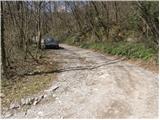
From the parking lot, we continue on the road beside which we parked (also possible on the footpath that branches off from the bend, a few meters before the parking lot, but the path is quite overgrown). The road, which gently ascends and mostly runs through the forest, brings us after approximately 45 minutes of walking to an unmarked crossroad, where we continue right. The road, which gradually becomes more panoramic, past a few houses brings us to the spot where a marked footpath from the village Plave joins from the left. We continue on the road, which slightly ascends and after a few minutes of further walking brings us to a smaller hamlet, where the blazes direct us left among the houses upwards. The path ahead moderately ascends, partly on a grassy slope, partly through the forest. At the top of this ascent we arrive at an asphalt road, where we continue right, but only about 20 m. After 20 m the blazes direct us left upwards, where in a traversing ascent over the grassy slope we climb to the next road. We continue left on the road, which turns right and goes into the forest. In the forest a path branches off to the left upwards to the church of St. Genderce, we here continue on the road, which again emerges from the forest onto panoramic grassy slopes. A little further on, we reach a parking lot, where a poorer road branches off to the left upwards, which after 100 m of walking brings us to the shelter on Korada. From the shelter we continue left on the path, which crosses a short stretch of forest and then along the panoramic summit ridge brings us to the top of Korada.
PS: We can descend past the church of St. Genderce, where we return to the road.

Photos:
 1
1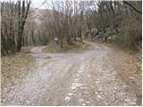 2
2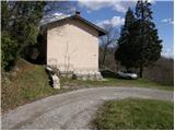 3
3 4
4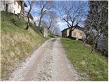 5
5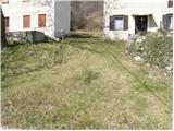 6
6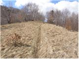 7
7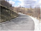 8
8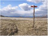 9
9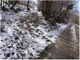 10
10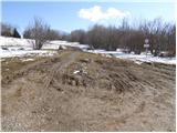 11
11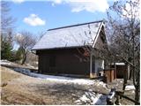 12
12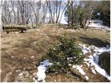 13
13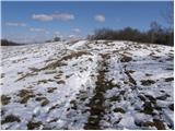 14
14 15
15
Discussion about the trip Zamedveje - Korada
|
| balon31. 08. 2013 |
Is parking possible around the house in picture 3? And how much walking is it if the starting point is from picture 3?
thanks
|
|
|
|
| balon20. 09. 2013 |
does anyone even walk this path?
|
|
|
|
| husky20. 09. 2013 |
Parking is possible about 200 m higher (at the junction of the marked path to Plave). From there to the top of Korada it's about 30 min walk.
|
|
|
To post a comment you must log in:
If you do not yet have a username, you must first
register.