Zalog - Storžič (via Psica)
Starting point: Zalog (600 m)
| Latitude/Longitude: | 46,3281°N 14,363°E |
| |
Route name: via Psica
Walking time: 4 h 30 min
Difficulty: very difficult marked way
Elevation gain: 1532 m
Elevation difference along the route: 1570 m
Map: Kamniške in Savinjske Alpe 1:50.000
Recommended equipment (summer): helmet
Recommended equipment (winter): helmet, ice axe, crampons
Views: 24.088
 | 2 people like this post |
Access to starting point:
From the highway Ljubljana - Jesenice, we take the exit Kranj West and follow the road ahead in the direction of Golnik. Soon after the village Tenetiše, we will notice signs for the village Goriče, which direct us right onto a local road. A little further on, we come to the next crossroads, where we continue right in the direction of the villages Trstenik and Preddvor. We don't follow this road for long either, because after a few meters we will notice the sign with the inscription Zalog, which directs us left onto an ascending road, which we then follow to the mentioned village. In the middle of the village, a little before the church, we will notice a road which turns right from the main road. We turn onto this road, beside which we soon notice blazes. We follow this road for approximately another 1 km, then we park on one of the parking areas by the road.
Route description:
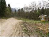
From the starting point we continue along the road beside which we parked, which becomes worse and brings us higher to the NOB monument, where we leave it and continue the ascent right along an ascending cart track. At the spot where the cart track, along which we continue the ascent, turns left, we will notice on the right side a footpath that starts to ascend more steeply through the forest (the beginning is not marked).
The path along which we notice rare blazes then takes us past a small chapel to a poorly marked junction, beside which on a panoramic rise we notice a pleasant bench.
From the viewpoint we continue along the path that ascends slightly right (left Mala Poljana) and goes into the forest after a few steps, where it starts to ascend steeply. The path soon transitions to a wide vegetated ridge, where it continues for quite some time.
A relatively steep path, which higher turns somewhat to the right, brings us after some time to a wide cart track, where we join the path from Povlje.
We continue straight along the ascending cart track, which past the "refreshment point" brings us to the spot where a marked footpath branches off to the left from the cart track. We can continue the ascent along the mentioned footpath, which ascends over grassy slopes, or along the cart track that ascends at the edge of the forest. Both paths join higher and bring us without difficulty to the hut on Velika Poljana.
From the hut we continue along a gentle path that ascends across the pasture and brings us in 5 minutes to the saddle between Grebenc and Psica, where there is also a marked junction. We continue right into the forest along the path towards Storžič via Psica (left Mala Poljana). The path starts to ascend quite steeply, then turns slightly right and the steepness eases somewhat. Such a path soon brings us out of the forest and to a path junction. We turn left onto the path via Psica, right leads an easier path to Storžič.
From the junction the path first runs across grassy terrain beside dwarf pines and sparse trees, then goes back into the forest and starts to ascend steeply. At some spots the path is also somewhat exposed. This is followed by an ascent across a grassy slope beside sparse dwarf pines to a panoramic ridge. We ascend for some time along the increasingly exposed ridge, then reach the indistinct summit of Psica. From the summit we descend slightly, then continue along the exposed ridge. Further on the path along the ridge rises and falls several more times, and some fixed safety gear assists us. Later the path through Žrelo joins from the left, but we continue along the path beside the ridge. In the last part of the path we ascend steeply several more times, with some fixed safety gear for assistance. A little below the summit the easiest path to Storžič joins from the right, which leads across the Javornik pasture. Only a short ascent along the summit slope of Storžič follows, reaching its summit in a few minutes.
Zalog - Velika Poljana 2:00, Velika Poljana - Storžič 2:30.

Photos:
 1
1 2
2 3
3 4
4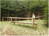 5
5 6
6 7
7 8
8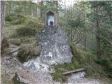 9
9 10
10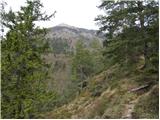 11
11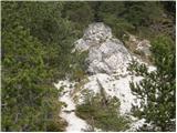 12
12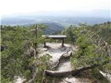 13
13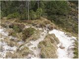 14
14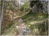 15
15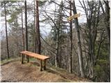 16
16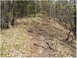 17
17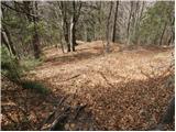 18
18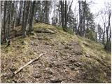 19
19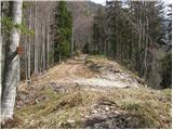 20
20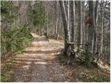 21
21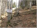 22
22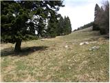 23
23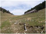 24
24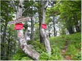 25
25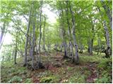 26
26 27
27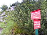 28
28 29
29 30
30 31
31 32
32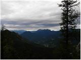 33
33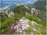 34
34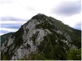 35
35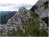 36
36 37
37 38
38 39
39 40
40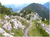 41
41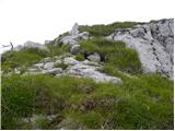 42
42 43
43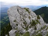 44
44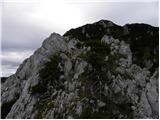 45
45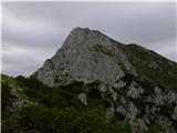 46
46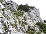 47
47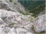 48
48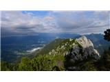 49
49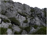 50
50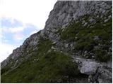 51
51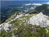 52
52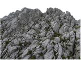 53
53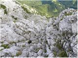 54
54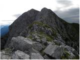 55
55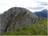 56
56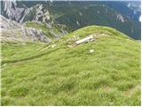 57
57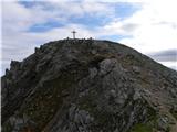 58
58 59
59
Discussion about the trip Zalog - Storžič (via Psica)
|
| barjus28. 07. 2009 |
The start of the trail can also be from Gozd past Kriško goro and first go towards Tolsti vrh and then to Mala polana. Then follow the signs. On the path many primroses are blooming. Nice but quite strenuous due to constant ascending and descending. Back down to planina Javornik as written and then cross back to Velika polana and on to Mala polana.
|
|
|
|
| velkavrh6. 05. 2011 |
I plan to do this tour over the weekend. Has anyone gone this way in the past few days? I'm interested if there's still any snow. Thanks!
|
|
|
|
| nata246. 05. 2011 |
Probably some is still left on the northern side somewhere. At the beginning of April I went on this path and it was mostly dry, only a bit below the summit there was one larger snow patch that could be avoided on the rocks.
|
|
|
|
| atoamac6. 05. 2011 |
On May 1st it looked like this from the summit, but no snow was visible on the southern part of the ridge. (went from Planina Javornik directly to the summit)
|
|
|
|
| atoamac6. 05. 2011 |
On May 1st, some steep snow patches and a thickened ridge edge could still be seen from the summit, but no snow was visible on the southern part of the ridge nor hikers. (went from Planina Javornik directly to the summit)
|
|
|
|
| JUREE6. 05. 2011 |
I went to Storžič via Psico at the end of April,
the path was dry except as Nata24 already wrote, below the summit there was a snow patch that could be avoided on rocks.
|
|
|
|
| barjus8. 05. 2011 |
Today I was up there, there's snow only for three steps. Otherwise nothing special.
|
|
|
|
| velkavrh9. 05. 2011 |
On Saturday I didn't take this route, but I'll definitely do it again this year. I went this path from Bašelj to Kališće and then along the ridge to the top.
|
|
|
|
| hohohodec15. 05. 2011 |
Yesterday I was on this path. It's wonderful, but I don't know if I would have gone if I knew it was very demanding... That's what it says at the junction, where you can go the easier or the very demanding one through Psico.
I don't want to stir up disputes: I know that opinions on what is demanding and very demanding are just as many as tastes and they are not debated. Even if we leave aside that criteria for difficulty could be made, I wonder why there's a difference in the description of difficulty here on the net and there on the sign?
Well, once again: the beauty of the path outweighed all the stress
|
|
|
|
| VanSims22. 06. 2012 |
So: demanding or very demanding path?
This first fixed cable that goes down is quite steep and also crumbly. Here I would recommend self-belaying. The rest is easy scrambling. After joining the path from Žrela it becomes a bit harder but overall in my opinion demanding+.
The path IS exposed and NOT for those afraid of heights.
Otherwise a very nice ridge suitable for those who like scrambling on ridges but don't have the technical skills or courage for harder stuff. 
|
|
|
|
| Kriška23. 06. 2012 |
I won't talk about this path because I haven't hiked it yet, but I would remind that the markings "easy, demanding, very demanding" are the official classification (you can read it on PZS and in some hiking guides) and not something that everyone interprets as they choose. It is true that on many paths the marking is very different, which has bothered me for a long time - we read something in the hiking guide, something "only on the terrain", again something third on forums (regarding difficulty and regarding the estimated average walking time). Perhaps it would be better to supplement the classification (officially, or at least in the descriptions on these pages) as it can be read for paths in some other country - namely triple description: technical, time, fitness difficulty, and possible notes on path exposure (many are easy, but at least locally exposed).
And one more observation: In random conversations with hikers/mountaineers over the years, I have countless times noticed that they don't know the official path classification, maybe it should be published somewhere prominent. And one more ... I occasionally meet hikers who go on the path (or have arrived from it) with a printed path description they found on hribi.net and often comments fall like "we were misled" with the marking e.g. "easy path" and then they add in the sense "yes, if experienced alpinists write the descriptions, then everything is easy for them ...".
|
|
|
|
| matttt30. 07. 2013 |
Hi,
I'm interested if anyone has already walked the path shown as a possible branch at picture 28. Does the path join the path leading from Krničarjeva koča and what's the walking time.
Thanks
|
|
|
|
| LidijaJesih30. 07. 2013 |
This path (to the right, easier path) joins the marked path in the southwest gully to Storžič (see description under Laško - Storžič) a little above Karničarjeva koča, I think it's about less than half an hour of gentle descent. It can be nicely seen on the map.
|
|
|
|
| ločanka9. 08. 2015 |
Today I did this path from Povelj, and I wasn't disappointed. It is really quite strenuous, demanding, requires constant concentration, really not for everyone, definitely not for those afraid of heights. But once you have it behind you, you feel like a winner. It is more solitary up to the junction of the path through Žrelo, after that not anymore.
|
|
|
|
| user031011. 08. 2025 18:33:50 |
hi, how about the need for SVK, I looked at the pictures and it doesn't look very exposed except for a few sections, but of course a picture can lie
|
|
|
|
| anica.zu11. 08. 2025 20:48:39 |
It is indeed quite exposed, as LOČANKA said. The pictures don't lie.
|
|
|
|
| Kranj11. 08. 2025 21:45:41 |
SVK is not suitable for Psico
|
|
|
To post a comment you must log in:
If you do not yet have a username, you must first
register.