Zajzera - Monte Nabois grande (variante per la crestaest)
Starting point: Zajzera (897 m)
Route name: variante per la crestaest
Walking time: 4 h 30 min
Difficulty: very difficult marked way
Elevation gain: 1416 m
Elevation difference along the route: 1430 m
Map: Julijske Alpe - zahodni del 1:50.000
Recommended equipment (summer): helmet, self belay set
Recommended equipment (winter): helmet, self belay set, ice axe, crampons
Views: 14.088
 | 3 people like this post |
Access to starting point:
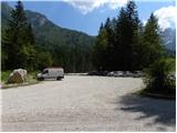
Via the border crossings Predel or Rateče we drive to Trbiž / Tarvisio. Further, we drive on the old road towards Videm / Udine. Already after a few kilometers from Trbiž / Tarvisio, the road to Ovčja vas / Valbruna branches off to the left. In Ovčja vas / Valbruna we turn left and follow the road ahead through the Zajzera valley upwards. After a few kilometers of driving, we come to an intersection at the small bridge above the road (at the second small bridge). Here we turn left in the direction of the signs for Svetih Višarij / Monte Lussari and then already after a few meters of driving, we turn right onto a large parking lot where we park.
Route description:
At the end of the parking lot, we head onto a cart track which after a few dozen meters joins the road. We continue left over the bridge and follow the road to an intersection where we head right following the signs »616 Rifugio Pellarini«. For some time we then walk along the river and soon join a mountain road. We continue left on the mountain road along which we then ascend for a long time. All the time while walking on the road we follow the signs for path 616 and hut Rifugio Pellarini.
At approximately half of the ascent on the road a very demanding path to Mali Nabojs (Piccolo Nabois) branches off to the right. We continue on the road all the way to the end, where there is the lower station of the cargo cableway. We continue slightly right onto a cart track which quickly turns into a path. The path then turns left and begins to ascend on a somewhat steeper slope below the cableway. We ascend mostly through the forest towards the east, occasionally a nice view also opens up on the surrounding peaks. Such a path brings us to a marked junction where we continue right following the signs Rif. Pellarini (20 min), while left leads path 617 to Svete Višarje (4 hours).
The path further soon brings us out of the forest onto scree from where a very nice view opens up towards Viš. Here the path turns right and follows the last ascent to hut Pellarini.
From the hut we continue on path 616, which already after a few dozen meters brings us to a junction. We continue right following the signs Sella Nabois (Škrbina Nabojsa), while left leads the path towards Žabniška škrbina (Sella Carnizza). The path then leads us across a wide torrent bed to the right side of the valley, where we soon reach a new junction. We head right onto the ridge path (variante per la crestaest).
After a short ascent the path brings us to a sign by the path, which warns that the path is very demanding and intended only for experienced mountaineers. The path further is indeed very poorly beaten and unsecured.
From the warning sign the path steeply ascends through dwarf pines and brings us to a grassy slope. Here we continue decisively to the right and the narrow and somewhat exposed path brings us to the ridge covered with dwarf pines. Further, we then ascend along the ridge through dwarf pines. When we come out of the dwarf pines the path veers from the steep ridge to the left and after a short somewhat exposed crossing brings us to a gully. Here considerable caution is needed, since on the path, which is poorly beaten, there is quite a lot of scree.
Follows an ascent up the fairly steep gully. From the gully we reach grassy slopes, where the path becomes very poorly visible. We continue decisively to the right up the grassy slope, so that we reach the main ridge of the mountain again. In the initial part of the ascent along the ridge considerable caution is needed since the ridge here is very steep.
Further the ridge becomes noticeably less steep and wonderful views open up on all sides. Later when the ridge becomes more demanding, we will on the left side spot a well-beaten path which leads to Veliki Nabojs (path via normale). At this point we leave the ridge and cross steep grass, so that we join the normal path. If the grass is wet one must be especially careful, since the slope is quite steep.
Follows an ascent along the path which leads us up the steep slope. The last ascent to the summit is very demanding, and the path on this section is secured with a steel cable.

Photos:
 1
1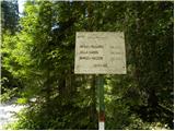 2
2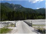 3
3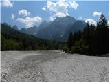 4
4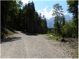 5
5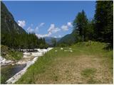 6
6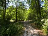 7
7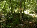 8
8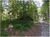 9
9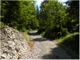 10
10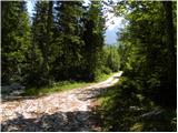 11
11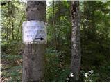 12
12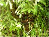 13
13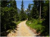 14
14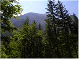 15
15 16
16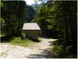 17
17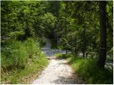 18
18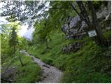 19
19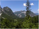 20
20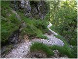 21
21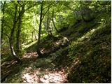 22
22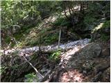 23
23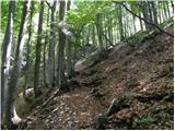 24
24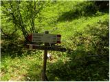 25
25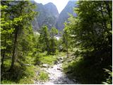 26
26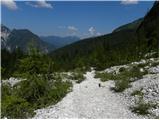 27
27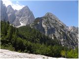 28
28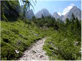 29
29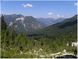 30
30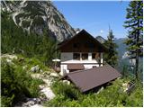 31
31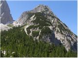 32
32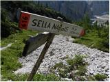 33
33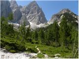 34
34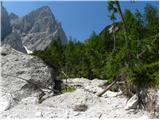 35
35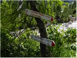 36
36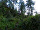 37
37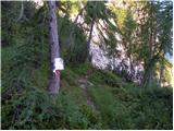 38
38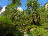 39
39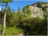 40
40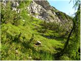 41
41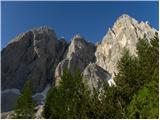 42
42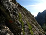 43
43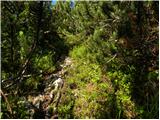 44
44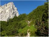 45
45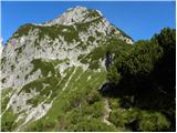 46
46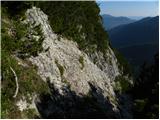 47
47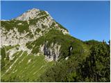 48
48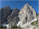 49
49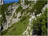 50
50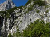 51
51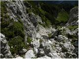 52
52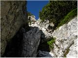 53
53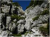 54
54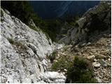 55
55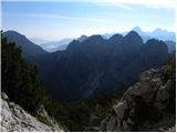 56
56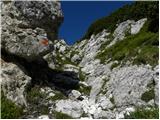 57
57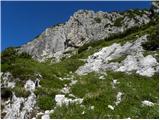 58
58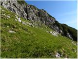 59
59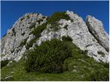 60
60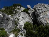 61
61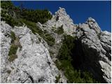 62
62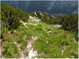 63
63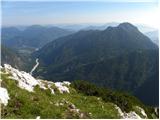 64
64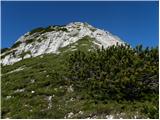 65
65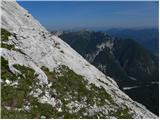 66
66 67
67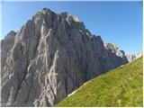 68
68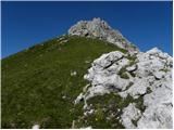 69
69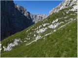 70
70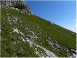 71
71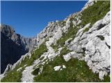 72
72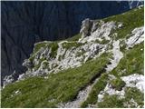 73
73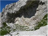 74
74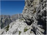 75
75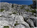 76
76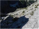 77
77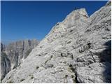 78
78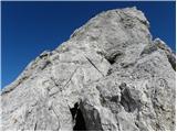 79
79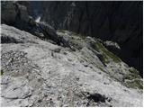 80
80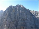 81
81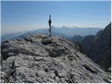 82
82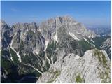 83
83
Discussion about the trip Zajzera - Monte Nabois grande (variante per la crestaest)
|
| lynx11. 07. 2011 |
The gully somewhere in the middle of the trail is quite eroded this year and filled with scree. Careful!
|
|
|
|
| gorskarozica13. 08. 2012 |
Yesterday I visited Veliki Nabojs via the ridge path. It is nice, a bit more wild, need to watch the red dots which serve as our markings. Anyway, nice tour, recommend descent via the normal path. 
|
|
|
|
| jax28. 06. 2015 |
The path is completely newly arranged (sawed fallen trees) and marked (markings are almost too many in places), and its course has been slightly changed - now there is no more crossing steep grass slopes to the normal path, instead the path follows the ridge all the way to the end and only joins the normal path at the sinkholes. At this point there is also a bonus - ascent to the last ridge pinnacle, which is not mandatory. Otherwise a very nice path, spoiled only by the extremely dangerous ascent through the fallen scree gully in the lower part, where you can trigger stones the size of a microwave oven. But once you reach the level above the gully and then the ridge itself, it becomes very nice and pleasant. Still - because of the lower part I would not unconditionally recommend it. It certainly offers a lot, but it is also among the more objectively dangerous paths I have hiked.
|
|
|
|
| ajo6219. 08. 2016 |
Hello all mountain lovers!
On Wednesday 17.8.16, a group of 14 young and less young enthusiasts climbed the entry ridge. Despite uncertain weather forecasts, the weather was fantastic! The path is excellent in every way, extremely scenic, airy, not overly difficult or dangerous, though it requires some fitness. A path that has nothing to envy many ascents to more famous peaks. That's why the satisfaction is even greater in this untouched corner of the western Julians. And a herd of 15 chamois greeted us on the upper meadow, and we repaid them at the summit with a fairly harmonious Signore delle cime...
Highly recommend this path to all lovers!
|
|
|
|
| masker20. 08. 2016 |
Bravo ajo62,
let me confide that I somewhat envy you and the rest of the colorful hiking group. I've been to Nabojs many times, but I haven't tried this ridge path yet. I believe I will in the near future. Mountains are like women. When conquering them, you need a lot of patience. Have fun and I wish you many more hiking pleasures.....
|
|
|
|
| IgorZlodej20. 08. 2016 |
The ridge path is nothing special, much nicer Via Nord, or via the western gully to the top.
|
|
|
|
| ajo6222. 08. 2016 |
Yes, northern approach maybe more interesting, wilder, probably nicer via Gamsja police. But ridge path has two advantages: first, recommendable to larger less experienced groups, second, incomparably more scenic, from ridge admire northern approach too, vice versa harder. Descent recommend via normal route. Mountain greetings!
|
|
|
|
| IgorZlodej22. 08. 2016 |
Yes in winter usually combine via normal route 
|
|
|
|
| ajo6222. 08. 2016 |
Wow, you're excellent, Zlodej, hats off, that's it.
|
|
|
|
| DarjaZaplotnik22. 08. 2016 |
@ajo62, I agree with the listed advantages. The ridge path has also been newly arranged regarding safety gear and markings.
best regards d 
|
|
|
|
| VanSims1. 07. 2017 |
Very nice route that pleasantly surprised me. I recommend it to everyone with appropriate experience.
The route now has a different name and of course also a signpost marking, about 10 minutes after Pellarini, no longer as written above, but "Sentiero Alpinistico Gasparini Florit" Just so that no one else gets lost almost at the junction for GOLA NE. 
Why 'Alpinistico' is not clear to me. Labeling every difficult route like that is nonsense. Then someone who climbs this route will want to go to a real alpine route, which might be... 
The route in terms of technical difficulty: first some unprotected crumbly climbing on a loose gully, then of course that famous gully, which is now so well secured that it is actually not the hardest part. Protection is perhaps recommended for the inexperienced, dizzy people have no business on this route anyway... Rocks do crumble,... careful if someone is behind you.
The more difficult (perhaps more from a psychological standpoint) part seemed to me from the little box onwards (watch out there for the first peg to the left after about a meter of climbing at the beginning), where some section might reach I+ and it is unprotected. Otherwise, difficulties on the route do not exceed I.
Then there is some more climbing at the end and we reach the junction with the normal route.
That 'optional tower' mentioned by @jax has difficulty up to I+. Descent from it towards the chains is somewhat tedious.
|
|
|
|
| serznoz14. 07. 2018 |
Up today. I can confirm the path is well marked and appropriately secured, but some spots still require extra caution. Above the gully, a bit of effort is needed to find the pegs, but they are in the right places. Some exposed sections are relatively short. Definitely not for those prone to vertigo, as from the summit ridge to the ground there's about 1200 meters of drop. The entry to the gully is about 20 meters above the outlet, and the cables significantly ease this section.
From encounters with ascenders on the descent, I got the feeling few follow the weather forecast. The forecast was spot on this time: at 1 pm I was at the parking lot in Zajzera, quarter hour later thunder and rain started.
|
|
|
To post a comment you must log in:
If you do not yet have a username, you must first
register.