Zagreben (pri Dikcu) - Malič
Starting point: Zagreben (pri Dikcu) (670 m)
| Latitude/Longitude: | 46,1876°N 15,1614°E |
| |
Walking time: 1 h 30 min
Difficulty: easy marked way
Elevation gain: 266 m
Elevation difference along the route: 350 m
Map: Posavsko hribovje - zahodni del 1:50.000
Recommended equipment (summer):
Recommended equipment (winter):
Views: 8.032
 | 1 person like this post |
Access to starting point:
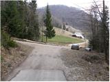
From the highway Ljubljana - Maribor, we take the exit Žalec and then drive towards Arja vas. At the crossroad at the end of the village, we continue straight in the direction of Liboje. Further, we drive through the village Liboje and then we drive on the road which starts ascending. After some time, the road brings us to a crossroad, where we continue straight (right Beškovnik). A little further ahead, we come to the next crossroad, by which we park (we recognize the crossroad by the sign on the left road which prohibits further driving).
Route description:
From the parking lot, we continue on the left asphalted road which is closed to traffic. The road soon becomes macadam and brings us to a crossroad, where we continue left in the direction of Šmohor. A fairly undulating road then bypasses Perniče (881m) on the left side and brings us to a wide grassy ridge, after which we reach the church of St. Mohor. From the church, we continue towards the east, first on the road then on a footpath, which through the meadow quickly brings us to the mountain hut on Šmohor.
Further, we continue the path in the direction of Liboje and Malič, on the path which first slightly descends, then past a newly built house brings us to a path junction, where we continue straight towards Malič. The path then goes into the forest and ascends parallel to the road. With some ascents and descents, the path brings us to a paragliding takeoff site. Further, the path steeply ascends and along the forested western ridge of Malič quickly brings us to the summit.

Photos:
 1
1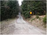 2
2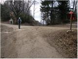 3
3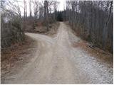 4
4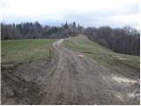 5
5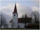 6
6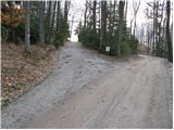 7
7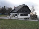 8
8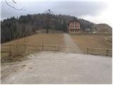 9
9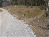 10
10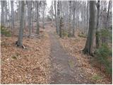 11
11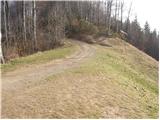 12
12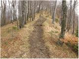 13
13 14
14
Discussion about the trip Zagreben (pri Dikcu) - Malič
|
| aleš88827. 05. 2014 |
Beautiful day for a hike. The path is well marked and quite undemanding.
|
|
|
To post a comment you must log in:
If you do not yet have a username, you must first
register.