Zagrad - Medvižica (via Razsušica)
Starting point: Zagrad (800 m)
| Latitude/Longitude: | 45,5043°N 14,0511°E |
| |
Route name: via Razsušica
Walking time: 1 h 45 min
Difficulty: easy unmarked way, easy marked way
Elevation gain: 281 m
Elevation difference along the route: 375 m
Map: Slovenska Istra - Čičarija, Brkini in Kras 1:50.000
Recommended equipment (summer):
Recommended equipment (winter):
Views: 5.187
 | 1 person like this post |
Access to starting point:
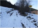
From the highway Ljubljana - Koper, we take the exit Kozina and follow the road ahead in the direction of Reka. In the village Obrov, we turn right in the direction of the village Golac, from which we continue driving towards the hamlet Zagrad. In Zagrad (not at the crossroads 30m before), we continue right (left Ostrič) and then after a few meters left on the upper road by which there is a sign "forest road use at your own risk" (right road joins the road which runs towards Velika vrata). We follow this at first very rough road to a larger clearing, which is the starting point for our tour (on the clearing the road changes into a cart track).
Route description:
From the starting point, we head onto the clearing along which we ascend in a gentle rise to its upper part. Here on the right side we notice a cart track (there are several cart tracks, but they all join higher up), which goes into the forest and starts to ascend moderately along the left side of a larger sinkhole. After approximately 15 minutes of ascent along the cart track, we reach a marked path that leads from Razsušica towards Plešivica.
We follow the marked path to the left (right Velika and Mala Plešivica) and ascend along it mostly in a traversing ascent. Further on, the well-marked path ascends more steeply higher up and after a good hour of walking from the starting point brings us to the summit of Razsušica, from which a view opens towards the neighbouring Medvižica.
From the top, we continue along the marked path, which first descends steeply, then with a few gentle ascents and descents brings us to a clearing, where a marked path to the summit Medvižica branches off to the left. The path immediately returns to the forest, where after a few steps of further walking we come to a rocky section. Here the path turns left and ascends steeply over the rocky slope. We then follow this steep path, which is surrounded by numerous cracks, to the scenic summit.

Photos:
 1
1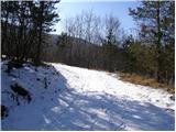 2
2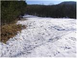 3
3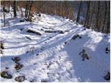 4
4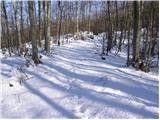 5
5 6
6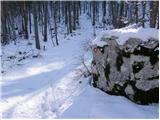 7
7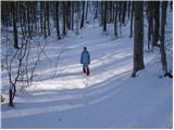 8
8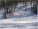 9
9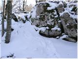 10
10 11
11 12
12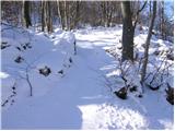 13
13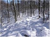 14
14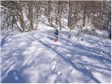 15
15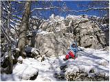 16
16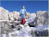 17
17 18
18
Discussion about the trip Zagrad - Medvižica (via Razsušica)
|
| squash1. 11. 2013 |
Today my wife and I did this trip. The weather was beautiful. From Medvižica there was a fantastic view in all directions. You could beautifully see the Brkini villages, Učka to the south and on the other side the Trieste Gulf. Čičarija is the right place to relax the soul, the landscape is beautiful. Due to its remoteness there are few people, you rarely meet any hikers.
|
|
|
To post a comment you must log in:
If you do not yet have a username, you must first
register.