Zagorje ob Savi - Vrh (Šticna) (Šmarjakova pot)
Starting point: Zagorje ob Savi (220 m)
| Latitude/Longitude: | 46,1317°N 14,9953°E |
| |
Route name: Šmarjakova pot
Walking time: 1 h
Difficulty: easy unmarked way
Elevation gain: 459 m
Elevation difference along the route: 459 m
Map:
Recommended equipment (summer):
Recommended equipment (winter):
Views: 7.668
 | 5 people like this post |
Access to starting point:
A) From the direction of Trojan:
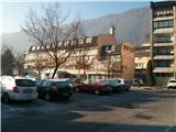
We follow the road signs in the direction of Zagorje ob Savi. When we come into the town, at the roundabout, we go towards the railway station. We follow the road to the traffic light, where we turn right towards the apartment buildings. We park on a large parking lot and go towards pizzeria Ašič.
B) From the direction of Trbovlje or Litija:
We follow the road signs towards Zagorje ob Savi. We drive through a bridge over Sava into Zagorje ob Savi. We follow the main road to the traffic light, where we turn left towards the apartment buildings. We park on a large parking lot and go towards pizzeria Ašič.
Route description:
From the parking lot, we go towards pizzeria Ašič. A large sign on the house shows the location of this pizzeria. At the crossroad, we go straight upwards and we follow the road past houses. When we leave the houses behind us, at the crossroad we turn right upwards and we follow the road towards the hamlet Podstrana. When the asphalt road ends, we step on a cart track which in a few steps brings us to the hamlet Podstrana. Again we step on an asphalt road, but only for a short time. We descend on the road downwards and we go on a macadam road which crosses the field. We follow this road all the way to a bigger rock, which stands on the left side of the road. Just behind it we leave the road and we go right upwards on a forest path. We then follow the path, at all crossings (there aren't many of those) we continue straight. When we come near the clearing, on which runs a power line, at the crossing we continue left. The path in a few additional strides brings us to a clearing, which we cross and we turn onto the left path which starts ascending (straight leads the path towards Podkraj pri Zagorju). The forest path starts ascending steeply in zigzags. The path is from here on very easy to follow, without crossings so we practically can't miss. The path is ascending, and when we come to the remains of a structure (probably some bunker from the 2nd World War) the path turns upwards. We follow the beaten path which ascends steeply straight upwards all the way to Vrh, which is distant only a few minutes. The forest path runs just by the forest border with a meadow and in a few additional strides, we reach the peak.

Photos:
 1
1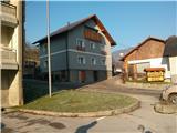 2
2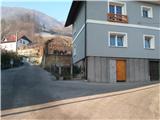 3
3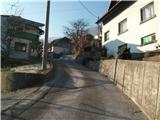 4
4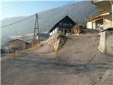 5
5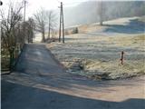 6
6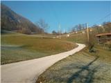 7
7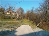 8
8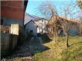 9
9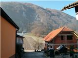 10
10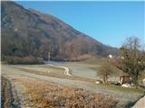 11
11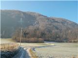 12
12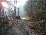 13
13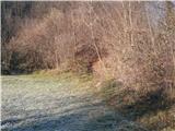 14
14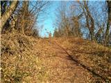 15
15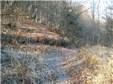 16
16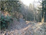 17
17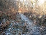 18
18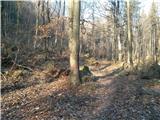 19
19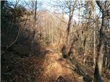 20
20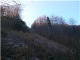 21
21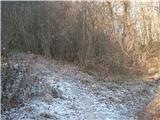 22
22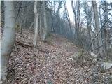 23
23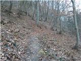 24
24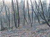 25
25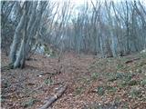 26
26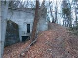 27
27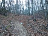 28
28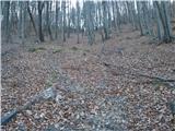 29
29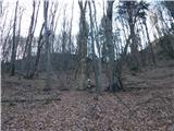 30
30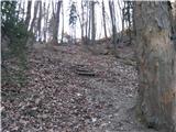 31
31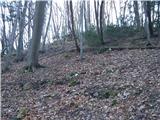 32
32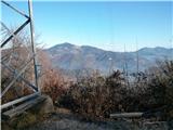 33
33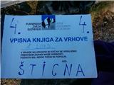 34
34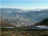 35
35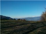 36
36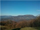 37
37
Discussion about the trip Zagorje ob Savi - Vrh (Šticna) (Šmarjakova pot)
|
| hribuc8524. 12. 2013 |
Very nice and relatively quickly accessible panoramic summit in Zagorje. The mentioned path is somewhat more difficult to walk in wet conditions due to the steep and overgrown section.
|
|
|
|
| Bandzo25. 12. 2013 |
Today on Šticna, views were good considering the weather, but the path was soggy and therefore quite challenging on that last ascent to the summit.
|
|
|
|
| michael6627. 12. 2013 |
Ha, ha, that peak is right above me, and I still haven't been up there
|
|
|
|
| docepe226. 02. 2015 |
Can someone explain, when you write paths semering and golavc in the logbook, which ones are those.
I also know a path that branches right soon after the big rock along the cart track past the former mine, where there was a rockfall and towards Rigel.
|
|
|
|
| hribuc8527. 02. 2015 |
Docepe2, hello.
Golavc is above the village Vrh nad Čolnišči. So if you come by road from Čolnišči, turn right in the village and then follow the cart track uphill past the new construction (I think someone is building a house there), reach a grassy clearing which you cross along the edge of the forest (keep more to the left) and then in the forest is the mentioned peak. It's not panoramic, but has a logbook and probably more (I was there only once). If you start from the top of Šticna (power line with logbook), go along the path into the forest and then right on the cart track to the village. I hear about Semering path for the first time too. If you know Mr. Jurjec Štefan from Dolenje vas 4 (above Okrogarjeva colony), ask him because I think he knows these areas better. Anyway, I also go to those parts and am still exploring them. Šticna is such a relatively quickly accessible and panoramic peak. Maybe we'll meet sometime (if we haven't by chance already).
Good luck!
|
|
|
|
| hribuc8528. 02. 2015 |
To supplement the previous article:
today I visited this place and after talking to a hiker learned the following: the Semering path is the path past abandoned concrete structures (formerly a cargo cableway ran here). When you reach the top (power line with logbook), continue on the path into the forest and then keep left through the forest towards the clearing (another power line). Well, that's the so-called Rigel. Hope I was clear enough.
Good luck!
|
|
|
To post a comment you must log in:
If you do not yet have a username, you must first
register.