Zagorje ob Savi - Črni vrh (Čemšeniška planina)
Starting point: Zagorje ob Savi (250 m)
| Latitude/Longitude: | 46,13459°N 14,99603°E |
| |
Walking time: 4 h 5 min
Difficulty: easy marked way
Elevation gain: 954 m
Elevation difference along the route: 1055 m
Map:
Recommended equipment (summer):
Recommended equipment (winter): ice axe, crampons
Views: 328
 | 1 person like this post |
Access to starting point:
From the road Ljubljana - Trbovlje, or the Štajerska highway exit Trojane, we drive to Zagorje ob Savi, where we park in one of the parking lots in town. The described path starts on Cesta 9. avgusta at the intersection with Levstikova ulica.
At the starting point are located the Kulturni center Delavski dom Zagorje ob Savi, the Knjižnica Mileta Klopčiča Zagorje ob Savi, the Plesni klub KATTAN, the Okrepčevalnica Vrt, the Občina Zagorje ob Savi...
Route description:
At the beginning of the path, signs for Čemšeniška planina direct us onto Levstikova ulica, along which we first ascend gently, but when we reach the gorge, we ascend somewhat more steeply. We bypass the company Gip beton MTO Zagorje on the left side, then go slightly right onto the road, where the blazes continue. A little further, at the last house, the road ends, and we continue on a footpath that bypasses the gardens on the left side. Then the path flattens and a little further joins a macadam road, which in a few steps leads us to an asphalt road, which we follow to the left. The asphalt road also brings us to an intersection in a few steps, and we continue on a footpath that bypasses the left road on the right side and then leads us alongside the sports airfield. When we reach the next road on the other side of the meadow, we follow it to the right, ascending along it to an intersection a few minutes away, located at a chapel, where there is also a bench for resting.
Here we go right, just a few steps past the chapel we go left, then we ascend across the meadow into the forest. Through the forest we ascend diagonally to the left for a few minutes, then we climb onto the ridge, where we quickly reach a smaller junction by a sign.
At the cross, an unmarked path branches off to the left to Vinski vrh, but we continue straight and further cross the northeastern slopes of the mentioned peak. A little further, we leave the forest and with nice views and later along the left side of the cross step onto an asphalt road, which we follow to the left, continuing along it to the settlement Zavine, where at several intersections we follow the blazes. At the end of the compact part of the settlement, we go slightly left, then follows a moderate ascent along a panoramic road. Higher up, from a smaller intersection at the edge of the forest, we go slightly right and quickly arrive at the hunting lodge Lovski dom na Klančišah.
We bypass the hunting lodge on the right side, then continue for a few minutes through the forest; when we leave the forest, we arrive at a marked intersection in the settlement Ržiše.
We continue straight (left Kisovec, right unmarked path to Gamberk castle) and continue walking along the asphalt road, which gradually turns toward the north, and the path leads us partly along meadows, partly through forest, and partly through individual hamlets. The path also leads us near the farm Virant Pr Grivc, where they sell homemade dairy products, and we then begin to descend gently. We then leave the village Ržiše and arrive at the settlement Razbor pri Čemšeniku, where at the bus stop and chapel we join the path that starts in the settlement Izlake.
We continue straight in the direction of Čemšeniška planina (left Izlake) and continue walking along a narrower macadam road, which past a few houses leads us to an asphalt road, which we follow left uphill.
Further on, we go past the lower station of the cargo cableway, which leads toward Dom na Čemšeniški planini (there is also a parking lot by the cargo cableway; if we park here, we shorten the path by about two hours); after the lower station, the road turns somewhat to the left, but we leave it before the start of the settlement Razbor pri Čemšeniku and continue slightly right onto a cart track. From the cart track we go right again, so that we ascend to the "last" house along a panoramic grassy slope.
We bypass the last house on the right side, then begin to ascend steeply through the forest. The steep path leads us to the edge of panoramic cliffs, from which a nice view opens onto the surroundings and nearby hills; when higher up the path flattens somewhat, we arrive at a marked junction.
From the junction we go left (right church of St. Primož and Felicijan 5-10 minutes), then with a few minutes of diagonal ascent we climb to a macadam road, which we follow to the left, walking along it only as long as it ascends, then we go slightly right onto a cart track. From the cart track we also go right soon, then join the path from Izlake through Čemšenik, where we go right once more.
We continue in the direction of Čemšeniška planina and ascend diagonally quite steeply. The diagonal ascent ends when we reach the ridge of Čemšeniška planina; at the mentioned spot we also join the path from Trojane or Prvin.
We continue right and continue the ascent along a gentle macadam road, which a little higher we leave and continue slightly right onto a marked footpath that leads us with nice views onto Zasavje and Posavsko hribovje with the highest Kum; in the distance we also see Snežnik. A little further we cross another strip of forest; the path then flattens and crosses a steep grassy slope, where when there is ice there is great danger of slipping, otherwise the path is wide and technically undemanding. A little before the mountain hut we cross the route of the cargo cableway, then with nice views we walk to the mountain hut.
From the mountain hut we continue toward the east or along the path in the direction of Krvavica. After the panoramic section the path enters the forest and continues along the gentle ridge of Čemšeniška planina; after a few minutes it forks. We choose the slightly right path in the direction of Zajčeva koča (slightly left Vransko and Tabor) and continue ascending slightly to moderately. First we go past the hunting observation post, then in a few minutes we ascend to a smaller saddle, where there is the stamping box.
A little before the stamping box we go left and in one minute of further walking we ascend to Črni vrh, which is the highest peak of Čemšeniška planina.
Starting point - hunting lodge 1:15, Hunting lodge - Ržiše 0:10, Ržiše - Razbor pri Čemšeniku 1:00, Razbor pri Čemšeniku - Koča na Čemšeniški planini 1:25, Koča na Čemšeniški planini - Črni vrh 0:15.
Description and pictures refer to the condition in February 2019 and January 2025.

Photos:
 1
1 2
2 3
3 4
4 5
5 6
6 7
7 8
8 9
9 10
10 11
11 12
12 13
13 14
14 15
15 16
16 17
17 18
18 19
19 20
20 21
21 22
22 23
23 24
24 25
25 26
26 27
27 28
28 29
29 30
30 31
31 32
32 33
33 34
34 35
35 36
36 37
37 38
38 39
39 40
40 41
41 42
42 43
43 44
44 45
45 46
46 47
47 48
48 49
49 50
50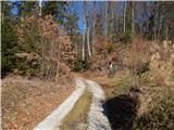 51
51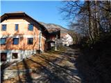 52
52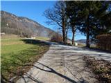 53
53 54
54 55
55 56
56 57
57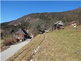 58
58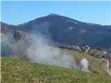 59
59 60
60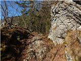 61
61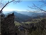 62
62 63
63 64
64 65
65 66
66 67
67 68
68 69
69 70
70 71
71 72
72 73
73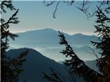 74
74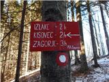 75
75 76
76 77
77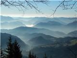 78
78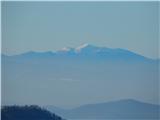 79
79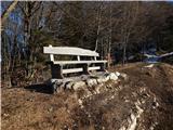 80
80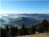 81
81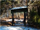 82
82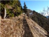 83
83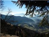 84
84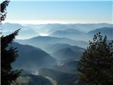 85
85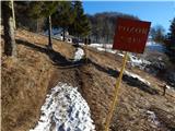 86
86 87
87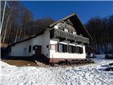 88
88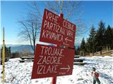 89
89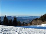 90
90 91
91 92
92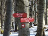 93
93 94
94 95
95 96
96 97
97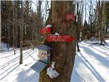 98
98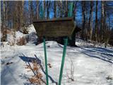 99
99 100
100
Discussion about the trip Zagorje ob Savi - Črni vrh (Čemšeniška planina)
To post a comment you must log in:
If you do not yet have a username, you must first
register.