Žagana peč - Kalški greben (via Škrbina)
Starting point: Žagana peč (812 m)
| Latitude/Longitude: | 46,3384°N 14,5702°E |
| |
Route name: via Škrbina
Walking time: 5 h 15 min
Difficulty: partly demanding unmarked way, easy marked way
Elevation gain: 1412 m
Elevation difference along the route: 1550 m
Map: Kamniške in Savinjske Alpe 1:50.000
Recommended equipment (summer): helmet
Recommended equipment (winter): helmet, ice axe, crampons
Views: 9.747
 | 1 person like this post |
Access to starting point:
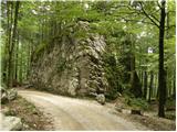
We drive to Kamnik and follow the road ahead towards the valley of Kamniška Bistrica. From the hut in Kamniška Bistrica we continue driving on the forest road, which higher up brings us to a crossroad, where we continue straight (right Jermanca, starting point for Kamniško sedlo). The road then brings us to Žagana peč (large boulder by the road), and we drive another 30 m ahead, where on the left side we notice a smaller parking lot on which we park.
Driving from the mountain hut in Kamniška Bistrica to Žagana peč is now forbidden (traffic sign); this extends the path by approximately 45 minutes.
Route description:
At the parking lot we notice the beginning of the hunting path, which leads us into the forest. The path soon starts to ascend steeply and after approximately 15 minutes brings us to a distinct forested ridge, where the path temporarily flattens. The path quickly leaves the ridge to the left, where in the ascent it crosses some steep slopes that are especially dangerous for slipping when wet. A short descent follows, then the path turns slightly to the right, where it starts to ascend very steeply (danger of slipping and falling rocks). An ascent follows along and beside a wide forested gully, from which the path higher up leaves to the left. Only a good 15 minutes of ascent through the forest follow, and the path brings us to the hunting hut, which is located at the edge of a panoramic slope.
From the hunting hut we continue on a well-visible footpath, which returns to the forest and first crosses slopes to the left, then turns somewhat to the right and gradually starts to ascend more steeply. Higher up, the path—along which we notice more and more "unofficial" blazes (red dots and lines)—brings us to a small valley and gradually starts to disappear among tall grasses. Although the path slowly disappears, we can still follow it for some time.
A little further we reach a small junction, where we continue on the left, less worn footpath (right upward Zob and one of the approach options to Kalška gora). The path ahead ascends gently (with the exception of a few short steep ascents) along the lower edge of rocky cliffs. The barely noticeable footpath ahead then brings us to the abandoned mountain pasture Ovčarije, at the end of which it completely disappears. Ahead we follow the frequent red dots and lines, which soon turn us quite to the right and higher again to the left. We follow the mentioned red lines all the way to the place where we step onto the marked path Krvavec - Kokrsko sedlo (if we have consistently followed the red lines, we will reach the marked path right at some kind of verse written on the rock above the path).
When we step onto the marked path, we follow it to the left; it then brings us after 5 minutes of traversing to an abandoned junction, where an abandoned path to Kalški greben branches off to the right upward (the mentioned path first ascends the slope straight upward, then before reaching the lower edge of the wall turns left into a steep gully, where old but partly still usable cables and pegs assist us. Higher the path turns to the right and after a short further ascent brings us to the main ridge, where we join the marked path Kokrsko sedlo - Kalški greben).
We continue straight on the path, which continues to cross slopes to the left and gradually descends, with the exception of shorter ascents. The path, which ahead runs through karst terrain full of limestone pavements and abysses, completely flattens after some time, and to our left below us we notice a small pond called Krvava lokev. The path ahead crosses one more somewhat longer scree slope, then starts to ascend more steeply and after a good 10 minutes of ascent brings us to a junction near Škrbina.
Here we continue right in the direction of Kalški greben (left junction to Škrbina 1 minute) and continue the path on a wide and initially also quite gentle footpath. The path ahead ascends more steeply for a short time through a belt of dwarf pines, then brings us to the edge of the ridge, from where a beautiful view opens up. The wide path soon leaves the ridge somewhat to the left, where it gradually transitions from dwarf pines to grassy slopes. A short traverse somewhat to the left follows, and the path quickly brings us to a small saddle, from which a view opens toward the mountains above the Kokra River. The path ahead in a traversing ascent passes onto the wide summit ridge, along which we then ascend to Kalški greben in a few minutes of further walking.

Photos:
 1
1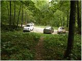 2
2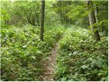 3
3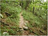 4
4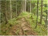 5
5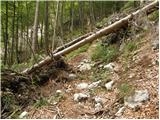 6
6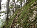 7
7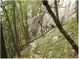 8
8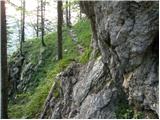 9
9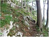 10
10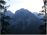 11
11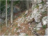 12
12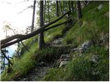 13
13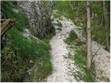 14
14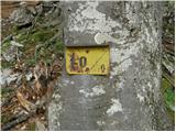 15
15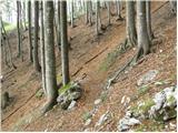 16
16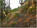 17
17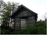 18
18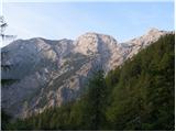 19
19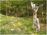 20
20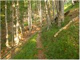 21
21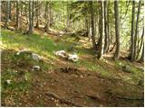 22
22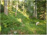 23
23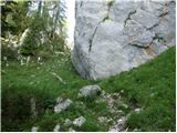 24
24 25
25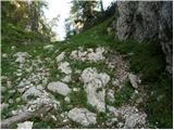 26
26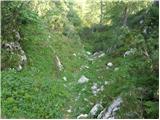 27
27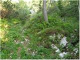 28
28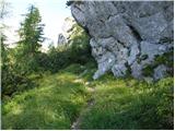 29
29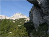 30
30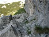 31
31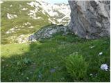 32
32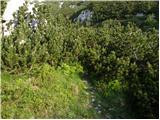 33
33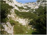 34
34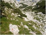 35
35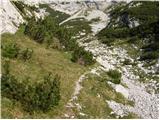 36
36 37
37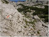 38
38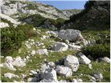 39
39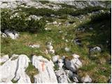 40
40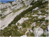 41
41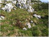 42
42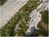 43
43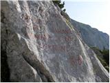 44
44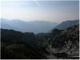 45
45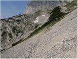 46
46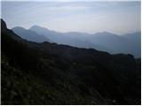 47
47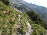 48
48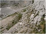 49
49 50
50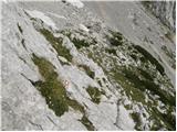 51
51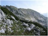 52
52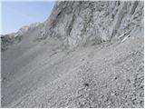 53
53 54
54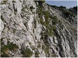 55
55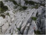 56
56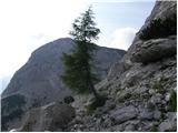 57
57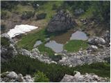 58
58 59
59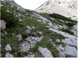 60
60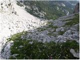 61
61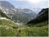 62
62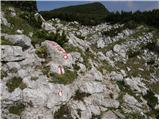 63
63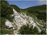 64
64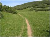 65
65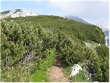 66
66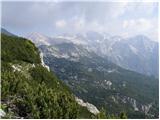 67
67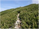 68
68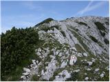 69
69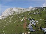 70
70 71
71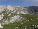 72
72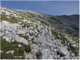 73
73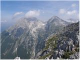 74
74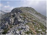 75
75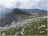 76
76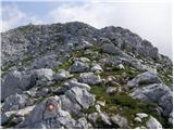 77
77 78
78
Discussion about the trip Žagana peč - Kalški greben (via Škrbina)
|
| klm27. 08. 2011 |
To Zob pod Kalško goro undoubtedly the most beautiful path in Grintovci, otherwise to Kalški greben even for "runners" relatively long, as it drags nicely to Škrbina and loses the gained elevation meters - "but never mind". If Kalško goro is also included in the tour, it becomes very nice and quite scenic. What an aesthetic experience it will be when the larches turn yellow!
|
|
|
|
| BSAE9. 11. 2015 |
Last Saturday I did a circular tour Žagana peč-via lovska gor-Škrbina-summit of Kalški greben-along the ridge to the junction, descent to Kokrško sedlo-back to the valley to the starting point. Really nice, circular, scenic tour that "conquers" you with views and silence.  For all those "loners" who like to enjoy peace above 2000m ... Helmet definitely recommended on the ridge section (summit - Kokrško sedlo). lp For all those "loners" who like to enjoy peace above 2000m ... Helmet definitely recommended on the ridge section (summit - Kokrško sedlo). lp
|
|
|
|
| alyas22. 10. 2017 |
Kalška gora and Kalški greben (from Žagana peč up and down)
Saturday conditions were ideal for this always interesting and beloved tour for me. Locally steep path through the forest to the hunting hut and further past the Turns is currently full of fallen leaves, so one must be careful with orientation or set up some more cairns for oneself – especially if returning the same way. In the scree basin below Škrbina, the cairns are hard to miss, they lead right upwards to the marked path (which comes under the walls of Kalški greben from Kalc) and then turn left (with the help of a fixed cable) upwards to the ridge between Kalška gora and Kalški greben (there is also a turn-off down to Kokrsko sedlo).
The protections through the first crossing on the ridge and further through Škrbina are OK, from Kalški greben towards Krvavec there are new markings, but on the way back along the lower path under Kalški greben they have unfortunately already faded quite a bit, so it's very hard to follow them, and thus this path has almost become "hunter-like". Some crossings past deep pits and scree could be dangerous in fog or poor visibility.
In normal conditions and with usual breaks, the tour is done in about 8 hours.
And info about the road: the road from Kamniška Bistrica to the cable car under Kokrsko sedlo or towards Jermenca is in several places quite potholed and "wavy".
|
|
|
To post a comment you must log in:
If you do not yet have a username, you must first
register.