Starting point: Zadnjica (642 m)
| Latitude/Longitude: | 46,3824°N 13,7604°E |
| |
Walking time: 6 h
Difficulty: easy marked way
Elevation gain: 1859 m
Elevation difference along the route: 1890 m
Map: TNP 1:50.000
Recommended equipment (summer):
Recommended equipment (winter): ice axe, crampons
Views: 66.472
 | 4 people like this post |
Access to starting point:
From Kranjska Gora, drive over Vršič Pass towards Bovec or vice versa, but only to the 50th hairpin turn of the Vršič or Russian road (near the village of Trenta). Here turn onto the side road, along which after a few hundred meters park at the parking lot by the road.
Route description:
From the parking lot, continue along the road, which takes us past a few houses, mainly weekend cottages, in about 15 minutes to the point where the road splits into two parts (there used to be a parking lot at the intersection, but parking is now prohibited).
From the old parking lot, head left towards Pogačnikov dom on Kriški podi (the right road leads towards Prehodavci and Dolič). After another 15 minutes of walking, the road brings us to the lower station of the cargo cableway, where it ends.
Continue the ascent along the marked hiking trail, a mule track that moderately ascends through the forest. The path, ascending above the valley of Beli potok, soon brings us to very steep slopes (danger of falling rocks), across which a wide path runs. The path then crosses the gully Veliki Presek, after which we reach a short exposed ledge, crossed with the aid of a fixed cable. Further on, the path returns to the forest, where it moderately ascends in numerous switchbacks. A bit further, the path brings us under a small overhang, where we can notice numerous sticks that hikers place so the rock does not collapse into the valley (the sticks are placed more for fun than seriously). The path then crosses a few smaller gullies, then past a chapel brings us to a larger gully. With some caution (easy) cross the mentioned gully, after which in a few minutes of further walking we ascend to a pleasant rest area (two benches along the path). Further, cross another larger gully (possibility of snow patch in early summer), then the path returns to the forest. Higher up, the forest becomes sparser, the path somewhat steeper and more panoramic.
The path, continuing to ascend along the old mule track, then past two more benches brings us into the dwarf pine belt, after which we enter a more rocky terrain. Further ascend over smaller screes along an increasingly panoramic path that higher brings us to a pleasant spring (source).
Just a few dozen steps above the mentioned spring, we reach an unmarked junction, where an unmarked path branches right towards Spodnje Kriško jezero, which is two minutes walk away; we continue slightly left along the still wide alpine path. The path further leads past smaller ruins, which we follow all the way to the marked junction, where we continue right towards Pihavec, Bovški Gamsovec, Stenar and Vrata valley (left Pogačnikov dom three minutes).
Continue the ascent along the increasingly panoramic path, from which soon a path to Pihavec branches right.
Continue straight along the moderately steep path, which higher brings us to Dovška vrata, where the next junction is.
Here continue straight towards Križ and Stenar (sharply right Bovški Gamsovec, right Vrata) along the path that gradually starts ascending towards Stenarska vratca. After a few minutes of ascent, the path splits into two parts.
Continue right (left Križ) along the increasingly panoramic path, to which just a few steps higher an unmarked path joins via Stenarska vratca. Continuing, cross a scree and with fine views of Triglav, Bovški Gamsovec, Pihavec and Trenta valley walk to the steep slopes of Stenar. From here, the path starts steeply ascending through nicely structured rockface, then turns sharply left, where after a few dozen meters it suddenly flattens. Here or already good ten meters before, a pathless approach to Spodnji Stenar branches right; we continue along the marked path, which again starts ascending more steeply. Follows another approximately 15 minutes of walking along the summit slope of the mountain and the increasingly panoramic path brings us to the 2501 m high summit.
Starting point - Na placu 0:15, Na placu - lower station of cargo cableway 0:15, lower station of cargo cableway - Na Utrci 2:00, Na Utrci spring below Kriški podi 1:05, spring below Kriški podi - Spodnje Kriško jezero 0:05, Spodnje Kriško jezero - Pogačnikov dom 0:20, Pogačnikov dom - Dovška vrata 0:45, Dovška vrata - Stenarska vratca 0:20, Stenarska vratca - Stenar 0:55.

Photos:
 1
1 2
2 3
3 4
4 5
5 6
6 7
7 8
8 9
9 10
10 11
11 12
12 13
13 14
14 15
15 16
16 17
17 18
18 19
19 20
20 21
21 22
22 23
23 24
24 25
25 26
26 27
27 28
28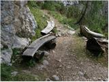 29
29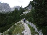 30
30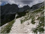 31
31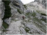 32
32 33
33 34
34 35
35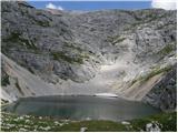 36
36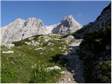 37
37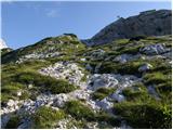 38
38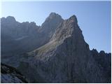 39
39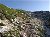 40
40 41
41 42
42 43
43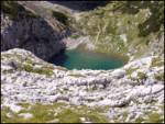 44
44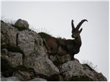 45
45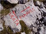 46
46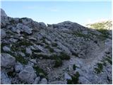 47
47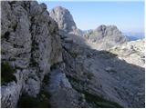 48
48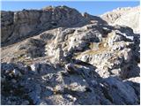 49
49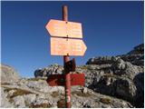 50
50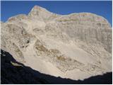 51
51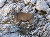 52
52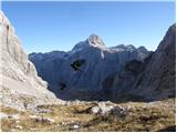 53
53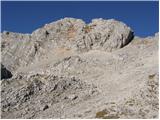 54
54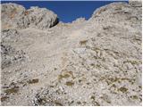 55
55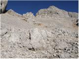 56
56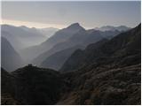 57
57 58
58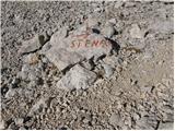 59
59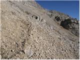 60
60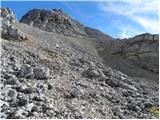 61
61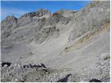 62
62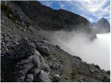 63
63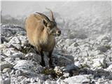 64
64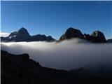 65
65 66
66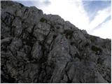 67
67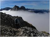 68
68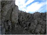 69
69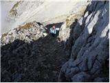 70
70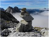 71
71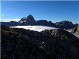 72
72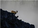 73
73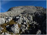 74
74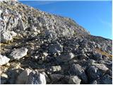 75
75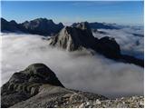 76
76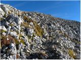 77
77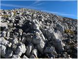 78
78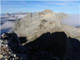 79
79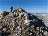 80
80 81
81
Discussion about the trip Zadnjica - Stenar
|
| Nacek29. 02. 2008 |
Best regards. I'm wondering, since it says it's an easy path, how 'easy' is this path, given it's over 2500m. Basically, I'm interested in the difficulty compared to say the ascent to Triglav, or Stol, or something similar...
|
|
|
|
| Tadej29. 02. 2008 |
The described path is similar to the ascent to Grintovec via Streho. There are no technically demanding sections on the path.
|
|
|
|
| Stolar21. 03. 2008 |
Last year I was on Stenar with 10- and 12-year-old children, and I can say they had no problems. We split the tour into two days and thus enjoyed two wonderful sunny days.
|
|
|
|
| velkavrh9. 07. 2008 |
To Stenar one usually goes from Vrata via Sovatna and when reaching the pass, then right straight to Stenar. The path is not demanding, but it does drag on a bit. In summer, it's advisable to go early because it can get very hot in nice sunny weather. I always encounter ibex on this path.
|
|
|
|
| triglavski10. 07. 2008 |
Why drive to Vrata when there's such a beautiful trail up from Zadnjica, cute girls at Pogačnikov dom, lakes, chamois, Stenar is just the icing on the cake, and return via Križ.
|
|
|
|
| silva.plevnik11. 07. 2008 |
Hello! My boyfriend and I plan to go to Škrlatica via Kriška stena tomorrow. Does anyone know the conditions at Bivak 4, Na Rušju? I've heard that Czechs often camp there. I hope it won't be "crawling with them".
Best, Silva
|
|
|
|
| Biser gora11. 07. 2008 |
Yes, it's true, Czechs are constant companions of Slovenian bivouacs. If the bivak is full, you can still extend to Pogačnikov dom or descend to Vrata.
|
|
|
|
| MATEJPETRA10. 07. 2018 |
Hello,
I'm interested in what the path from Zadnjica to Stenar is like regarding snow?
Best, Petra
|
|
|
|
| VanSims10. 07. 2018 |
To Pogačnik, due to the southern exposure and altitude below 2000, there shouldn't be any problems.
From the junction to Stenar onwards, two snowfields await you, both passable without gear with a bit of caution.
Between Pogačnik and the junction, if you go along the southern side of the lakes (Dovška vratca) there is no snowfield, on the northern side from Bovških vratc also not. But how it is between Pogačnik and Bovškimi vratci, I don't know.
|
|
|
|
| MATEJPETRA11. 07. 2018 |
Thanks for the information,
good luck
|
|
|
|
| ucakakla11. 06. 2019 |
Hello,
I'm interested in the path from Vrata to Stenar regarding snow conditions?
Thanks and best regards.
|
|
|
|
| Hribolazec8118. 09. 2023 00:13:42 |
I'm wondering about the starting point, is it very crowded, is it paid?
|
|
|
To post a comment you must log in:
If you do not yet have a username, you must first
register.