Zadnja Trenta (Flori) - Zavetišče pod Špičkom
Starting point: Zadnja Trenta (Flori) (900 m)
| Latitude/Longitude: | 46,4043°N 13,7098°E |
| |
Walking time: 3 h 30 min
Difficulty: easy marked way
Elevation gain: 1164 m
Elevation difference along the route: 1164 m
Map: TNP 1:50.000, Trenta 1:25.000
Recommended equipment (summer):
Recommended equipment (winter): ice axe, crampons
Views: 38.811
 | 3 people like this post |
Access to starting point:
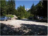
From Kranjska Gora we drive over the Vršič Pass towards Bovec or vice versa, but only as far as the 49th hairpin bend of the Russian Road (near the village of Trenta). Here we turn onto the side road in the direction of the source of the Soča River. The road after a short ascent quickly brings us to the parking lot in front of the hut at the source of the Soča. We continue left across the bridge and follow the road further to the parking lot at the end of the road (at the parking lot we notice mountain signs for Bavški Grintavec, the Suhi potok waterfalls and Jalovec).
Route description:
From the parking lot we head right on the footpath in the direction of Jalovec and the Shelter under Špiček (the left path leads to Bavški Grintavec). The path, from which a beautiful view of the already mentioned Bavški Grintavec opens at the beginning, quickly passes into a dense forest where it begins to climb steeply. The steep path, which runs almost the entire time through the forest, after about an hour and a half of walking brings us to a crossroads where we continue on the left path in the direction of the Shelter under Špiček (right: Vršič, Jalovec, Mali kot and Jalovška škrbina, both paths are marked). The path ahead levels out for a while, then begins to climb steeply again, this time through occasionally sparser forest. Higher up the forest becomes even sparser and beautiful views of the surrounding peaks start to open from the path. A little further on we reach a less noticeable crossroads where a marked but little-used path branches off to the left to Bavški Grintavec (path via Konj).
We continue straight in the direction of the Shelter under Špiček along the path that passes into a belt of dwarf pine. Further on we climb through the dwarf pine for some time, then we join the path from the Vršič Pass.
We continue straight in the direction of the Shelter under Špiček along the path that enters the world of pastures. The path from which beautiful views of the peaks above the Upper Soča Valley open up brings us higher to a small crossroads where a path to Jalovec branches off to the right (the path that bypasses the Shelter under Špiček). We continue straight and, along the path where we notice some interesting inscriptions (verses), we arrive at the Shelter under Špiček in a few minutes.
Starting point - Planina Trenta 1:30, Planina Trenta - turnoff for Sedlo planja 0:50, turnoff for Sedlo Planja - crossroads under Špiček 0:20, crossroads under Špiček - Shelter under Špiček 0:50.

Along the route: Planina Trenta (1398m), Odcep proti Sedlu Planja (1681m), Razpotje pod Špičkom (1769m)
Photos:
 1
1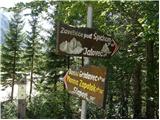 2
2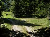 3
3 4
4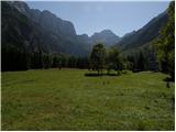 5
5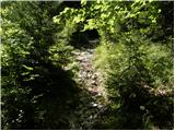 6
6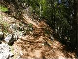 7
7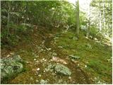 8
8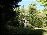 9
9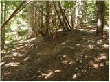 10
10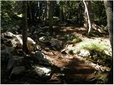 11
11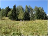 12
12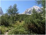 13
13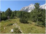 14
14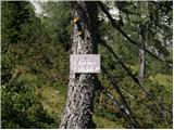 15
15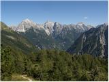 16
16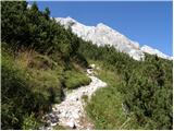 17
17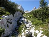 18
18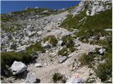 19
19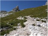 20
20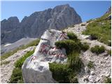 21
21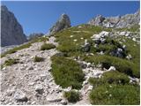 22
22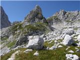 23
23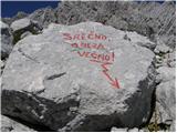 24
24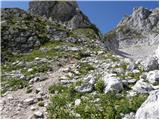 25
25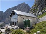 26
26
Discussion about the trip Zadnja Trenta (Flori) - Zavetišče pod Špičkom
|
| tagec13. 09. 2012 |
Nice Tuesday morning in Bovec, cloudless, unfortunately I learn that I have to work in Lj., so the planned trip to Jalovec is cancelled. Still, we drive to Zadnja Trenta, several cars already parked. After 40 min. we reach the junction, I'm a bit surprised, the sign shows 4 hours to Jalovec, 6 hours at Flori, 3 hours to the shelter. The steep path finally rises above the forest line, the views are fantastic. We meet a couple of people, no crowd really, and after a good 2 hours we are at the hut, so the 3.5 hours timetable is a bit exaggerated (at least to us!). A little chat with the friendly hut keepers, I learn there was a huge crowd on Jalovec over the weekend, then we say goodbye, time to go back. Too bad about Jalovec, when I know it would take only about an hour and a half to the summit, but it will wait. We happily return to these beautiful, somewhat distant areas for us. Three days passed like a flash, it could be extended by at least a couple more days..
|
|
|
|
| rodica19. 06. 2013 |
Can someone tell me how much snow is left on the path to Zavetišče pod Špičkom. I would go up on Saturday.
|
|
|
|
| IgorZlodej20. 06. 2013 |
There is some snow, but it doesn't pose any problems , see the Jalovec thread.
|
|
|
|
| SuzanaM7. 07. 2013 |
To the trail description I would add that the junctions are now nicely marked with mountain signs. Some confusion is only with the times. At the start Zadnja Trenta-Flori, the mountain sign says 4 hours, the wooden signpost 3.5 hours. I myself took 3.5 hours from the hut at the source of Soča with countless stops, so good 3 hours from Flori are probably closer to the real time.
From the junction to Bavški Grintavec to the next junction where the path from Vršič joins, according to mountain signs we make a time jump. For 90m ascent we use about 20 minutes, according to signs 1 hour. But at this junction the times roughly match reality.
The path through the forest is really steep, the slopes it climbs are steep too. In places where the trail narrows to shoe width, quite some caution is needed so we don't slip on the leaves.
|
|
|
|
| georgia27. 07. 2019 |
Strenuous but wonderful and solitary trail! During the week we met only a couple of hikers. Most of them apparently reach the shelter from Vršič.
The trail is mostly steep and goes through forest, the last part is open with wonderful views and flowers. But the heat plagued us at the end... No water anywhere on the trail! Luckily we had enough with us. From Flori we needed 3.5 hours with breaks. Down was easier then.
The young hut keeper is friendly, praise! When the shelter is closed, the book and stamp are in the box at the entrance.
Maybe next time to Jalovec and overnight here under Špičkom... 
|
|
|
|
| aditaker17. 08. 2021 19:26:12 |
I would ask if this trail is unsuitable for those afraid of heights like me, as I'm scared of precipices and exposed paths. I'm interested if there's no precipice anywhere along the trail because I have a really strong fear of heights. I would need a zig from this shelter?
|
|
|
|
| garmont17. 08. 2021 19:40:07 |
No problems up to the shelter. Go ahead boldly.
|
|
|
|
| plavžar19. 08. 2021 18:03:01 |
Robbers!
One Radler and one piece of pastry = 9EUR
|
|
|
|
| ovi19. 06. 2023 15:21:10 |
update:
@Georgina - you're right - warning to all: if you intend to do the ascent the same day (without bivouac) start still in the dark - Jalovec, the giant, has (ask locals) reputation of "workers' micro-thunderstorms" - by 14h down from the wall - back at the shelter...!
Safe steps (alone the path from Koča pri izviru Soče over Špička (shelter) took me 14 hours (1 hour of clear weather just below Špička)...just for info...
|
|
|
|
| capraibex20. 06. 2023 13:30:23 |
Last year I did the ascent to Jalovec from Zadnja Trenta via Jalovška škrbina, descent past Špiček. I would warn that the junction for the mentioned ascent is very poorly marked on the section where the path from Vršič also runs and branches off to the saddle. Nearby is a hunting hut, if I remember correctly, but several unmarked paths quickly mislead us. The mentioned ascent is a very demanding full-day tour.
|
|
|
To post a comment you must log in:
If you do not yet have a username, you must first
register.