Starting point: Zabočevo (400 m)
| Latitude/Longitude: | 45,9095°N 14,4008°E |
| |
Walking time: 1 h 40 min
Difficulty: easy pathless terrain
Elevation gain: 540 m
Elevation difference along the route: 550 m
Map: Ljubljana - okolica 1:50.000
Recommended equipment (summer):
Recommended equipment (winter):
Views: 6.504
 | 1 person like this post |
Access to starting point:
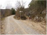
From the Ljubljana–Koper motorway, we take the Vrhnika exit and follow the road ahead in the direction of Verd, Bistra, Borovnica and Podpeč. In Borovnica, we come to a crossroads, where we continue right in the direction of Pekel. We follow the relatively narrow road ahead in the direction of Brezovica pri Borovnici, but only to the spot where the signs for the village Zabočevo direct us to the left. The road soon brings us to the mentioned village, and we follow it a little further to the mountain signposts for Rakitna. We park on one of the parking spaces along the road.
Route description:
From the starting point, by which there is also a warning sign that we are entering the bear area, we head onto the footpath in the direction of Rakitna. The path initially leads along a wide cart track, which after a good 10 minutes of moderate ascent brings us to a smaller clearing, where there is also a poorly marked junction.
Rare and occasionally quite faded blazes here direct us right onto a noticeably steeper cart track, which then continues to ascend diagonally. The path higher brings us to a forest road, which we only cross, as the signs for Rakitna and Krimšček direct us onto a cart track that continues to ascend through the forest.
The increasingly gentle path, which continues towards the southeast, brings us after a while to a junction at the NOB monument.
We continue straight on the poorer forest road (left downhill to Rakitna), along which, besides the usual ones, we also notice triangular blazes. Higher, we reach an unmarked junction, where we continue on the left wider cart track, along which the triangular blazes continue (here the path with usual blazes turns right). The cart track, which is becoming worse, ascends more steeply higher and brings us out of the forest onto grassy slopes, where we also reach a small saddle.
On the saddle, which is located between Novaška gora on the left and Krimšček on the right, we also leave the marked path and continue the ascent right on an initially poorly visible trail, which higher completely disappears. When the trail disappears, we continue slightly left and after a few steps of pathless ascent, we reach the summit of Krimšček.

Photos:
 1
1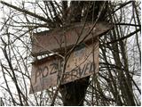 2
2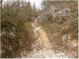 3
3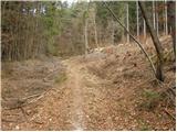 4
4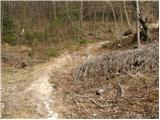 5
5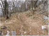 6
6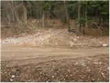 7
7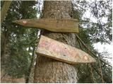 8
8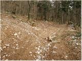 9
9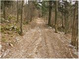 10
10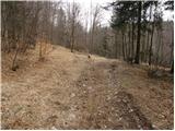 11
11 12
12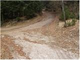 13
13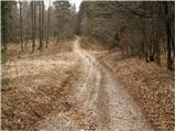 14
14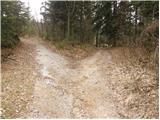 15
15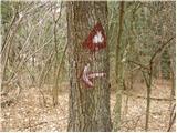 16
16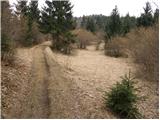 17
17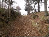 18
18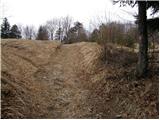 19
19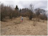 20
20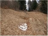 21
21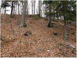 22
22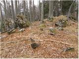 23
23
Discussion about the trip Zabočevo - Krimšček
|
| basist11. 04. 2010 |
Does anyone know what those triangular markers indicate? I noticed them also on Srebotnik and Prevejk. These are peaks between Ljubljansko barje and Rakitna. Is it perhaps some special path?
|
|
|
|
| anamarijana11. 04. 2010 |
I REALLY DON'T KNOW WHERE YOU GOT THE NAME KRIMŠČEK FROM. AS A LOCAL I KNOW IT'S KRIMČEK.
|
|
|
|
| basist11. 04. 2010 |
Ok. Don't get upset  ) But do you know anything about those triangular markers? ) But do you know anything about those triangular markers?
|
|
|
|
| edob12. 04. 2010 |
Hello! Those triangles delimit the hunting area of Rakitna and Borovnica. Otherwise, a marked path to Slivnica runs through Krimček, and in between to Krimska jama. The triangles have nothing to do with that.
|
|
|
|
| dj1212. 04. 2010 |
Thanks "edob" for explaining those triangles. Sometime in the near future, we'll have to hop over to Krimček to build up fitness. Best regards D&A
|
|
|
|
| darh19. 05. 2013 |
We tackled the ascent described here yesterday afternoon - it turned out perfect for the time we had available. A few greener shots and some more impressions here.
|
|
|
To post a comment you must log in:
If you do not yet have a username, you must first
register.