Za Loncem - Tolsti vrh (Veža)
Starting point: Za Loncem (980 m)
| Latitude/Longitude: | 46,3262°N 14,6543°E |
| |
Walking time: 3 h 35 min
Difficulty: easy unmarked way
Elevation gain: 1005 m
Elevation difference along the route: 1005 m
Map: Kamniške in Savinjske Alpe 1:50.000
Recommended equipment (summer):
Recommended equipment (winter): ice axe, crampons
Views: 6.601
 | 2 people like this post |
Access to starting point:
Access from Luče: In Luče we head onto the road in the direction of Kamnik and follow the road ahead past the inn Gams and ahead over the bridge of the stream Lučka Bela. Only a few dozen meters after the bridge, the road into the Lučka Bela valley branches off to the right. We head onto this road and follow it to the parking lot at the signs Korošica 3:30.
Access from Kamnik: From Kamnik we drive to Stahovica and further towards the mountain pass Črnivec. Only a little before the mountain pass, the road towards Kranjski Rak branches off sharply to the left. We head onto this road, which brings us to the mountain pass at Kranjski Rak. Further, we head in the direction of Luče and continue driving on the road which is descending. When the road brings us into the valley, we will notice signposts for Korošica on the left side of the road. We head onto this road and follow it to the parking lot at the signs Korošica 3:30.
Route description:
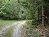
From the parking lot, we head onto the path in the direction of Korošica. Initially a wide and gentle path soon brings us to steep slopes, where the path ascends more steeply. The path, which ascends through the forest, a little higher crosses a small clearing, where the steepness for a short time decreases. The path then goes back into the forest, where it crosses a torrent and then ascends steeply. A little higher, a beautiful view opens up towards Lučka kopa and Konj. The path ahead slowly transitions into dwarf pines, continuing to a smaller junction at Vratca. We continue straight in the direction of Korošica, initially slightly downhill (the path to the right crosses exposed slopes below Lastovec). Already after a few steps, the path brings us to the intermittent lake at Stare Štale. Here, next to the lake, we can often notice a group of marmots running on grassy slopes. The path ahead starts to ascend moderately again and soon brings us to a stream, which is among the highest in Slovenia. The stream has some smaller waterfalls, which at this altitude stand out particularly. A little higher, the path, which still runs among dwarf pines, brings us to a junction, where we continue right in the direction of Vodotočnik (left Korošica). The path ahead ascends for some time over grassy slopes surrounded by dwarf pines to the spot where we spot the lake below us. Only a few steps of descent down the grassy slope to the lake follow.
From the lake, we continue ahead on the path leading to the saddle between Tolsti vrh on the left and Deska on the right. After ten minutes of walking on a grassy slope surrounded by dwarf pines, the path brings us to the mentioned saddle, where we continue left upwards on an unmarked trail. Here the path ascends steeply and after a further ten minutes brings us to Tolsti vrh.

Photos:
 1
1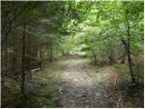 2
2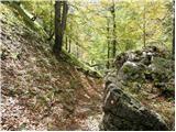 3
3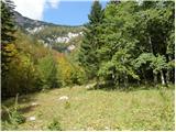 4
4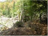 5
5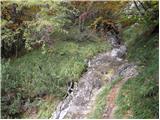 6
6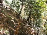 7
7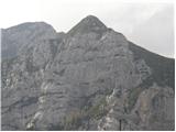 8
8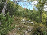 9
9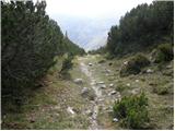 10
10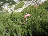 11
11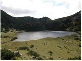 12
12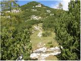 13
13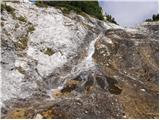 14
14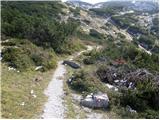 15
15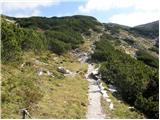 16
16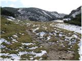 17
17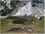 18
18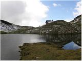 19
19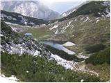 20
20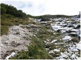 21
21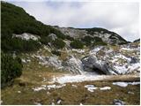 22
22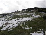 23
23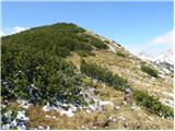 24
24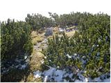 25
25
Discussion about the trip Za Loncem - Tolsti vrh (Veža)
|
| Delta0413. 05. 2012 |
Hi! This is at least for me a phenomenal hike and mountain. The summit itself really isn't anything special but that's why it has a very nice view.
A little addition about the path.
Access from Kamnik: From Kamnik we drive to Stahovica and further to Črnivec pass. Look for the Kranjski Rak sign. Turn left towards Kranjski Rak and drive all the way to the top or to the refreshment hut at the top. Continue the path straight ahead on the asphalted road. We descend into the valley and reach the village Podvolovjek. Soon on the left we spot a T junction and a smaller hayrack on which there is also a red sign Korošica 4:30h. We continue left on the forest path. On this path we drive past the warning sign that we are driving at our own risk. We continue 5 km on this path, which slowly ascends. Every now and then we notice marking on the trees. We drive until we reach a small clearing at the Korošica 3:30h sign. There we leave the car and continue on foot.
|
|
|
To post a comment you must log in:
If you do not yet have a username, you must first
register.