Weißensteinhütte - Ameringkogel (Packalpe) (circular path)
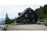
Starting point: Weißensteinhütte (1706 m)
| Latitude/Longitude: | 47,0586°N 14,7936°E |
| |
Route name: circular path
Walking time: 5 h 30 min
Difficulty: easy marked way
Elevation gain: 481 m
Elevation difference along the route: 600 m
Map: KOMPASS št. 219 - Lavanttal
Recommended equipment (summer):
Recommended equipment (winter): crampons
Views: 2.261
 | 4 people like this post |
Access to starting point:
A) From the Gorenjska side we go over the border crossing Ljubelj to Celovec / Klagenfurt or through the Karawanks to Beljak / Villach. Next we head onto the motorway in the direction of the signs for Gradec / Graz. We leave the motorway before the approximately 2 km long tunnel in the direction of Bad St. Leonhard. Further, we drive past the village of St. Peter to the settlement Obdach. From the main road the signs for Obdach direct us to the left and soon we come to the industrial zone. Before the underpass we turn right, where after a few dozen meters we cross a railway track. We follow the road, which becomes macadam at all crossroads, towards the signs for Weißensteinhütte.
B) From Koroška we first drive to Dravograd and further into Austria. We follow the road further towards St. Paul, St. Andrä and Wolfsberg. In Wolfsberg we head towards Bad St. Leonhard and further towards St. Peter. Further, we follow the description from Gorenjska.
C) From the Štajerska side we drive to Maribor and further over the border crossing Šentilj into Austria. We follow the motorway in the direction of Celovec / Klagenfurt. We leave the motorway at the exit Bad St. Leonhard. Further, we follow the description from Gorenjska.
Route description:
At the mountain hut Weißensteinhütte, where we've left the car, we turn sharply right. The path leads us on a cart track slowly upwards. After a few minutes of walking through the forest we arrive at the first junction. Here we turn left in the direction of Speikkogel. Through low bushes the path starts ascending. When the path brings us above the treeline it is very hard to follow the blazes. If we follow the fence for livestock we will arrive at the emergency bivouac. From here we follow the ridge and the path brings us to the top of Weißenstein (2160 m), after which the mountain hut is named. Here we turn left and after a few minutes of walking we arrive at the highest peak of Packalp - Ameringkogel (2187 m) it is a domed peak on which a metal cross stands and offers a nice view on the neighbouring mountains.
From the top we descend back to the top of Weißenstein, where we continue straight in the direction of Speikkogel. First a descent follows along the ridge, then the path gently continues to Hofalmkogel (2040 m), Speikkogel (1993 m) and to the large metal cross, which stands above the saddle Peterer Sattel. From the cross we do not turn left on the marked path, but descend right on the unmarked path to the mentioned saddle, which lies at an altitude of 1745 m. When we arrive at the saddle we turn right onto path no. 521A, which leads back to the hut. After a little less than an hour of walking above the treeline we arrive at the first alpine pasture. From here we continue on the macadam road and arrive at the signpost, where we turned for Speikkogel. From here only a gentle descent follows to the hut where we parked the car.

Along the route: Weißenstein (2160m), Hofalmkogel (2040m), Speikkogel (1993m), Peterer Sattel (1745m), Hofhütte (1746m), Sturmerhütte (1726m)
Photos:
 1
1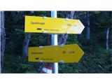 2
2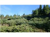 3
3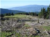 4
4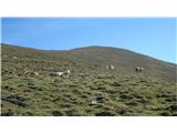 5
5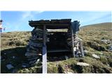 6
6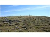 7
7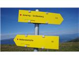 8
8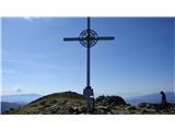 9
9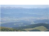 10
10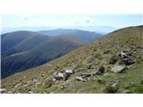 11
11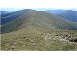 12
12 13
13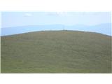 14
14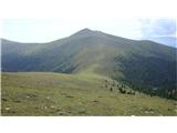 15
15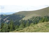 16
16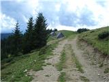 17
17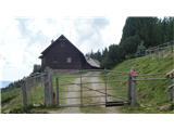 18
18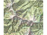 19
19
Discussion about the trip Weißensteinhütte - Ameringkogel (Packalpe) (circular path)
To post a comment you must log in:
If you do not yet have a username, you must first
register.