Weissensee - Techendorfer Alm (steep way)
Starting point: Weissensee (940 m)
| Latitude/Longitude: | 46,6989°N 13,4148°E |
| |
Route name: steep way
Walking time: 2 h 15 min
Difficulty: easy marked way
Elevation gain: 633 m
Elevation difference along the route: 633 m
Map:
Recommended equipment (summer):
Recommended equipment (winter):
Views: 3.705
 | 1 person like this post |
Access to starting point:
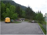
A little before Spittal from the direction of Beljak/Villach (on the old road), the road towards the village Ziebel branches off to the left. In the mentioned village, we continue driving towards Lake Weissensee, which is approximately 15 km from Ziebel. We park on a large organized parking lot near the lake.
Route description:
From the large parking lot, we descend a few meters to the main road, where on the left side we notice signposts. We head on a wide path which leads by the lake following the signs »Techendorf«. The path first leads us over a small bridge and brings us to the camp on the eastern side of Lake Weissensee. Here we turn right on an asphalt road which runs by the camp and brings us to a crossroads where we turn left and after a few meters of walking we come to signposts. We go left following the signs »Techendorfer Alm steil«. After a few meters we come again to signposts and go right on a steep path towards the mountain pasture Techendorfer Alm. The left path runs on a more gentle route, which mostly leads on the road.
The path quite steeply ascends through the forest and brings us to a clearing where we cross a cart track and start ascending along the edge of the forest. Here the first views already open up towards the nearby peaks in the Latschur group. The path again ascends through the forest and then crosses the mountain road several times. At all crossroads, which are very well marked, we continue in the direction of Techendorfer Alm steil (steep path). Finally, when the path towards the saddle Stosia branches off to the left, we continue on the road which after approximately 15 minutes of walking brings us to the mountain pasture Techendorfer Alm, where there also stands a smaller mountain hut.

Photos:
 1
1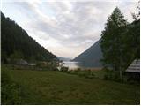 2
2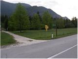 3
3 4
4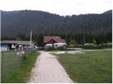 5
5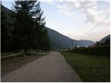 6
6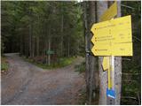 7
7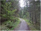 8
8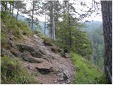 9
9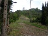 10
10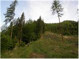 11
11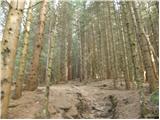 12
12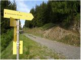 13
13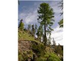 14
14 15
15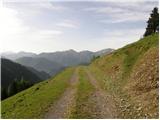 16
16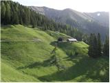 17
17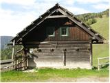 18
18
Discussion about the trip Weissensee - Techendorfer Alm (steep way)
|
| VanSims19. 10. 2010 |
Warning, the owners of this hut have an unleashed dog up there that barks at hikers and attacks them. If you continue towards Latschur, Almspitz, Eckwand or other nearby mountains, you can avoid this alpine pasture by turning towards the Stosia saddle, already about 5-10 minutes earlier instead of from this pasture.
|
|
|
To post a comment you must log in:
If you do not yet have a username, you must first
register.