Weißenbach - Schoberstein
Starting point: Weißenbach (470 m)
| Latitude/Longitude: | 47,8001°N 13,5401°E |
| |
Walking time: 1 h 30 min
Difficulty: partly demanding marked way
Elevation gain: 567 m
Elevation difference along the route: 567 m
Map:
Recommended equipment (summer):
Recommended equipment (winter): ice axe, crampons
Views: 681
 | 1 person like this post |
Access to starting point:
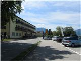
Through the Karawanks Tunnel, we drive into Austria and continue on the Tauern motorway past Salzburg. We leave the motorway at the exit for Mondsee, which we bypass along the eastern shore. We continue towards Attersee, where we immediately turn right and follow the road along the southern and then eastern shore of the lake to the town of Weißenbach am Attersee. We park at one of the arranged parking lots along the main road or the road that branches off towards Bad Ischl.
Route description:
In Weißenbach there are several very well-marked starting points of the trail to Schoberstein - we look for the nearest and head onto the path. The paths join at the chapel of St. Nicholas, where the ascent begins. The path ascends serpentinely through the forest; just before leaving the forest, the path flattens briefly. Then the serpentine ascent continues, with steel cables helping on parts of the path. Just below the summit we turn left and ascend to the summit. The entire path is very well marked.
Photos:
 1
1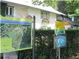 2
2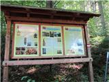 3
3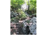 4
4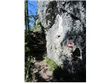 5
5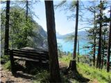 6
6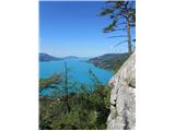 7
7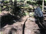 8
8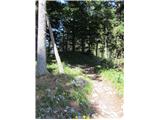 9
9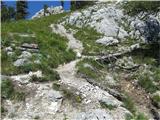 10
10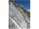 11
11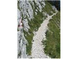 12
12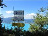 13
13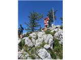 14
14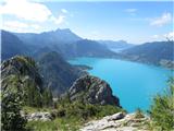 15
15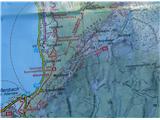 16
16
Discussion about the trip Weißenbach - Schoberstein
|
| J.P.7. 05. 2025 21:00:22 |
The tour is too short if we only go to Schoberstein. An excellent circular tour is made if we extend further over Mahdlgupt and Dachsteinblick, then at the saddle right behind Dachsteinblick we descend and return to the starting point. It's worth it because the views are magnificent. Parking is available right next to the starting point or a bit further, on the main road before turning into the village (if coming from the Berghof direction). Price for 6 hours is 4€.
|
|
|
To post a comment you must log in:
If you do not yet have a username, you must first
register.