Starting point: Weißenbach (470 m)
| Latitude/Longitude: | 47,8001°N 13,5401°E |
| |
Walking time: 2 h 15 min
Difficulty: partly demanding marked way
Elevation gain: 791 m
Elevation difference along the route: 791 m
Map:
Recommended equipment (summer):
Recommended equipment (winter): ice axe, crampons
Views: 791
 | 1 person like this post |
Access to starting point:
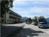
Through the Karawanks Tunnel, we drive to Austria and continue on the Tauern highway past Salzburg. We leave the highway at the exit for Mondsee, which we bypass along the eastern shore. We continue in the direction of Attersee, where we immediately turn right and follow the road along the southern and then eastern shore of the lake to the town of Weißenbach am Attersee. We park on one of the designated parking lots along the main road or the road that branches off towards Bad Ischl.
Route description:
In Weißenbach there are several very well-marked starting points for the trail to Mahdlgupf (signs for Schoberstein) - we find the nearest one and head onto the trail. The trails join at the chapel of St. Nicholas, where the ascent begins. The trail ascends in zigzags through the forest; just before leaving the forest, the trail flattens out briefly. Then the zigzag ascent continues, and steel cables assist us on parts of the trail. A signpost at the saddle directs us right back into the forest. We ascend in zigzags to the next signpost just below the summit, where we continue left.
The entire trail is very well marked.
Photos:
 1
1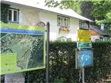 2
2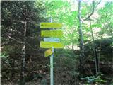 3
3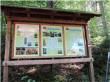 4
4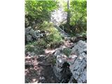 5
5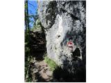 6
6 7
7 8
8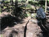 9
9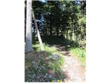 10
10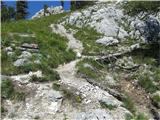 11
11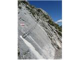 12
12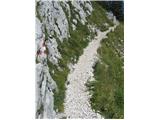 13
13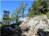 14
14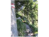 15
15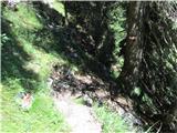 16
16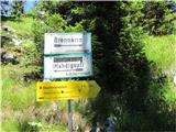 17
17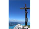 18
18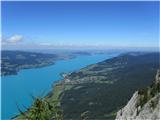 19
19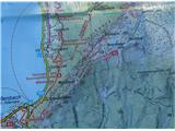 20
20
Discussion about the trip Weißenbach - Mahdlgupf
To post a comment you must log in:
If you do not yet have a username, you must first
register.