Vurmat (Šturm) - Sveti Duh na Ostrem Vrhu
Starting point: Vurmat (Šturm) (295 m)
| Latitude/Longitude: | 46,5829°N 15,4448°E |
| |
Walking time: 1 h 45 min
Difficulty: partly demanding marked way
Elevation gain: 609 m
Elevation difference along the route: 610 m
Map: Pohorje 1:50.000
Recommended equipment (summer):
Recommended equipment (winter): crampons
Views: 11.965
 | 4 people like this post |
Access to starting point:
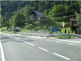
On the road Maribor - Dravograd near the hydropower plant Fala we will notice a small bridge on the Šturmov potok stream. Exactly on that bridge there is also the border between Štajerska and Koroška. We leave the car at the sawmill or somewhere nearby.
Route description:
The path begins at the sawmill, which is visible also from the road Maribor - Dravograd. The path initially runs along a wide macadam road, which leads us past a few houses of the dispersed hilly settlement Vurmat. Higher up, we reach a sharp left turn, where we leave the road and continue on a usually quite muddy cart track. We walk on the cart track for only about a minute, then cross a footbridge. After the footbridge, the path becomes steeper and enters Zrnkova grapa. Further on, we ascend along a partly slippery and steep path, which on one section is also secured with a steel cable. Above the steel cable, the path flattens temporarily, then after the second footbridge it steeply ascends again along a path that is in places quite overgrown. Higher up, the path leads us over the third footbridge, after which we reach a lonely cottage and a little further the Virtičev mlin.
From the mill onwards, the path continues along a gently sloping macadam road, which leads past a pond, after which it ascends more steeply in two hairpin turns. Further on, the road leads us past the Knap farm, after which we arrive at the village Sveti Duh na Ostrem vrhu. Upon arriving in the village, the path first leads past the NOB monument, above which we reach the church of the Holy Spirit, located on top of the hill.
The stamp and logbook are located in the nearby inn Heric.

Photos:
 1
1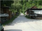 2
2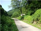 3
3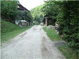 4
4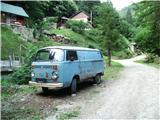 5
5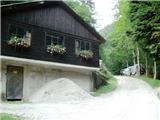 6
6 7
7 8
8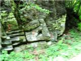 9
9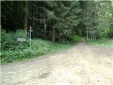 10
10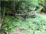 11
11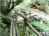 12
12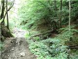 13
13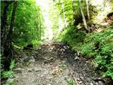 14
14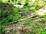 15
15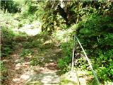 16
16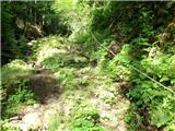 17
17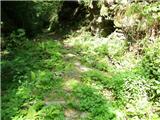 18
18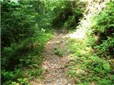 19
19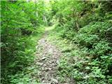 20
20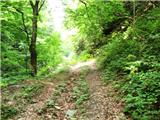 21
21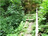 22
22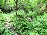 23
23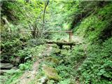 24
24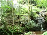 25
25 26
26 27
27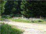 28
28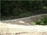 29
29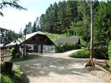 30
30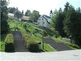 31
31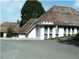 32
32
Discussion about the trip Vurmat (Šturm) - Sveti Duh na Ostrem Vrhu
|
| dija13. 04. 2014 |
Today the path was walked, but in the opposite direction. To the top we went on an unmarked path which starts somewhat 10 m towards Maribor, so we (with partner) arrived at the marked path at Volovška. That unmarked part dragged on and on, was very steep.. the path is 2 km... at the end it was therefore a circular path. Light rain drove us under rocks on the cliff-viewpoint, then onwards to Sv. Duh. From there the path led us down Šturmova graba where the stream gurgled.
|
|
|
|
| Marx29. 03. 2015 |
I was on the trail on 28.03.2015.
Now the section from the start to the Gradinšek farm (photo 6) is asphalted.
The van from photo 5 is also gone...
The third little bridge before the exit to the hunting hut and Virtičev mlin (photo 24) is dangerous (old wood) and caution is needed on it...
|
|
|
|
| pohodnik388. 04. 2015 |
On Monday, April 6th, I walked the mentioned path and it is without special features, but the consequences of last year's severe flood that raged around here are still visible. Some impressions from the path in video snippets.
VIDEO
Best regards! Tone
|
|
|
|
| skladatelj893. 09. 2016 |
The van from picture 5 is back, but it no longer has any markings on it. They repainted it
|
|
|
To post a comment you must log in:
If you do not yet have a username, you must first
register.