Vršič - Veliki Ozebnik (via Jalovška škrbina)
Starting point: Vršič (1611 m)
| Latitude/Longitude: | 46,4336°N 13,7435°E |
| |
Route name: via Jalovška škrbina
Walking time: 5 h 35 min
Difficulty: difficult pathless terrain
Elevation gain: 869 m
Elevation difference along the route: 1200 m
Map: TNP 1:50.000
Recommended equipment (summer): helmet, self belay set
Recommended equipment (winter): helmet, self belay set, ice axe, crampons
Views: 12.178
 | 3 people like this post |
Access to starting point:
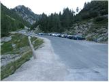
From Kranjska Gora, we drive towards Bovec or vice versa, but only to the Vršič pass, where we park.
Route description:
From the parking lot at the Vršič pass, we head in the direction of Trenta, where we quickly reach a small intersection, where a road closed to public traffic branches off to the left towards the nearby Tičarev dom and continues to Poštarski dom, but we go right, where next to the cabin selling various souvenirs we notice the beginning of the marked path leading towards Jalovec and Zavetišče pod Špičkom.
The path takes us after just a few steps to the foot of the scree below Mala Mojstrovka, but we keep slightly to the left, where the path through a belt of dwarf pines leads us to the foot of the cliffs, along which we descend slightly. Further on, the path is initially quite scenic and takes us through several short ascents and descents to a shorter steeper section, where fixed protection helps us at two difficult spots, which is particularly useful when the path is wet or slippery. After this section, the path gradually begins to descend transversely, and we descend for quite some time, giving the impression that the path will take us down into the valley and not towards the area around Jalovec. During the traverse, we occasionally get a nice view of the mountains above the Trenta valley, and when the path returns to the forest, we reach a marked junction near the hunting hut in Rutarska Trenta, which is set slightly off the marked path.
We continue right in the direction of Jalovec (left downhill Zadnja Trenta, straight Zavetišče pod Špičkom) along a path that ascends quite steeply, initially still through the forest, higher up along increasingly scenic slopes below Goličica, Lopo and Šitami.
On this section, we mostly ascend the southeast slopes, which become increasingly rocky higher up, and when we reach about 1950 meters above sea level, an unmarked path branches off to the right towards Šitami, but we continue along the marked path, which turns slightly left and ascends a bit higher to a marked junction below Jalovška škrbina.
Here we go left towards Jalovec (straight Jalovška Škrbina and dolina Tamar) and traverse the slopes to the entrance into the wall of Goličica.
Before entering the climbing section, we put on our helmets, and the sign informs us that we will continue the ascent on a very demanding path.
The first part of the ascent up the wall of Goličica is done in a slight traversing ascent to the left, then the path turns right and begins to ascend up the wall. The path becomes increasingly exposed further on, and the fixed protection is really only at the most difficult spots; otherwise, we have to do most of the ascent without protection (this part of the path is particularly dangerous for slipping on the descent).
Higher up, the steepness eases, and we reach the scree south of Goličica, along and over which we then ascend transversely to the left.
The increasingly scenic path then takes us through Vratca v Ozebnik to a point from where we get a nice view into Jalovčev ozebnik and towards dolina Tamar; the path through the cirque has been closed for several decades.
We continue along a less steep path that takes us over Jalovsko sedlo to the junction at Jezerca, which we reach with a slight descent.
We continue left towards Zavetišče pod Špičkom (right Jalovec) along a path that continues to ascend gently over partly grassy slopes. After a few minutes of easy walking, the path takes us to a point where we leave the marked path leading towards Zavetišče pod Špičkom (we leave the marked path just a few meters before the fixed cable and gully, which is exposed to falling rocks).
We continue right and continue the ascent through pathless terrain on the southern slopes of Veliki Ozebnik. Further on, we ascend along the right side of the gully through very steep terrain, where there is a high risk of rockfall. After 20 minutes of easier climbing, which does not exceed grade 1, we reach the summit of Veliki Ozebnik.
Orientation in the last section is difficult, and there is also a high risk of falling rocks.
Vršič - Rutarska Trenta 2:15, Rutarska Trenta - junction below Goličica 1:30, junction below Goličica - Jezerca 1:20, Jezerca - junction off marked path 0:10, junction off marked path - Veliki Ozebnik 0:20.

Along the route: Rutarska Trenta (1546m), Razpotje pod Goličico (2070m), Vratca v Ozebnik (2327m), Nad kuloarjem (2371m), Jalovško sedelce (2394m), Jezerca (2390m), Odcep z markirane poti (2380m)
Photos:
 1
1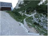 2
2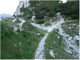 3
3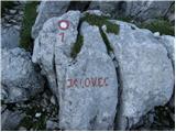 4
4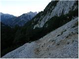 5
5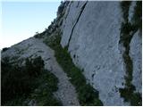 6
6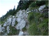 7
7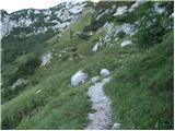 8
8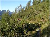 9
9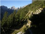 10
10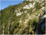 11
11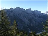 12
12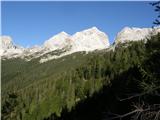 13
13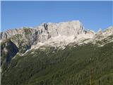 14
14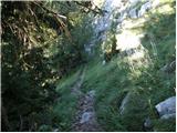 15
15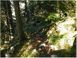 16
16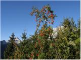 17
17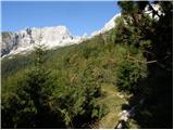 18
18 19
19 20
20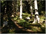 21
21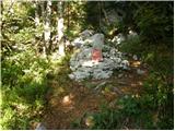 22
22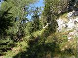 23
23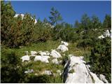 24
24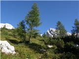 25
25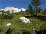 26
26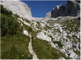 27
27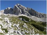 28
28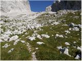 29
29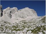 30
30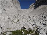 31
31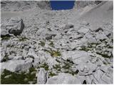 32
32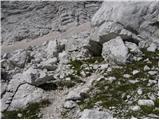 33
33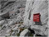 34
34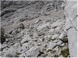 35
35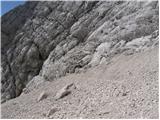 36
36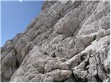 37
37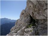 38
38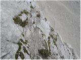 39
39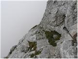 40
40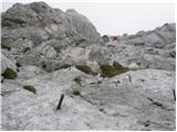 41
41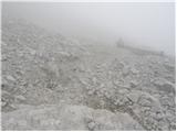 42
42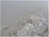 43
43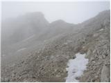 44
44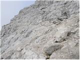 45
45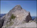 46
46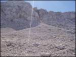 47
47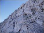 48
48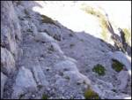 49
49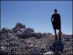 50
50
Discussion about the trip Vršič - Veliki Ozebnik (via Jalovška škrbina)
|
| bo_zl7. 08. 2025 20:52:52 |
Before entering the Goličica wall, there is no longer a sign indicating it's a very difficult path. Or maybe I missed it, someone correct me. There are enough fixed protections and I don't think they are sparingly placed, nowhere are they missing where needed. The wall itself is short, it doesn't take more than half an hour. When we leave the marked path, we cross the scree towards the gully, climb up the gully, at the top of the gully about a meter maybe a meter and a half flat, then straight up the hill. There are cairns and plenty of them so you can follow. I improved some, enlarged them to make them more visible. From the junction off the marked path to the top it's no more than 20 minutes.
|
|
|
|
| VelikiZajetnež11. 08. 2025 20:49:45 |
bo_zl, the sign is still there, just faded 
I was at V. Ozebnik today, but didn't see any cairn so I took the path my own way 
|
|
|
To post a comment you must log in:
If you do not yet have a username, you must first
register.