Starting point: Vršič (1611 m)
| Latitude/Longitude: | 46,4336°N 13,7435°E |
| |
Route name: via ridge
Walking time: 4 h 55 min
Difficulty: difficult pathless terrain
Elevation gain: 739 m
Elevation difference along the route: 1000 m
Map: TNP 1:50.000
Recommended equipment (summer): helmet
Recommended equipment (winter): helmet, ice axe, crampons
Views: 13.362
 | 4 people like this post |
Access to starting point:
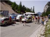
From Kranjska Gora we drive towards Bovec or vice versa, but only to the Vršič pass, where we park.
Route description:
From the parking lot at the Vršič pass, we head onto the marked path towards Mala Mojstrovka and Slemenova špica. The path quickly splits, and we choose the left path towards Mala Mojstrovka (right is Slemenova špica and Hanzova pot to Mala Mojstrovka). This is followed by a traverse ascent to the left, where we first go through a belt of shrubs, then arrive among dwarf pines and a sparse larch forest, through which a wide, mostly rocky path leads. After about half an hour of ascent, we reach a larger scree field, where an unmarked path branches off to the right to Šitna glava, and straight ahead the marked path continues towards Mala Mojstrovka.
We continue the ascent on the unmarked path, which leads us in a slight traverse ascent to the right towards the slopes of Šitna glava. A relatively well-visible trail soon brings us to an indistinct small valley between Mala Mojstrovka and Šitna glava. Here the path turns slightly left and ascends a bit more steeply on an increasingly rocky slope. When the path already approaches the summit quite closely, it turns right, crosses a partially overgrown scree field and then ascends to the grassy summit of Šitna glava.
From Šitna glava we continue along the ridge towards the west, first slightly downhill, then uphill in the direction of Mojstrovka (unmarked). The poorly visible trail on which we continue to ascend brings us after about 20 minutes of walking from Šitna glava to the place where we join the Hanzova pot to Mojstrovka, which we reach above a very demanding section.
Further on, orientation is easier, but the path is increasingly steep. After a few more minutes, the steepness eases and the path brings us to a more level terrain, which we bypass on the right side. Further, the path approaches the ridge, and we see Mangart and Jalovec in front of us. Here the path turns slightly left and brings us to the next steep section, where with the help of a few pitons, but mainly without protection, we climb up the steep summit slope of Mala Mojstrovka to its panoramic summit.
From Mala Mojstrovka we continue in the direction towards Velika Mojstrovka. First we descend a bit and head onto the trail that leads slightly right towards the saddle between the two Mojstrovkas. The path then crosses a scree field and begins to traverse the steep southern slopes below Velika Mojstrovka in ascent. The slope soon becomes less steep and the path turns right upwards. From here follows only a short ascent on a rocky slope to the eastern summit of Velika Mojstrovka.
From the eastern summit we continue along the ridge in the direction towards the west. The path soon becomes somewhat more demanding and begins to ascend on a slightly crumbly slope on the southern side of the ridge. The path is marked on this section with numerous cairns. This is followed by an ascent towards the ridge where we soon reach the western summit of Velika Mojstrovka.
Also from the western summit we continue further along the very panoramic ridge. The ridge is precipitous on the northern side all the time, but it is wide enough that walking on it does not present major difficulties. Later, the slope on the southern side of the ridge also becomes somewhat steeper and there follows an even steeper ascent on a rocky ridge to the summit of Zadnja Mojstrovka.
The path along the ridge subsequently becomes more demanding and if we are not accustomed to walking on demanding unsecured terrain, it is advisable to return a few minutes back, where the southern slopes are not so steep and descend onto an unmarked trail that runs somewhat lower on the less steep southern slopes parallel to the ridge. If we continue along the ridge, we first descend a bit on a narrow and quite exposed ridge. The path subsequently gradually becomes less demanding again, then brings us to a somewhat more grassy slope. On this section there is practically no trail and there follows a traverse of a steep slope on which there is also some rubble, so this part is dangerous for slipping. A little later there follows a steep descent into a narrow notch from which we then have to climb up a very steep slope. There is climbing for only a few steps, but one needs to be very careful because the slope is exposed. The path then becomes less demanding and brings us to the slopes below Travnik. Here the path turns slightly to the left and begins to ascend over scree fields. Later the path turns to the right and there follows the last ascent on a rocky slope to the summit of Travnik.
From Travnik we continue along the ridge and begin to descend. We can avoid the steep ridge slightly to the southern side and then traverse the slope parallel to the ridge. At the end we turn right and there follows a short ascent to the summit of Kol.
We can descend via the ascent path or via an easier path that runs somewhat lower on the southern side parallel to the ridge.
Vršič - turnoff from the marked path 0:35, turnoff from the marked path - Šitna glava 0:45, Šitna glava - Edge of the northern wall of Mala Mojstrovka 0:20, Edge of the northern wall of Mala Mojstrovka - Mala Mojstrovka 0:35, Mala Mojstrovka - Velika Mojstrovka (eastern summit) 0:30, Velika Mojstrovka (eastern summit) - Velika Mojstrovka (western summit) 0:15, Velika Mojstrovka (western summit) - Zadnja Mojstrovka 0:25, Zadnja Mojstrovka - Travnik 1:15, Travnik - Kol 0:15.

Photos:
 1
1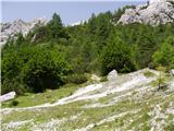 2
2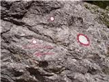 3
3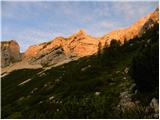 4
4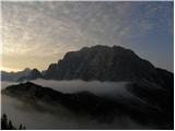 5
5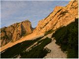 6
6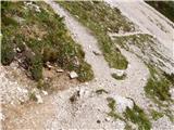 7
7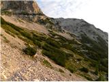 8
8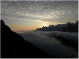 9
9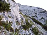 10
10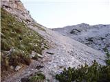 11
11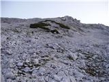 12
12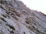 13
13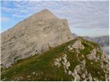 14
14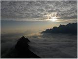 15
15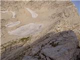 16
16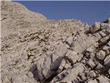 17
17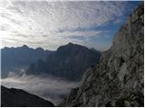 18
18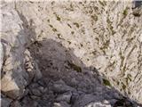 19
19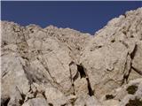 20
20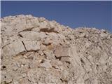 21
21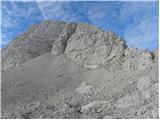 22
22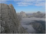 23
23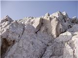 24
24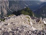 25
25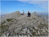 26
26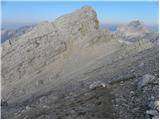 27
27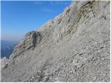 28
28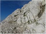 29
29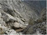 30
30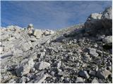 31
31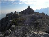 32
32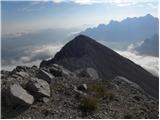 33
33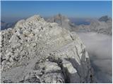 34
34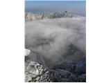 35
35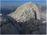 36
36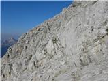 37
37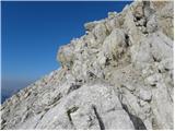 38
38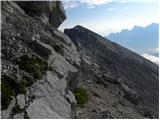 39
39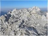 40
40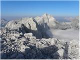 41
41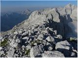 42
42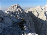 43
43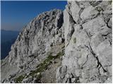 44
44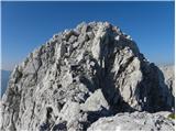 45
45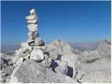 46
46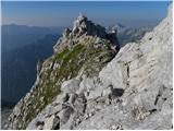 47
47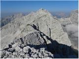 48
48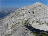 49
49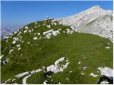 50
50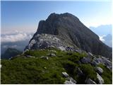 51
51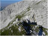 52
52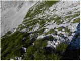 53
53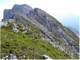 54
54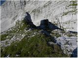 55
55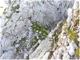 56
56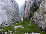 57
57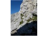 58
58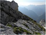 59
59 60
60 61
61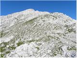 62
62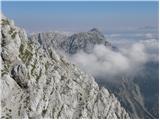 63
63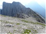 64
64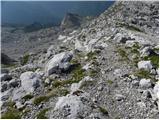 65
65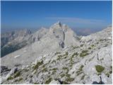 66
66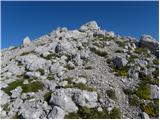 67
67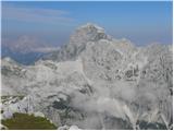 68
68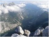 69
69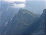 70
70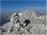 71
71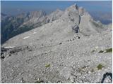 72
72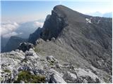 73
73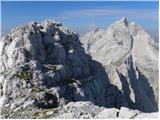 74
74 75
75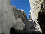 76
76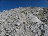 77
77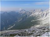 78
78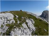 79
79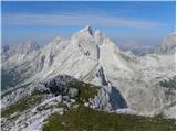 80
80
Discussion about the trip Vršič - Kol (via ridge)
|
| Kriška3. 08. 2009 |
Magnificent path, beautiful photos!
|
|
|
|
| rober4. 08. 2009 |
Excellent photos, need to experience it live...
|
|
|
|
| cics5. 08. 2009 |
Very nice, excellent pictures,... maybe repeat sometime....
|
|
|
|
| štempilka6. 08. 2009 |
Crazy, what beautiful views, this has to be checked out. So far I've only made it to Mala Mojstrovka.
|
|
|
|
| lukk22. 06. 2014 |
I'm interested in the conditions on the path and how demanding the path is.
|
|
|
|
| ločanka5. 01. 2015 |
Nice photos and very good description!
|
|
|
|
| goretz2. 08. 2022 22:56:40 |
Hi,
I'm wondering if the ridge trail is still marked with cairns, and if it's really to Kol, in case we go over all the listed peaks along the trail it's really only 4h 45 min. It seems a bit too little considering that you have to climb up and down each peak after all. Best regards and safe hiking
|
|
|
|
| ppegan3. 08. 2022 14:24:58 |
Even if there are no cairns, you stick to the ridge, you can't go far wrong  Unfortunately I don't remember how long my buddy and I took, but it seems to me that the time is quite realistic. Unfortunately I don't remember how long my buddy and I took, but it seems to me that the time is quite realistic.
|
|
|
|
| goretz9. 08. 2022 17:47:44 |
@ppegan thanks for the reply. Do you perhaps remember how technically demanding the path is on certain sections? From the path description I can see that there is some climbing, but is the path suitable for beginners who otherwise have stamina? Thanks and best regards
|
|
|
|
| felix9. 08. 2022 18:56:41 |
Along the ridge itself there are no problems, the question is where you plan to return. If you plan to descend to the former lower path (only here and there you can see some faded mark), you have to find a suitable passage down, which is nowhere easy. A few years ago I returned to Travnik and found a suitable passage, then above Suhim vrhom to Vratc.
|
|
|
|
| ppegan10. 08. 2022 08:08:29 |
@goretz, if not too late - the most technically demanding is the notch (pictures 56-58), but it can be climbed nicely, not as bad as it looks on the pictures. This notch worried me the most too, but on site it turned out it poses no problems (my layman's assessment is II to climb here, but only 2-3 meters). In principle the path is not too demanding, just watch out not to slip due to scree. The step must be safe and stable. Good luck
|
|
|
|
| sAleska10. 08. 2022 16:33:43 |
This notch is really the most demanding, but I'd say it's not a II or barely that, just one or two moves. It's exposed, though. Holds and steps are excellent, rock solid.
The biggest catch is the very worn path from the notch down left. No need to go there, as it's much more dangerous (scree on inclined slabs) and especially tiring, as you descend quite a bit then up again. One of us went there and regretted it.
It's important to examine the rocks well in the notch and you'll see the logical passage. It goes directly from the notch up about a meter then slightly right up on the inclined ledge. There you already look over the edge onto the vast meadow. Altogether it's barely the height of a basketball player.
Good luck.
|
|
|
|
| goretz11. 08. 2022 22:15:20 |
Many thanks for the answers. We plan to go on the path on Monday, if the weather permits of course.
|
|
|
To post a comment you must log in:
If you do not yet have a username, you must first
register.