Vrhnika pri Ložu - Racna gora
Starting point: Vrhnika pri Ložu (584 m)
| Latitude/Longitude: | 45,7069°N 14,5076°E |
| |
Walking time: 1 h 45 min
Difficulty: easy marked way
Elevation gain: 556 m
Elevation difference along the route: 556 m
Map: Snežnik 1:50.000
Recommended equipment (summer):
Recommended equipment (winter): ice axe, crampons
Views: 10.642
 | 4 people like this post |
Access to starting point:
From the Ljubljana - Koper motorway, take the Unec exit and follow the road ahead in the direction of Cerknica. Further on, we drive through Cerknica, Martinjak and Grahovo to the village of Bloška polica, where at the crossroads we continue right in the direction of the village of Lož (straight to Sodražica, access also possible from that direction). Just a little after the village of Lož we reach Stari trg pri Ložu, where we continue left in the direction of the villages of Markovec and Vrhnika. Further on, we drive on a somewhat narrower road, which takes us past the village of Markovec to the beginning of the village of Vrhnika pri Ložu. Further on, be attentive, because when we notice on a tree the mountaineering signpost for "grad Snežnik - straight ahead" we continue left onto a macadam road (the turn-off is not marked, but we will notice the blazes by the road). We then follow this macadam road for about 100 m to the parking lot by the road.
Route description:
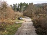
From the parking lot, we continue on the macadam road, which soon brings us to a right turn in the middle of which we notice a signpost for Racna gora. We continue right and the road brings us after a few minutes of walking to its turning point.
Ahead, the road ends, but we continue straight on the marked cart track, which goes into the forest and brings us in a gentle ascent to a junction. We continue on the right cart track, which higher up levels out somewhat and after a while brings us to a well-marked junction, where we leave the cart track. We continue left onto a partly grassy slope, where there are no traces of the mountain path.
Orientation ahead becomes harder, but if we continue straight up the slope we will soon notice blazes, which higher up are more frequent. The steep and barely visible path then brings us higher under rocky cliffs, where it turns left and levels out somewhat. There follows a passage through a small "door", after which the marked path turns right and a little higher joins the cart track, which we follow to the right. After some 10 steps on the cart track, the blazes direct us left onto a footpath, which quickly joins another cart track coming from the end of the forest road that we can see on our right (the road comes from the village of Dolenje Poljane).
We continue on the well-marked cart track, which after a few more minutes brings us to a larger clearing in the middle of which we notice a hunting observatory. The path then continues along the cart track for quite some time, and we follow it to the point where the marked footpath directs us left onto a less trodden path, which a little higher joins the path from the hunting hut Urška. We continue right on the somewhat steeper path, which after a short ascent brings us to the vegetated summit of Racna gora.

Photos:
 1
1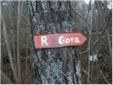 2
2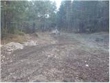 3
3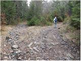 4
4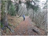 5
5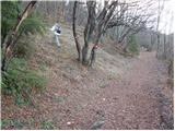 6
6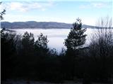 7
7 8
8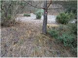 9
9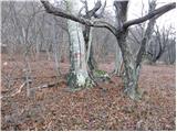 10
10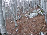 11
11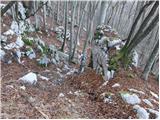 12
12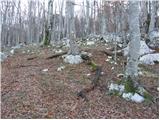 13
13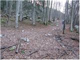 14
14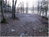 15
15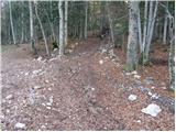 16
16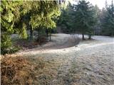 17
17 18
18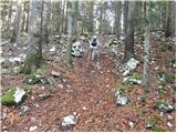 19
19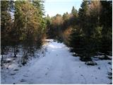 20
20 21
21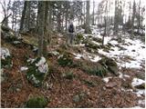 22
22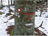 23
23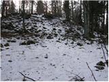 24
24 25
25
Discussion about the trip Vrhnika pri Ložu - Racna gora
|
| fpetel19. 12. 2008 |
Interesting early winter pictures. How to best return via circular path from the hunting hut back to Vrhnika.
Nice regards!
|
|
|
|
| Tadej9. 12. 2008 |
We descended from the hunting lodge along the road into Kočevje Valley and continued along it to the intersection for Knežja Njiva. A little further on, we noticed a cart track that branched off to the left downhill. After a few minutes of descent, we reached the valley. All that followed was a walk through the village to the starting point.
From the hunting lodge to the starting point approx. 1.5h.
|
|
|
|
| navdušena15. 07. 2019 |
Yesterday we were on Racna gora via this path. Quite overgrown (grass), morning dew, recommend good footwear and good trousers. Otherwise the path is well marked, just need to be a bit attentive.
We descended to Dolenje Poljane and continued to Gornje Poljane. We could have gone the circular path, but not this time. It remains for next time!
|
|
|
To post a comment you must log in:
If you do not yet have a username, you must first
register.