Starting point: Vrh Bače (1273 m)
| Latitude/Longitude: | 46,2381°N 13,9804°E |
| |
Walking time: 1 h
Difficulty: easy marked way
Elevation gain: 329 m
Elevation difference along the route: 329 m
Map: TNP 1:50.000
Recommended equipment (summer):
Recommended equipment (winter): ice axe, crampons
Views: 12.230
 | 1 person like this post |
Access to starting point:
A) First, we drive to Bohinjska Bistrica, then we continue driving towards Soriška planina and Tolmin. Before we get to the parking lot below the ski center Soriška planina, i.e. about 400 meters lower, a macadam road branches off to the right, which we follow to its end.
B) From Železniki or Podbrdo, first we drive to Soriška planina, and from there we start descending towards Bohinjska Bistrica. After about 400 meters of descent, we need to pay attention to the left turn-off of the macadam road, because we will continue driving on it. We then follow this road to its end, where we also park.
Route description:
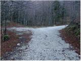
From the parking lot, we walk to the saddle Vrh Bače, where signs for Možic and Šavnik direct us left onto an ascending footpath. The path ahead steeply ascends through the forest for a short time, then brings us to a grassy flat area, where the path temporarily levels out. The path then returns to the forest, where after a short ascent it brings us to an old military bunker that has been converted into some kind of weekend cottage, and the path bypasses it on the right side. A moderately steep path then brings us to the edge of the ridge (here we can in a few steps ascend to a nice vantage point - view on Baška grapa and Kobla) along which we then ascend through more or less dense forest. Higher, the path turns to the left and completely flattens. There follows good 5 minutes of walking, then the path brings us to a larger grassy slope between Šavnik and Slatnik. Here we continue on an easy path that turns to the right and after a few steps brings us to a marked junction.
We continue straight (left Šavnik) and continue the path through the meadow named Na poljani. After a few steps, we bypass an emergency bivouac and a little further we come to a less noticeable junction, where we continue slightly right (slightly left planina za Šavnikom). The marked path then enters the forest, where it begins to ascend relatively steeply. Higher the forest thins, and the path brings us to a smaller saddle between Možic on the left and Slatnik on the right. Here we continue sharply left (right Slatnik and Lajnar) and continue in the direction of Možic. The path ahead continues on an old mule track, which we then follow to the summit of Možic, which we reach after approximately 10 minutes of further walking.

Photos:
 1
1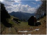 2
2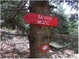 3
3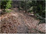 4
4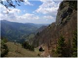 5
5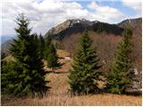 6
6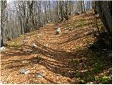 7
7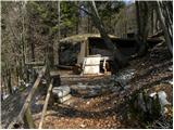 8
8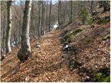 9
9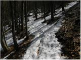 10
10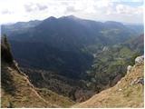 11
11 12
12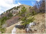 13
13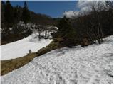 14
14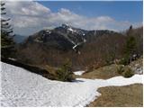 15
15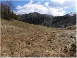 16
16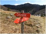 17
17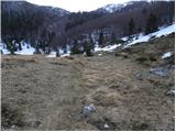 18
18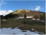 19
19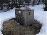 20
20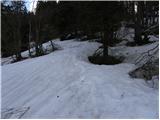 21
21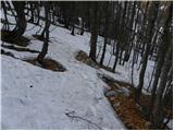 22
22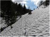 23
23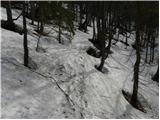 24
24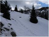 25
25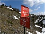 26
26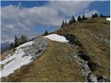 27
27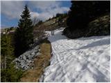 28
28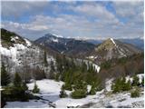 29
29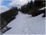 30
30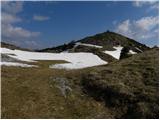 31
31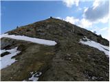 32
32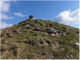 33
33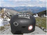 34
34 35
35
Discussion about the trip Vrh Bače - Možic
|
| maks5725. 07. 2021 13:05:18 |
Please, I'd appreciate some tangible instructions on how to find this starting point. Last year my wife and I couldn't find it.
|
|
|
|
| turbo25. 07. 2021 15:23:11 |
If driving from Soriška planina towards Bohinjska Bistrica, the turn-off on the left looks like this:
https://www.google.si/maps/@46.2475728,14.0055057,3a,75y,328.19h,90t/data=!3m7!1e1!3m5!1sPXKbTQXE3jhZv6Dauk-rEg!2e0!6shttps:%2F%2Fstreetviewpixels-pa.googleapis.com%2Fv1%2Fthumbnail%3Fpanoid%3DPXKbTQXE3jhZv6Dauk-rEg%26cb_client%3Dsearch.revgeo_and_fetch.gps%26w%3D96%26h%3D64%26yaw%3D327.8025%26pitch%3D0%26thumbfov%3D100!7i13312!8i6656?hl=sl
If driving from Bohinjska Bistrica upwards, it's on the right, so driveable, and looks like this:
https://www.google.si/maps/@46.2480385,14.0051434,3a,75y,200.23h,100.15t/data=!3m6!1e1!3m4!1sxdwHO26fiyUxzRJpEajEaw!2e0!7i13312!8i6656?hl=sl
|
|
|
|
| Lapuh20725. 07. 2021 17:04:28 |
Then you have to drive along this forest road all the way to the end. About a quarter of an hour. It's not in the best condition, but with a bit of caution you can reach the end with any car. There's a parking lot in the woods there. Left you'll find the path to Možic and Slatnik (as nicely described above), right to Črno prst.
|
|
|
|
| maks5728. 07. 2021 20:34:43 |
Big thanks for the help or answer, turbo and Lapuh207.
On Saturday we'll try again to find that starting point and on the way to vacation in Bohinj climb Šavnik, which is the only one we still miss in the entire Soriska chain. Thanks!
|
|
|
To post a comment you must log in:
If you do not yet have a username, you must first
register.