Starting point: Vrh Bače (1273 m)
| Latitude/Longitude: | 46,2381°N 13,9804°E |
| |
Walking time: 45 min
Difficulty: easy marked way
Elevation gain: 225 m
Elevation difference along the route: 250 m
Map: TNP 1:50.000
Recommended equipment (summer):
Recommended equipment (winter): ice axe, crampons
Views: 13.248
 | 2 people like this post |
Access to starting point:
A) First, we drive to Bohinjska Bistrica, and then we continue driving towards Soriška planina and Tolmin. Before we get to the parking lot below the ski center Soriška planina, i.e., about 400 meters lower, a macadam road branches off to the right, which we follow to its end.
B) From Železniki or Podbrdo, first we drive to Soriška planina, and from there we start descending towards Bohinjska Bistrica. After about 400 meters of descent, we need to pay attention to the left turn-off of the macadam road, because we will continue driving on it. We then follow this road to its end, where we also park.
Route description:
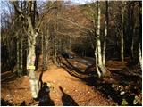
From the end of the road, we continue right in the direction of Črna prst. The path at first runs on a cart track, which quickly turns into a footpath and mostly in a diagonal ascent brings us to the GRS cottage.
The path ahead brings us from the deciduous forest into the coniferous forest, which is becoming thinner. And only a little ahead, the path brings us onto the ridge of Kobla, from which a nice view opens up. Next follows a steep ascent along the ridge, which is on the south side very steep and in wet dangerous for slipping. After a few minutes of ascent along the ridge, the path brings us to the forepeak of Kobla. Here the ridge turns right, and we follow the path, which still runs along the ridge, for approximately 30 m to the highest point of the indistinct summit of Kobla.
Photos:
 1
1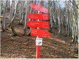 2
2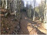 3
3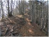 4
4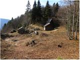 5
5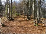 6
6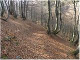 7
7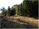 8
8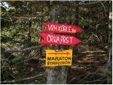 9
9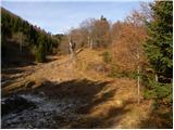 10
10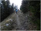 11
11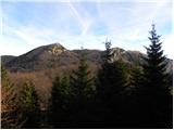 12
12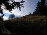 13
13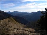 14
14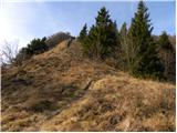 15
15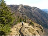 16
16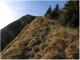 17
17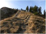 18
18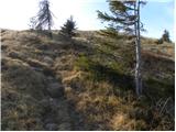 19
19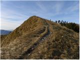 20
20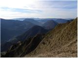 21
21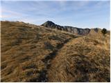 22
22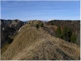 23
23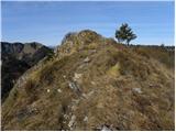 24
24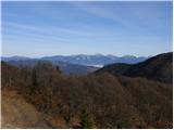 25
25 26
26
Discussion about the trip Vrh Bače - Kobla
|
| PUHIPUHI14. 02. 2017 |
Hello!
I'm interested if anyone knows the condition of the gravel road leading to the start of the mentioned trail. Normally drivable for passenger cars? Thanks, Lp
|
|
|
|
| luka2015. 02. 2017 |
hi.
Do you mean now in winter conditions or in general? For now I don't know, but otherwise it's in fairly good condition, normally drivable for cars, last year I ran from Vrh Bače towards Soriški along this gravel road and it was in very good condition and some cars were parked at Vrh Bače too-
lp,luka
|
|
|
|
| bumbi16. 02. 2017 |
On Saturday, February 11, the road was almost invisible due to considerable snow.
|
|
|
|
| PUHIPUHI16. 02. 2017 |
Apparently we have to wait for spring. Many thanks!
|
|
|
To post a comment you must log in:
If you do not yet have a username, you must first
register.