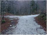
Starting point: Vrh Bače (1273 m)
| Latitude/Longitude: | 46,2381°N 13,9804°E |
| |
Walking time: 3 h 10 min
Difficulty: easy marked way
Elevation gain: 571 m
Elevation difference along the route: 775 m
Map: TNP 1:50.000
Recommended equipment (summer): helmet
Recommended equipment (winter): helmet, ice axe, crampons
Views: 25.818
 | 1 person like this post |
Access to starting point:
A) First, we drive to Bohinjska Bistrica, and then we continue driving towards Soriška planina and Tolmin. Before we get to the parking lot below the ski center Soriška planina, i.e. about 400 meters lower, a macadam road branches off to the right, which we follow to its end.
B) From Železniki or Podbrdo, we first drive to Soriška planina, and from there we begin descending towards Bohinjska Bistrica. After about 400 meters of descent, we need to pay attention to the left turn-off of the macadam road, because we will continue driving on it. We then follow this road to its end, where we also park.
Route description:
From the end of the road, we walk to the mountain signposts, and from there we continue right in the direction of Črna prst. This is followed by a few minutes' ascent through the forest, then the path flattens and brings us to the GRS hut. Further on follows a short descent, and the path from the slopes of Šanc gradually passes to the less vegetated slopes of Kobla. Here we first ascend through a sparse forest, then the path brings us to a slightly exposed ridge, along which we begin to ascend steeply (in wet conditions there is a risk of slipping on some spots). Higher up the ridge flattens, and the path turns right, which after one more minute of walking brings us to the indistinct summit of Kobla.
From Kobla follows a slight descent, then the path continues along a less steep ridge towards the neighbouring Krevl. Towards the summit of Krevl, a marked path branches off a little further to the left in the direction of "Kobla žig", but we continue straight and bypass the summit on the right side, to which there are otherwise only a few 10 steps.
On the other side of Krevl the path begins descending again, this time to the nearby ski slope. When we reach the edge of the ski slope, we notice the signs for Črna prst, which direct us left downwards. This is followed by some more descent, then we arrive at the small swamp Na Kalu, where there is also a less noticeable junction. We continue on the right path (to the left over a small saddle leads an old shepherd path that crosses the southern slopes of the lower Bohinj Mountains, which later joins the path from Podbrdo towards Črna prst), which continues gently descending and a little lower brings us to a marked junction, where the path from the mountain pasture Za Črno goro joins from the right.
At the mentioned junction we continue slightly left, then we begin moderately ascending through the forest. Higher up the trail makes a few long serpentines, then from the increasingly sparse forest or belt of shrubs it brings us to the screes below Rušni vrh. Here the path temporarily flattens, then on the other side of the scree it begins steeply ascending along a grassy gully below the Home ridge. On this section in late spring there is an increased danger of falling rocks. Higher up the gully ends, and the path crosses a short steep slope, where snow can still persist until early summer. Above the steep section we join the path from Orožnova koča, a few meters higher we step onto the ridge, which we reach at the saddle Čez Suho.
Here we continue right and, with views of Baška grapa, Bohinj and the highest peaks of the Julian Alps, in a few minutes we ascend to the Dom na Črni prsti, which is located only a few meters below the summit.
We bypass the Dom Zorka Jelinčiča on the left side and over a short steep slope in a few steps ascend to the panoramic summit.

Photos:
 1
1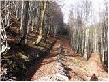 2
2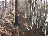 3
3 4
4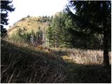 5
5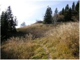 6
6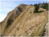 7
7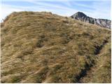 8
8 9
9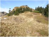 10
10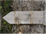 11
11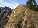 12
12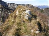 13
13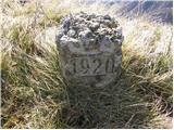 14
14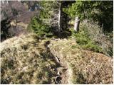 15
15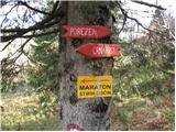 16
16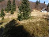 17
17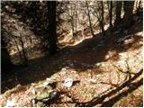 18
18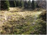 19
19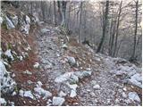 20
20 21
21 22
22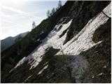 23
23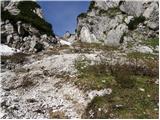 24
24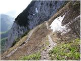 25
25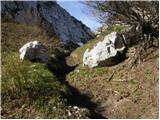 26
26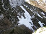 27
27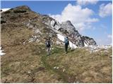 28
28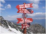 29
29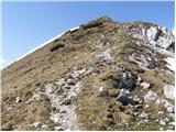 30
30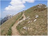 31
31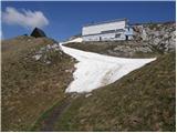 32
32 33
33
Discussion about the trip Vrh Bače - Črna prst
|
| Gost3. 11. 2007 |
And how do I get to the starting point from the coastal side?
|
|
|
|
| Gost4. 11. 2007 |
Via Soriska planina, if the road is impassable then by car train from Podbrd to Bohinjska Bistrica and from there along the described path.
|
|
|
|
| Gost4. 11. 2007 |
From the coast we can drive to Podbrd, then left to the village of Bača and then on foot along the path to Vrh Bače. This way we get to see an interesting village that also has its own little church.
|
|
|
|
| Gost6. 11. 2007 |
Thanks! If it's nice, we'll go on Sunday via this path to Črna prst.

|
|
|
|
| mavrinc22. 08. 2016 |
Am I imagining, or is some description missing? As I know terrain, from ski resort parking to Vrh Bače quite a walk, or not that parking at ski resort.
|
|
|
|
| Tadej22. 08. 2016 |
Thanks for warning. Access description to starting point was wrong. Park at end of road near Vrh Bače saddle, not at parking under Soriska planina.
|
|
|
|
| mlostr8. 09. 2020 |
I would really like to go on this path to Črna prst. I tried a few years ago but couldn't find that junction under Soriska planina. Is it marked now perhaps?
|
|
|
|
| Janez Seliškar8. 09. 2020 |
A forest road leads to the starting point at the saddle Vrh Bače and only at this saddle do we step onto the marked mountain trail.
|
|
|
|
| pikica18. 09. 2020 |
Hi, when I wanted to go from here to ČP in July or August, I didn't reach the end of the road. There were forestry machines on the road and a cable across the road. I then turned around and went back. There was a sign at the start of the road that it was closed but I deliberately ignored it  I don't know how it is at this time, if the sign is still there on the ground, the road is probably still not passable. Lp. I don't know how it is at this time, if the sign is still there on the ground, the road is probably still not passable. Lp.
|
|
|
|
| mlostr9. 09. 2020 |
Thanks, so there is a junction from the main road, I didn't find it.
|
|
|
|
| edoo13. 09. 2020 |
About a kilometer from Litostrojska koča on Soriska planina towards B. Bistrica, a gravel forest road branches sharply left leading to the saddle Vrh Bače, 4 km of solid gravel.
|
|
|
|
| MateZ22. 09. 2020 |
On Sunday, the forest road was all good again. But I wouldn't even rate it as "solid", more like "barely passable". Watch your undercarriage or better choose the tour from Petrovo Brdo. 
|
|
|
To post a comment you must log in:
If you do not yet have a username, you must first
register.