Vonarje - Sveta Ema (Emina tematska pot)
Starting point: Vonarje (203 m)
| Latitude/Longitude: | 46,18583°N 15,60376°E |
| |
Route name: Emina tematska pot
Walking time: 25 min
Difficulty: easy marked way
Elevation gain: 141 m
Elevation difference along the route: 141 m
Map:
Recommended equipment (summer):
Recommended equipment (winter):
Views: 123
 | 1 person like this post |
Access to starting point:
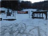
a) Drive to Mestinje, then follow the signs to Podčetrtek; at the end of the settlement Pristava pri Mestinju, cross Nezbiški potok, after which at a small intersection where the road to Eco vili Mila branches off to the left, the described trail begins. At the starting point, there is a small parking lot next to the information boards, where we park.
b) Drive to Brežice, then follow the road towards the settlements Bizeljsko, Bistrica ob Sotli, Podčetrtek and Celje. When Podčetrtek ends, first cross Mestinjščica, a little further the railway track. A short drive along the railway follows, then we arrive at a small intersection where the road to Eco vili Mila branches off to the right. Turn right here and park in the small parking lot at the intersection, where Emina tematska pot also begins.
Route description:
From the starting point, head southeast, ascending along the right side of nearby houses to the edge of the forest. This is followed by a traverse ascent along the forest edge, accompanied by fairly frequent educational panels of Emina tematska pot. Higher up, the trail leads through the forest; upon leaving the forest, traverse up to nearby houses, following the signs of Emina tematska pot at several intersections.
The ascent continues past the cemetery with increasingly beautiful views reaching towards Boč, Donačka gora, Silavec and other hills, quickly arriving at the church of St. Emma.
The description and photos refer to the condition in January 2026.
Photos:
 1
1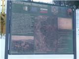 2
2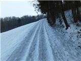 3
3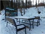 4
4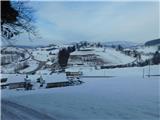 5
5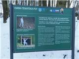 6
6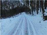 7
7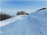 8
8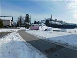 9
9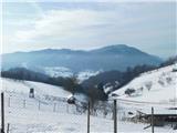 10
10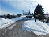 11
11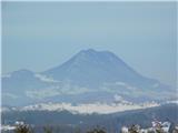 12
12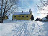 13
13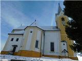 14
14
Discussion about the trip Vonarje - Sveta Ema (Emina tematska pot)
To post a comment you must log in:
If you do not yet have a username, you must first
register.