Volčji Potok - Castle Stari grad (Volčji Potok) (steep path)
Starting point: Volčji Potok (338 m)
| Latitude/Longitude: | 46,1848°N 14,6064°E |
| |
Route name: steep path
Walking time: 20 min
Difficulty: easy unmarked way
Elevation gain: 60 m
Elevation difference along the route: 60 m
Map:
Recommended equipment (summer):
Recommended equipment (winter):
Views: 969
 | 2 people like this post |
Access to starting point:
A) From the Ljubljana–Maribor highway, take the Domžale exit, then continue driving towards the settlement of Vir and Arboretum Volčji Potok. We then follow the signs for Volčji Potok, driving through Količevo, Škrjančevo, Radomlje and Hudo, then arrive at the settlement Volčji Potok, where we park on the large parking lot next to Arboretum Volčji Potok.
B) From Mengeš or Domžale, drive to Radomlje, from there follow the signs for Volčji Potok. When we arrive in Volčji Potok, park on the large parking lot next to Arboretum Volčji Potok.
C) From the Ljubljana–Jesenice highway, take the Vodice exit, then continue driving towards Kamnik. After Qlandia Kamnik, first cross the Kamniška Bistrica river, then arrive at a roundabout, where continue right towards Volčji Potok. When we arrive in Volčji Potok, park on the large parking lot next to Arboretum Volčji Potok.
D) From Gornji Grad or Luče, drive to Kamnik, then along the Kamnik bypass to the roundabout, from where continue driving towards Volčji Potok. When we arrive in Volčji Potok, park on the large parking lot next to Arboretum Volčji Potok.
Route description:
From the parking lot, first walk to the ticket office, where we buy tickets, then enter the Arboretum Volčji Potok park. Initially, walk straight along the wider walking path that leads along the stream, from which views open up of the landscaped park and part of the Kamnik Savinja Alps. Further on, there are several junctions; past the French Garden we walk to the summer café. From the summer café, go slightly left, then notice on the right an unmarked branch of a poorly trodden path that starts to ascend. Initially, we still ascend along a well-maintained path, then the path turns into a forest trail, along which in a few minutes we climb to the 398-meter-high peak, on which are the renovated ruins of Stari grad.
Description and pictures refer to the condition in 2016 (August).
Photos:
 1
1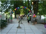 2
2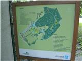 3
3 4
4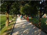 5
5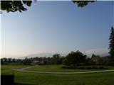 6
6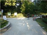 7
7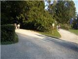 8
8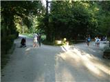 9
9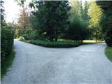 10
10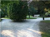 11
11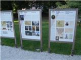 12
12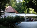 13
13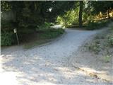 14
14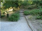 15
15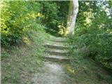 16
16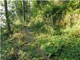 17
17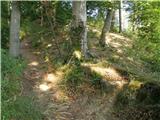 18
18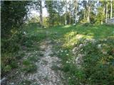 19
19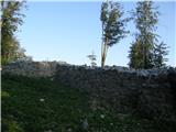 20
20 21
21
Discussion about the trip Volčji Potok - Castle Stari grad (Volčji Potok) (steep path)
To post a comment you must log in:
If you do not yet have a username, you must first
register.