Starting point: Volče (215 m)
| Latitude/Longitude: | 46,1712°N 13,7086°E |
| |
Walking time: 40 min
Difficulty: easy unmarked way
Elevation gain: 238 m
Elevation difference along the route: 238 m
Map: Julijske Alpe - zahodni del 1:50.000
Recommended equipment (summer):
Recommended equipment (winter):
Views: 14.297
 | 2 people like this post |
Access to starting point:
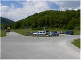
A) First, we drive to Nova Gorica, and then we continue driving towards Bovec. Only a little after the village Čiginj we turn right towards the nearby factory, and at the first crossroad we turn left on a side road which ends at the nearby NOB monument. We park by the mentioned road (on the nearby arranged parking lot the parking is allowed only to employees).
B) From central Slovenia we drive to Tolmin, and then we continue driving towards Bovec. When we get to a roundabout, we leave the road which leads towards Bovec and we continue driving in the direction of Nova Gorica (to the mentioned roundabout we can come also from the direction of Bovec). Above the village Volče, more precisely only a few tens of meters after the NOB monument, we leave the main road and we continue left towards the nearby factory. At the smaller crossroad in front of the factory we turn left on a dead-end street, which ends by the earlier mentioned monument.
Route description:
Near the NOB monument, we will notice signs for Mengore, which point us to a footpath which quickly enters the forest. Along the path, which at first ascends through a belt of bushes, we will soon notice the first of fourteen chapels (Way of the Cross to Mengore).
At the second chapel we arrive at a smaller junction, where to the left branches the path to Brce, and we continue straight on the lower path, along which the Stations of the Cross continue. Higher up, the path begins to ascend more steeply and leads us past an old military cavern, then brings us to a wider cart track, which we follow to the right. When we step onto the cart track we first descend a little, then the path past a chasm and a smaller cavern brings us to the outdoor museum, where there is also a logbook box.
From the information boards and memorial plaques we continue along the wider cart track, which a little higher is crossed by an unmarked path from the saddle Poljance. We continue straight and past two more Stations of the Cross quickly arrive at Mengore.

Photos:
 1
1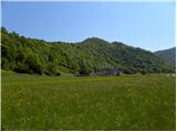 2
2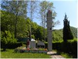 3
3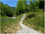 4
4 5
5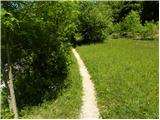 6
6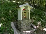 7
7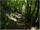 8
8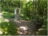 9
9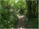 10
10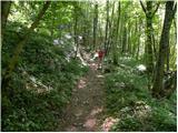 11
11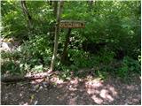 12
12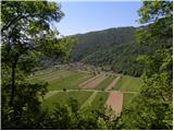 13
13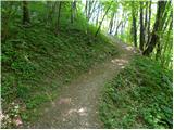 14
14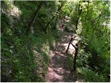 15
15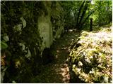 16
16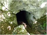 17
17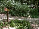 18
18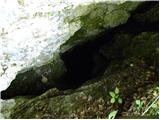 19
19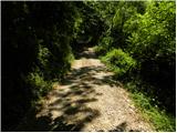 20
20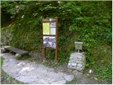 21
21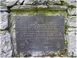 22
22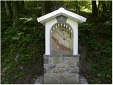 23
23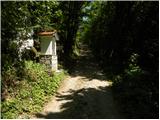 24
24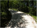 25
25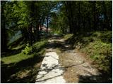 26
26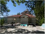 27
27 28
28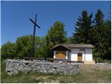 29
29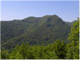 30
30
Discussion about the trip Volče - Mengore
|
| Lj17. 05. 2011 |
We visited Mengore last year during vacation in Drežniške ravne. I must say, I have never seen such beautiful stations of the cross, real works of art!
|
|
|
|
| sPolonca17. 05. 2011 |
You can read more about the mosaics here http://www.centroaletti.com/slo/opere/slovenia/60.htm They are the work of Fr. Marko Ivan Rupnik and other artists from the Aletti Center in Rome. The trail description doesn't mention anywhere who the author of these artworks is, but they are already visible in the photos below.
|
|
|
|
| Lj18. 05. 2011 |
Polonca, thanks for the interesting link.
LpLj
|
|
|
|
| Stolar19. 05. 2011 |
I don't know these areas very well, will have to go check it out sometime. Looks nice
|
|
|
To post a comment you must log in:
If you do not yet have a username, you must first
register.