Vitovlje - Vitovski hrib (west path)
Starting point: Vitovlje (360 m)
| Latitude/Longitude: | 45,9342°N 13,7695°E |
| |
Route name: west path
Walking time: 40 min
Difficulty: easy marked way
Elevation gain: 244 m
Elevation difference along the route: 250 m
Map: Goriška - izletniška karta 1:50.000
Recommended equipment (summer):
Recommended equipment (winter): crampons
Views: 10.797
 | 3 people like this post |
Access to starting point:
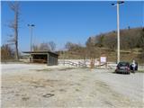
A) From the highway Vipava - Nova Gorica, we take the exit Selo, then continue driving on the regional road towards Nova Gorica and Šempas. After a few kilometers of driving, we arrive at the village Vitovlje, where we turn right in the direction of the farm Maloščevo. A little further, the road splits into two parts (Vitovska circular path), and we continue right, and in the next crossroads, we stick to the left directions. The relatively steep road leads us higher through the hamlet Vožice, where it turns a little more to the left. From the hamlet we drive for a short time, and then we arrive at a large event venue and sports field in Vitovlje, where we park.
B) From Nova Gorica, we drive to Šempas, and from there we continue driving on the old road towards Ajdovščina. When we arrive at the village Vitovlje, we turn left in the direction of the farm Maloščevo. A little further, the road splits into two parts (Vitovska circular path), and we continue right, and in the next crossroads, we stick to the left directions. The relatively steep road leads us higher through the hamlet Vožice, where it turns a little more to the left. From the hamlet we drive for a short time, and then we arrive at a large event venue and sports field in Vitovlje, where we park.
Route description:
From the parking lot, we first walk to the asphalt road and continue left along it. After a minute or two we arrive at a marked junction, where we continue right in the direction of the Vitovska church and Vitovsko Lake.
From the junction, we continue on a rough macadam road which quickly enters the forest, through which we ascend gently to moderately. Not much time passes and we already arrive at the next well-marked junction, where we leave the rougher road and continue the ascent left in the direction of the Vitovska church (straight ahead the path past Vitovsko Lake). We continue on a gentle path, which crosses slopes towards the left, and it even slightly descends further. When the short descent ends, we continue right (straight we arrive in Vitovlje on one of several paths) on a gradually steeper path. The path which runs through the forest leads us past a smaller stone chapel, where it temporarily entirely flattens. A short moderate ascent follows, then we join a wider path, which we follow to the right, and we quickly ascend to a viewpoint right below Vitovski hrib. Here we continue left and in a few steps we ascend to the nearby Vitovska church.

Photos:
 1
1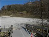 2
2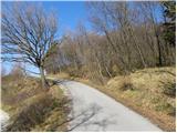 3
3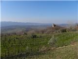 4
4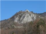 5
5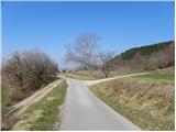 6
6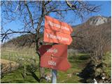 7
7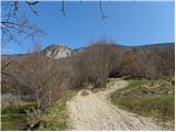 8
8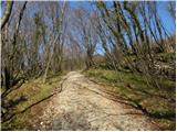 9
9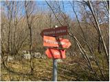 10
10 11
11 12
12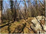 13
13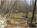 14
14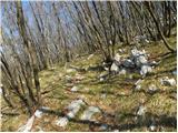 15
15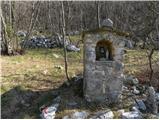 16
16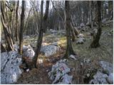 17
17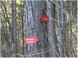 18
18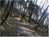 19
19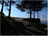 20
20 21
21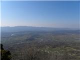 22
22 23
23
Discussion about the trip Vitovlje - Vitovski hrib (west path)
|
| grega_p24. 02. 2021 |
Beautiful path, quite steep in the middle section, which in these warm days due to the southern exposure brings real summer.
Due to the cooler sea than the air, there was a lot of moisture in the air, so visibility was barely to Trstelj. Typical for this time of year.
Otherwise, the church with ideal sunny location, on the descent to the east a lake and next to it a refreshing spring and a bit lower a beautiful clearing with old chestnuts. Recommended!
Correction and note - the settlement (hamlet) is called Užiče, parking is also at the fork (picture no. 6) - for approx. 4 cars
|
|
|
To post a comment you must log in:
If you do not yet have a username, you must first
register.