Starting point: Vitanje (452 m)
Walking time: 1 h 50 min
Difficulty: easy marked way
Elevation gain: 639 m
Elevation difference along the route: 650 m
Map: Pohorje 1:50.000
Recommended equipment (summer):
Recommended equipment (winter): ice axe, crampons
Views: 11.960
 | 1 person like this post |
Access to starting point:
A) From the Ljubljana - Maribor highway, take the Celje - center exit and continue driving towards Vojnik. In Vojnik, continue left towards Dobrna, and follow the mentioned road to the settlement Nova Cerkev, where signs for Vitanje direct us to the right. Further on, drive on a narrower and winding road, by which we arrive in the settlement Vitanje. Park in an appropriate place somewhere in the center of the settlement.
B) From the Maribor - Ljubljana highway, take the Slovenske Konjice exit, then follow the road towards the mentioned settlement. From Slovenske Konjice, continue driving on the regional road towards Celje, and follow it to the settlement Stranice, where at the roundabout we turn right towards Vitanje. Follow the road to the mentioned settlement, where somewhere in the center of the settlement we park in an appropriate place.
C) From the Velenje - Slovenj Gradec road, at the settlement Gornji Dolič turn right (if coming from the direction of Slovenj Gradec, then left) towards Vitanje. When we arrive in the mentioned settlement, park in an appropriate place in the center of the settlement.
Route description:
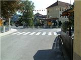
From the place where we have parked, we first walk to the main intersection in Vitanje, from there we continue along the main road towards Slovenske Konjice. Along the main road we walk a few hundred meters, then a signpost directs us right downhill to the nearby small bridge. After the small bridge, we climb the road past the kindergarten to Cvetlična ulica. When we climb along it to the intersection with Štajnhof street, we continue left, and we climb the road to the last house, which is located in the immediate vicinity of the sharp left bend. At the end of the bend, a macadam road branches off to the right, and we walk on it only 2 meters, then continue left into the forest (possible by car to here).
We continue on the marked path, which begins to ascend steeply through the forest. Higher up, the path becomes even steeper, then it brings us to a viewpoint with a bench, where it flattens. Further on, the path leads past a prefab house, and higher, when the forest ends, also past the Vodovnik farm. Here the markings temporarily end, and we continue across the yard of the mentioned farm and then along the forest road back into the forest. We continue along the road for about a minute, then a narrower path branches off to the right, along which we continue the ascent. Further on, we ascend somewhat more steeply through the forest again, and the steepness eases somewhat higher when we reach the next forest road, which is usually quite muddy. We continue along the road, which at the next intersection we follow left, then after a few minutes right. Now we walk along the forest road, which runs parallel to a wide cart track. When the forest thins out, the markings disappear again, and we arrive at a very wide and well-maintained road, which we just cross. We continue along the serpentine path, which leads us through low forest and ferns. Higher up, the path returns to the forest, and ahead of us is the last steep section. For some time we ascend steeply, then before reaching the ridge, where a short path branches off to the nearby viewpoint. When we reach the ridge, the path flattens, from there a path branches off to the Marijina roka shrine. From the junction, another 5 minutes of walking follow, and we arrive at the top of Stenica.

Photos:
 1
1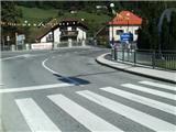 2
2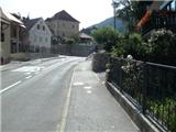 3
3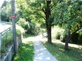 4
4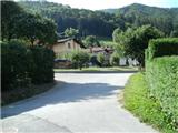 5
5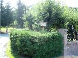 6
6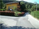 7
7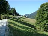 8
8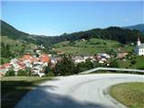 9
9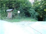 10
10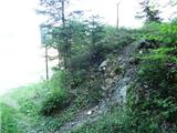 11
11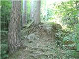 12
12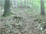 13
13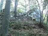 14
14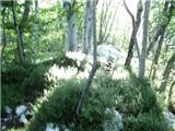 15
15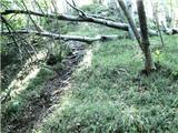 16
16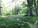 17
17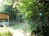 18
18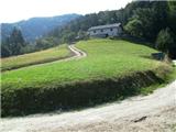 19
19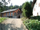 20
20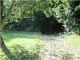 21
21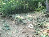 22
22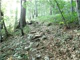 23
23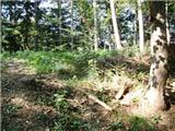 24
24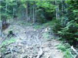 25
25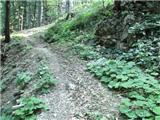 26
26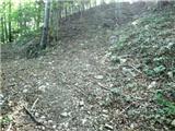 27
27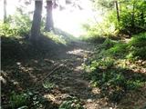 28
28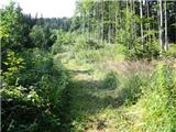 29
29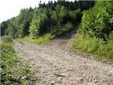 30
30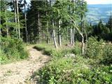 31
31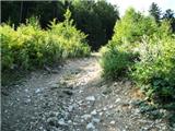 32
32 33
33 34
34 35
35 36
36
Discussion about the trip Vitanje - Stenica
|
| Marx9. 02. 2014 |
I was again on Mali gori / Stenica. A new path variant has been made - now on picture 19 we no longer go all the way through the Vodovnik farm, but continue north on the forest road. When we reach the forest, after a couple of minutes we go sharply left at the junction upwards. When we spot the farm we go sharply right into the forest and will see the markings there. We return to the described path around picture 24. It seems to me this variant lengthens the path by about five minutes.
|
|
|
|
| giovannixyz23. 08. 2015 |
As a new mountaineer  I can say that the path is very poorly marked in places. I can say that the path is very poorly marked in places.
elsewhere excellent, almost every 10m markers.
The path is great and I recommend it
|
|
|
|
| Fulcrum2. 01. 2016 |
The path to Stenica is now well marked and slightly changed, as it completely avoids the Vodovnik farm. When we pass the weekend house (pic. 18) to the road (pic. 19) we go right on the gravel road, which soon turns sharply left. We walk a few hundred meters along the road until the signpost directs us right onto the marked path.
|
|
|
|
| pohodnik3819. 02. 2017 |
Since Stenica doesn't have its own place in the conditions topic, I'll post here. Yesterday I walked this path which is quite well marked in the settlement, a bit less but still traceable. The path has no special features.
PICTURES and personal impressions from the path
Regards! Tone
|
|
|
|
| VanSims26. 02. 2024 15:04:59 |
The trail from photo 10 (sign) - 17 (viewpoint) on descent in wet conditions (as it was yesterday) can be very dangerous.
An alternative descent offers itself. From the top of the viewpoint, after about 10 meters, we descend back to a small saddle and from there continue left and descend along a comfortable cart track that goes down to the road, where we go left again and after about 10 minutes we reach photo 10 again.
|
|
|
|
| plaNinaPirsMajcen23. 01. 2026 22:18:08 |
Hi,
Stenica a few days ago:
https://youtu.be/-9r1AxcM8Qc?si=cV-6bnb1hMWpGXOj
We went up along the Jez stream valley on the botanical thematic path, marked with the Vitanje flag.
We descended on the marked path.
The summit is worth a visit, as the trees are cut and offer nice views.
Best, Nina
|
|
|
|
| aonuk124. 01. 2026 17:27:56 |
This is not the top of Stenica.
|
|
|
|
| nejcf25. 01. 2026 17:47:31 |
aonuk1 obviously you haven't been up there for a while
|
|
|
|
| Trobec26. 01. 2026 15:03:57 |
Of course it's the top of Stenica, there's even a new bench and table from last year, which has already been the target of reports.
P.s., the trees were not (intentionally) cut down, the storm did its work.
|
|
|
To post a comment you must log in:
If you do not yet have a username, you must first
register.