Starting point: Vitanje (452 m)
| Latitude/Longitude: | 46,3811°N 15,2939°E |
| |
Walking time: 25 min
Difficulty: easy unmarked way
Elevation gain: 97 m
Elevation difference along the route: 97 m
Map:
Recommended equipment (summer):
Recommended equipment (winter):
Views: 3.206
 | 2 people like this post |
Access to starting point:
A) From highway Ljubljana - Maribor we go to the exit Celje - center and we continue driving towards Vojnik. In Vojnik we continue left towards Dobrna, and we follow the mentioned road to the settlement Nova Cerkev, where signs for Vitanje point us to the right. Further, we drive on a narrower and winding road, on which we get to the settlement Vitanje. We park in the settlement at an appropriate place (suggestion - park at KSEVT and visit this unique institution).
B) From highway Maribor - Ljubljana we go to the exit Slovenske Konjice, and then we follow the road towards the mentioned settlement. From Slovenske Konjice we continue driving on a regional road towards Celje, and we follow it to the settlement Stranice, where at the roundabout, we turn right towards Vitanje. We follow the road to the mentioned settlement, where in the settlement we park at an appropriate place.
C) From the road Velenje - Mislinja at settlement Gornji Dolič we turn in the direction of Slovenske Konjice and we drive to the settlement Vitanje. In the settlement, we park at an appropriate place.
Route description:
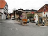
In Vitanje we look for municipality building (picture 1), which is located a little after the bridge over Hudinja. There a sign (2) directs us along the street ahead towards Krajnikov grad. After 150 meters we come to the chapel (3), where we turn left, immediately behind the farm again left (4). The path starts ascending (5) and we soon come to a crossing (6), where we turn right. If we want a nice view towards Vitanje, at the crossing we turn left and after 10 meters a nice view opens up on the settlement (7).
After further ascent we get to new crossing (8), where we turn left. The path soon comes to fenced area (10), and we a few meters before turn right uphill among branches (11). The path a little steeper ascends (12) and it turns left, where by the ruins (13) we get to the castle Krajnikov grad (14).
Photos:
 1
1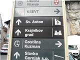 2
2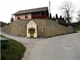 3
3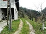 4
4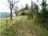 5
5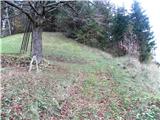 6
6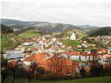 7
7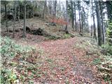 8
8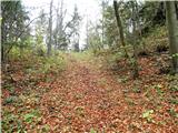 9
9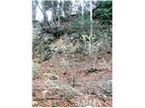 10
10 11
11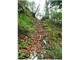 12
12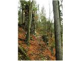 13
13 14
14
Discussion about the trip Vitanje - Krajnik Castle
To post a comment you must log in:
If you do not yet have a username, you must first
register.