Vikrče - Šmarna gora (Kovačeva steza)
Starting point: Vikrče (320 m)
| Latitude/Longitude: | 46,1285°N 14,4446°E |
| |
Route name: Kovačeva steza
Walking time: 1 h 10 min
Difficulty: easy marked way
Elevation gain: 349 m
Elevation difference along the route: 360 m
Map: Ljubljana - okolica 1:50.000
Recommended equipment (summer):
Recommended equipment (winter): crampons
Views: 7.899
 | 1 person like this post |
Access to starting point:
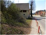
A) From the highway Ljubljana - Jesenice we go to the exit Ljubljana - Šmartno, and then we continue driving towards Tacen. In Tacen just before the road over the bridge crosses the river Sava we continue slightly right in the direction of Pirniče. Only a little after Ljubljana ends, we get to Vikrče, and we follow the road to the inn Kovač, which is located right next to the bus stop. At the starting point, there are no appropriate parking spots.
B) From Šentvid we drive to Tacen, and there immediately after the bridge over the river Sava left towards Pirniče. Only a little after Ljubljana ends, we get to Vikrče, and we follow the road to the inn Kovač, which is located right next to the bus stop. At the starting point, there are no appropriate parking spots.
C) From Medvode we drive to Zgornje and then to Spodnje Pirniče, and we follow the road towards Tacen. When we get to Vikrče, we join the road which leads from Smlednik towards Tacen, and here we continue right and follow the road to the nearby inn Kovač, where there is the starting point of our path. At the starting point, there are no appropriate parking spots.
D) To the starting point we can also arrive by LPP bus number 15.
Route description:
Behind the inn Kovač we continue right into the forest, where we immediately get to a crossing of two marked paths. We choose the left path with signs Kovačeva steza (slightly right Westrova pot), and it starts ascending diagonally towards the left. After a short ascent Učna pot branches off slightly to the left, and we continue slightly right on the Kovačeva steza. Higher, the path flattens and turns a little to the left and then back right, where it gradually passes into a smaller erosion ditch. There follows a short steeper ascent, and then we step on a cart track, where we continue left (right Grmada - path, which joins the Westrova pot).
There follows a short crossing and the path brings us to a poorer road which leads towards the saddle Sedlo pod vrhom Šmarne gore. Higher, the road brings us out of the forest on panoramic slopes. With a view on the summit of Šmarna gora and Kamniško Savinjske Alpe we quickly get to the homestead Gorjanc, from which follows a short walk to the marked crossing Na Sedlu.
Here we continue left still on the road, and it soon splits into two parts. We can continue the ascent on the road, in this case we get to the summit past the wish bell, or we continue right on a marked footpath which past the chapel of sv. Sobota also brings us to the summit of Šmarna gora.

Along the route: Na Sedlu (580m)
Photos:
 1
1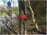 2
2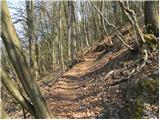 3
3 4
4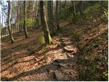 5
5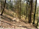 6
6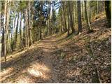 7
7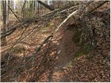 8
8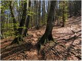 9
9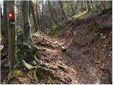 10
10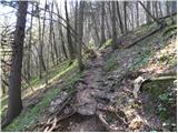 11
11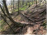 12
12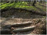 13
13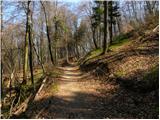 14
14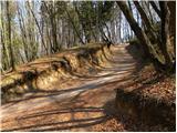 15
15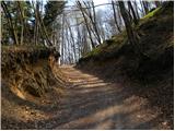 16
16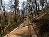 17
17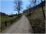 18
18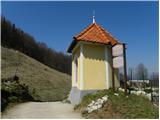 19
19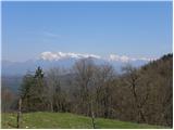 20
20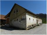 21
21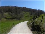 22
22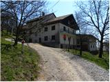 23
23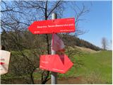 24
24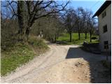 25
25 26
26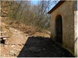 27
27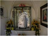 28
28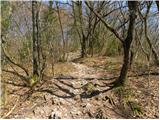 29
29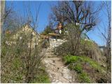 30
30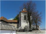 31
31 32
32
Discussion about the trip Vikrče - Šmarna gora (Kovačeva steza)
|
| francimedved20. 04. 2013 |
On this path we fixed some steps, so the approach is now a bit easier.
|
|
|
|
| tinky22. 04. 2013 |
I was curious what was renovated, but it's nothing much. Four steps at the bottom and three renewed at the top. Fallen trees still obstruct the trail. Another one up with a motorbike.
|
|
|
|
| francimedved22. 04. 2013 |
Tinky, of course no issue, thanks for the notice about fallen trees, we'll fix it.
|
|
|
|
| tinky22. 04. 2013 |
I think the biggest problem of Kovačeva, Westrova, Mazijeva, Čez Peske and also Pogačnikova is parking.
|
|
|
|
| francimedved22. 04. 2013 |
Yes I know parking is a problem. The parking space for Šmarna gora visitors is at disco Lipa, but what when you have to pay I think one euro. There is also parking space for buses. From that parking space it's not far to the starting point of all mentioned paths.
|
|
|
|
| tinky22. 04. 2013 |
They say it's 1.5 euros per hour. If you chat a little at the top, you won't get down in one hour. I won't give them 3 euros though.
|
|
|
|
| jax22. 04. 2013 |
Free parking however is at the church or Mercator in Pirniče. Then you have to walk a couple minutes on asphalt, but that's how it is.
|
|
|
|
| francimedved22. 04. 2013 |
Tinky, you're right I wouldn't give it to them either. Lucky that I live right below Šmarna gora and don't have these problems. Free parking (don't know how much time anymore) is also at the bridge near gostilna Košir, only there it's hard to find space.
|
|
|
|
| Enka22. 04. 2013 |
Anya, where are those tennis courts?
|
|
|
|
| francimedved22. 04. 2013 |
I think it's this one. On the map find and type,
Novi šrc Šturmova 13
|
|
|
|
| Enka23. 04. 2013 |
Aha found it, thanks francimedved.
|
|
|
To post a comment you must log in:
If you do not yet have a username, you must first
register.