Vgriz / Ogris - Ogrisalm/Vgrizeva planina
Starting point: Vgriz / Ogris (1180 m)
Walking time: 1 h 15 min
Difficulty: easy marked way
Elevation gain: 389 m
Elevation difference along the route: 389 m
Map: Karavanke - osrednji del 1:50.000
Recommended equipment (summer):
Recommended equipment (winter): ice axe, crampons
Views: 5.261
 | 1 person like this post |
Access to starting point:
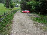
We drive to the border crossing Ljubelj and continue on the Austrian side. Soon after that, when we notice a smaller church on the left side of the road, the road towards the village Poden / Bodental branches off to the left. At the crossroad past the village Slovenji Plajberk / Windisch Bleiberg we turn left towards Poden / Bodental. In Poden / Bodental we come to mountain signposts for Celovško koča / Klagenfurter Hütte left and right. We head right and follow the road ahead to the next crossroad, where we turn left. We follow this road to a smaller parking lot, where the unmarked path from the inn Podnar / Bodenbauer joins (further driving is forbidden).
Route description:
From the parking lot, we continue past the gate on a road which in the initial part offers quite a nice view. The road then goes into the forest and brings us to a crossing, where we turn left onto a cart track. We follow the cart track ahead slightly upwards to a crossing of two cart tracks. We go onto the slightly right-marked cart track, which then starts to change into a footpath that starts to ascend more steeply. The path brings us after a shorter ascent onto a ridge, where the path turns left and continues first still on the ridge and then along the ridge. The path then transitions to steep slopes which we cross without major ascents. Further, we cross a shorter partly already overgrown scree after which the path again starts to ascend and soon brings us to the grazing fence of the mountain pasture Vgriz which we reach in a few minutes of additional walking. On the mountain pasture, where a shepherd's hut stands, a beautiful view opens up.
Photos:
 1
1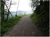 2
2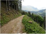 3
3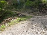 4
4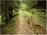 5
5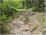 6
6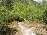 7
7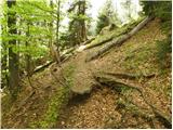 8
8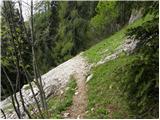 9
9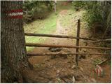 10
10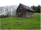 11
11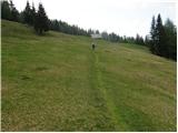 12
12
Discussion about the trip Vgriz / Ogris - Ogrisalm/Vgrizeva planina
|
| Gost16. 05. 2007 |
I have this excursion planned again for the end of the month, but I'm a bit surprised by the names used here. The word "Vgriz" is indeed written on our Karavanke map, but it sounds somewhat unnatural to me. In Austrian maps, this surname and place name doesn't exist, instead it's written Ogris (e.g. Ogrisalm - Ogrisova planina). (My club's invitation for the excursion also invites to Ogrisova planina). Conversely, only the German term for Podnarja (Bodenbauer) is used here, which is completely domesticated and used by us, the same goes for Celovška koča (Klagenfurthütte). In my opinion, for path descriptions in foreign-language areas, it would be best to write each place name in the language of the local residents and in Slovenian (for border places in Austria and Italy that also have Slovenian names).
|
|
|
|
| Lunca9. 05. 2018 |
How do I find the path from this alpine pasture to Kosmatico? Thanks for the answers, LP
|
|
|
To post a comment you must log in:
If you do not yet have a username, you must first
register.