Starting point: Vas na Skali (980 m)
| Latitude/Longitude: | 46,3404°N 13,7097°E |
| |
Walking time: 3 h 30 min
Difficulty: easy unmarked way
Elevation gain: 895 m
Elevation difference along the route: 910 m
Map: TNP 1:50.000, Trenta 1:25.000
Recommended equipment (summer):
Recommended equipment (winter): ice axe, crampons
Views: 33.497
 | 3 people like this post |
Access to starting point:
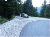
From Bovec, we drive towards Trenta or vice versa. At the village Soča, more precisely at the spot where signs for the tourist farm Jelinčič direct us to the right (from the direction of Trenta - left), we leave the main road and continue driving on a narrower but asphalted road. The road ascends further through the dispersed settlement Vrsnik and brings us higher to the starting point of the path for the ascent to the mountain pasture Za skalo. We continue further on the occasionally quite steep road, which brings us higher to a sharp left turn, in the middle of which a road closed by a ramp branches off to the right. We park on the parking lot, which is located right next to the mentioned junction.
Route description:
From the parking lot, we head onto the right road, which is closed to public traffic with a traffic sign and ramp. The road first ascends gently through the forest, then approaches the Suhi potok stream very closely (here, if we step a little off the path to the nearby footbridge, we can view a smaller waterfall, or rapids of the mentioned stream). The road then ascends somewhat more steeply through two successive serpentines, then turns more to the right, where we first cross the Suhi potok over a bridge, then a cart track branches off to the right downwards to the nearby holiday cottage. We follow the macadam road only for another 10 m, then on the left side we notice a cairn, which directs us onto an unmarked but easily followable footpath. The path ahead ascends through the forest and higher crosses a shrub-covered slope (Plazič), from which a nice view opens onto Bavški Grintavec. The path immediately returns into the forest and a little further only crosses a forest road. The path ahead ascends gently along an initially indistinct small valley, then withdraws left into the forest, where it again starts to ascend more steeply. Here we will hear the roaring of the nearby waterfall on the right side, we continue on the pleasant forest path, which higher again crosses a forest road (this time it is not the same road). We continue on a somewhat more overgrown path for a short time, which turns a little to the right and quickly brings us to the end of the nearby cart track. Along the mentioned cart track we walk to the nearby road, we walk on it only a few steps, then on the left side we notice the continuation of the forest footpath. Further we ascend along the mentioned path, then we come out of the forest, where we step onto the lower edge of the mountain pasture in Plazeh. Here we continue right to the nearby hunting observatory, where we again step onto a poorer road.
We continue towards the east (left across the meadow in 5 minutes we arrive at the TNP cottage on the mountain pasture in Plazeh) along the poorer road, which crosses the slopes in the already mentioned direction. We follow the mentioned road for approximately 5 minutes, then on the left side we will notice an initially poorly visible footpath, which for a short time ascends parallel to the mentioned road (cart track), then passes into the forest, where it continues along an old military mule track. On some somewhat more overgrown parts of the path, higher it starts to ascend more steeply and gradually brings us out of the forest onto increasingly panoramic slopes. Higher the path turns to the right and ascends transversely across a somewhat steeper slope. The path, from which increasingly beautiful views open onto the ridge of Špičja, quickly brings us to the saddle Čez Drt, where the path from Trenta or Trebiški dol joins us.
We continue left and along a somewhat steeper path in 10 minutes of further walking we step onto the panoramic Čisti vrh.

Photos:
 1
1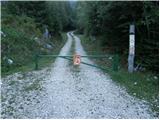 2
2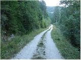 3
3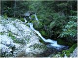 4
4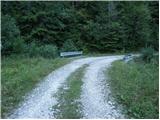 5
5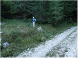 6
6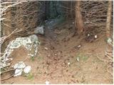 7
7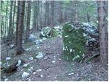 8
8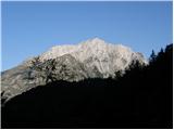 9
9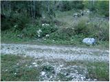 10
10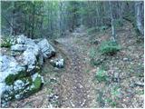 11
11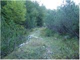 12
12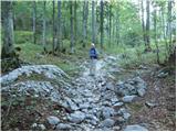 13
13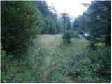 14
14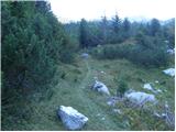 15
15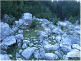 16
16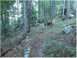 17
17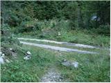 18
18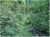 19
19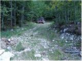 20
20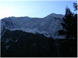 21
21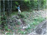 22
22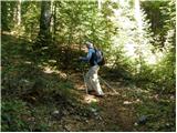 23
23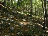 24
24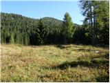 25
25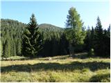 26
26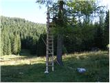 27
27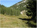 28
28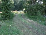 29
29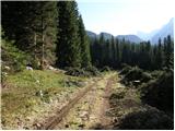 30
30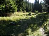 31
31 32
32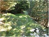 33
33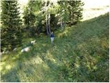 34
34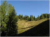 35
35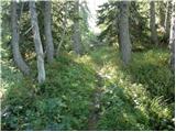 36
36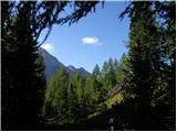 37
37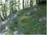 38
38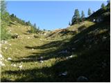 39
39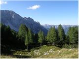 40
40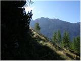 41
41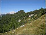 42
42 43
43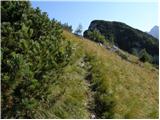 44
44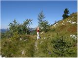 45
45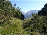 46
46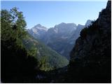 47
47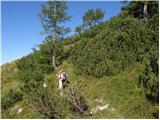 48
48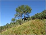 49
49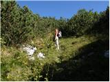 50
50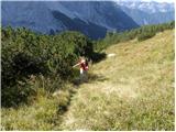 51
51 52
52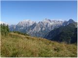 53
53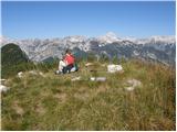 54
54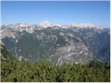 55
55
Discussion about the trip Vas na Skali - Čisti vrh
|
| adry28. 09. 2015 |
Yesterday's beautiful autumn Sunday lured us to Čisti vrh, the path is nicely trodden, and surprisingly in such a remote area we met as many as ten hikers. The magnificent view and good company kept us on the summit, so we weren't in a hurry to go down to the valley. The summit logbook is in very poor condition, it needs a new one. I replaced the chemical pencil with a new one. We'll come back, just waiting for the winter idyll.
|
|
|
|
| ljubitelj gora28. 09. 2015 |
In 2-3 weeks the larches will already be in color, they just shed it quickly.
|
|
|
|
| adry29. 09. 2015 |
Thanks to Igor for the immediate response, nice that we take care of such viewpoints as Čisti vrh.
|
|
|
|
| ločanka14. 09. 2017 |
A peak you probably won't climb just once, since once you've stood on it, you won't be able to silence the desire for a return visit . .
|
|
|
|
| damijanp26. 08. 2018 |
Beautiful path into a solitary and wonderful natural gem. I agree with @ločanka that we need to return here
Čisti vrh
|
|
|
|
| darinka43. 10. 2019 |
I haven't been to this summit yet. I'm interested if the path is traceable? Whoever has walked it and when is a suitable time for the ascent?
|
|
|
|
| turbo3. 10. 2019 |
Usually there are enough cairns to know where to leave the road and when to turn onto the footpath. From the hunting stand upwards the path is clearly visible, below too, you just need to know where to turn off the road. Ask (call) Vinko for more detailed instructions and inquire about the bears. They are there, so caution is not superfluous. Now is a very suitable time, a little later even better, because the larches will be yellow. Also in winter it's great, on skis or snowshoes
|
|
|
|
| miri3. 10. 2019 |
When you reach the planina, turn right onto the cart track, which even descends a bit. After a couple hundred meters, watch for the path that turns left. From there onwards, the trail is visible.
|
|
|
|
| darinka45. 10. 2019 |
Yesterday we went to Čisti vrh. Following the path descriptions, because all four of us were first-timers. And after the road we noticed a cairn by the house. We continued further. And after barely an hour of walking we returned to the starting point. Right at the house was the homeowner, who explained exactly where to go. When you reach the little lakes, which way next. And indeed we had no more problems with orientation. If we hadn't missed the path we would have arrived in 3.5 hours. But we didn't get upset at all because of the extra hour of walking. At the summit we were rewarded with beautiful views. There were some snowflakes in the air. And cold. We didn't meet anyone.
|
|
|
|
| darinka49. 10. 2019 |
At the saddle Drt, the path from Trebiški dol joins. But where is the junction in Trebiški dol then? Maybe there, where the hunting hut stands?
|
|
|
|
| jax9. 10. 2019 |
Yes, at the hunting hut, the path is visible. Apparently there is another junction lower down, but I didn't see any path there anywhere.
|
|
|
|
| mirank9. 10. 2019 |
I have a question; Darinka, what house are you talking about? There (Čisti vrh, Tičarca) I've been a couple of times and at the starting point by the barrier there is no house. A couple of hundred meters along the road (gravel) and soon after the little bridge you turn left into the forest....
|
|
|
|
| darinka410. 10. 2019 |
The reverse direction of the tour interested me. From Trebiški dol. From the barrier we went last time. And we saw about three hikers who were probably ahead of us up and were descending to Trebiški dol. To the other side.
|
|
|
|
| mirank10. 10. 2019 |
I know the starting point from Trebiški dol towards the pass over Drt. I only asked you where you started; the tour you are commenting on has no house by the road
|
|
|
|
| darinka410. 10. 2019 |
We started from the barrier. The house is under the road. About ten meters back is that cairn, where we went along the path past the planina na Plazeh. The man was just preparing wood higher up by the road, so he explained to us where to go to Čisti vrh. In Soča we turned earlier past the sign for kmetija Jelinčič along the road I think through Vrsnik. To the barrier.
|
|
|
|
| mirank10. 10. 2019 |
Once again; look at the pictures and read the descriptions above and it might be clear to you that there is no house with a little man by the road nor later by the path. I assume you drove by car to the end of the asphalt (to the second barrier)-or am I wrong? I have never gone from there and others don't describe from there either. and others don't describe from there either.
|
|
|
|
| mirank10. 10. 2019 |
Yes, Mr. Šafarič's weekend house right after the ramp to the right 150m down along the bridge over the stream and 50m up that one is really close, the farm where they sell cheese is 200m before that also 100m off the road to the right in the opposite direction. Those are really on the path yes.
|
|
|
|
| darinka410. 10. 2019 |
Yes when you go for the first time like us four just by descriptions it's a bit demanding because you get lost. We went along the road from that house further but that road went downhill and we preferred to return. And there we asked that gentleman who explained where to go. Then there were no more problems. Better to take an hour more than to get lost somewhere.
|
|
|
|
| ljubitelj gora4. 11. 2019 |
On Friday I set off to these parts. At picture 10 turned right and then straight into Ravni dol. It was quite long before I reached the dwarf pine ridge. First to the summit of Plazjanski Vršac, then descended a bit and below the ridge (one part is demanding due to crossing a gully) continued to Čisti vrh. From Čisti vrh searching for passages through the dwarf pines awaited me, which I hit quite well. I reached Velika Tičarica before dark. Descended back to the grassy areas and down towards the alpine pasture, but there the hunting trail got lost.
http://shrani.si/f/1A/DR/3b31QrIy/img1081.jpg
|
|
|
|
| djimuzl19. 09. 2020 |
The entire area in the forest under the road leading to the mountain pasture - pictures 18 and 19 - is impassable due to really massive windthrow, recommend another access.
|
|
|
|
| di24. 07. 2021 16:47:40 |
Has the trail's passability been restored by now?
|
|
|
|
| ljubitelj gora31. 10. 2021 23:02:04 |
Most of it the foresters have already cleared, they just need to haul the wood down to the valley.
|
|
|
|
| Jernej9687. 10. 2023 12:25:46 |
On 29.9.2023, my colleague and I did this trail. Only two trees remain on the path, so it is normally passable. There are many deer in the area that are mating at this time, breaking the silence of these solitary places with their calls. The view from the top is fantastic.
|
|
|
To post a comment you must log in:
If you do not yet have a username, you must first
register.